SEPTA Rt. 101/102: Media-Sharon Hill Line
Route Description
Your ride starts at 69th Street Terminal, and your car leaves the Terminal boarding area, crosses the busy intersection of Victory Avenue, West Chester Pike (Market Street) and Terminal Square, and passes through a maze of switches in a small yard before curving onto Terminal Square. In the median of West Chester Pike, another small yard, a part of the former line to Llanerch and Ardmore, stores a few cars in off-peak hours. The carbarn for the line was in Llanerch until 1971 when it was moved into the Market-Frankford el shops at 69th Street. A spur track from the loading area provides access for cars going to and coming from the shops.
Contrary to popular belief, 69th Street is not in Philadelphia, but in Upper Darby (the Philadelphia city limit is a little over a half-mile to the east). 69th Street is the only numbered street in Upper Darby, and allegedly got its name by distance. In Philadelphia, numbered streets are roughly 0.1 mile apart. Thus, the street being about 0.6 mile from 63rd Street, the last numbered street which intersects Market Street in Philadelphia, was given the name '69th'. (At one time, Millbourne, the Market-Frankford El stop between 63rd and 69th, was also known as '66th', even though no such street exists, again following the pattern of numbered streets.)
Your car swings around Terminal Square, passing several shops in the once thriving but now struggling 69th Street shopping area. Shortly, your car parallels Garrett Road. moving from center median right of way to the west side of Garrett Road. After a couple of stops, your car passes Beverly Hills (not the one of TV fame) and vaults across a bridge which spans a former Pennsylvania Railroad spur (the spur served the carbarn at Llanerch, and many of the former rolling stock on the line were delivered on this rail branch). Back down to grade, you approach Lansdowne Avenue, a fairly significant intersection. Separate loading platforms exist here to serve three nearby high schools, which still rate a couple of special runs (although nowhere near the number of trips which ran several years back). The line curves slightly away from Garrett Road but continues to parallel it for a few more stops until Shadeland Avenue is reached.
At Shadeland Avenue, also known as Drexel Hill Junction, the routes diverge. Your car, a 101, takes the tracks to the right and continues its private right of way run moving away from Garrett Road deep into Drexel Hill and Springfield. Some 101 trips operate non-stop in the peak direction between Shadeland Avenue and 69th Street, but again not as many as in days gone by. The stops are fewer and further between and cars can pick up a little speed in the stretch between Shadeland Avenue and Woodland Avenue, with a wooded setting surrounding the tracks. Many of the stop buildings in this stretch are the old cut stone Red Arrow trademark, and most have been well kept over the years.
Scenic Road comes up a few stops into the speedway, with a crossover for turnbacks, although it is rarely used these days. Some limiteds operate to and from this point in the peak direction, but again these are few. At Saxer Avenue, the center of Springfield's "historic" shopping district, many shops have retained the flavor of an old trolley/ interurban town.
Two more stops down the line is Woodland Avenue, the end of double track and the terminal for Springfield turnbacks. Two tracks cross Woodland Avenue, although only one is operational - the second was installed as part of a highway project many years ago, in the anticipation that the line would be double-tracked. A short portion of the line east of Scenic Road was single-tracked until a project corrected that in the mid-1970's.
Once past Woodland Avenue, the line re-enters "the woods". Although only one track exists, the right of way and bridges in this area are sufficient for two tracks. This has been discussed several times but the line remains one track. Shortly, the former Chester Road (actually, Sproul Road these days) stop approaches. It has been renamed the Springfield Mall stop, and the mall is at the top of a long slope which involves a long walk. Your car will likely spend a few minutes at the Mall stop, given the large volume of riders who must exit the single set of offside doors (the platform is on the inbound side) after paying their fares (fares are collected as you leave outbound, as you enter inbound). The line continues in a deep cut in the wooded area through Smedley Park and under I-476, re-entering double track at Pine Ridge. The double track does not last long, and two stops later, Bowling Green, it ends once again at the Media city limits.
You cross Providence Road from Bowling Green and enter State Street, Media's main drag. The single track is dead center in the street and it presents a traffic nightmare, as the street is barely wide enough to have traffic lanes on either side of the tracks. Even this is a tight squeeze and not for the squeamish driver. Your car continues for a little over a half-mile, past the Delaware County Court House, and comes to rest at the end of rail at Orange Street. In the days of double-ended streetcars, the motorman would exit the car and change poles, a task no longer necessary with pantograph-equipped LRVs.
In bad weather, or in the event of street festivals which happen on State Street occasionally, the cars will terminate at Bowling Green and passengers will be transferred to shuttle buses for the remainder of the trip on State Street. Every so often, a proposal to make this permanent is floated by SEPTA and shot down by locals. In the 70's, State Street would have street festivals and sidewalk shopping at least one weekend a month in the nicer weather, and SEPTA would end regular service at Bowling Green, placing a Red Arrow center entrance car on shuttle service on State Street. Those days are, unfortunately, gone.
You pay your fare, allow the operator to switch ends, and pay another fare (!), adding 40 cents for a transfer, to return to Shadeland Avenue and ride the 102. The line is pretty much the same as the outbound trip, until you reach the junction and transfer to a Sharon Hill car. (Locals rarely call the lines by their route numbers, steadfastly retaining the Media and Sharon Hill designations, and still calling the operation the Red Arrow.)
Your 102 car veers toward the left at Drexel Hill Junction and stays on its own right of way, crossing Garrett Road very quickly and passing a number of stops. Shortly it crosses Darby Creek on a truss trestle at Oakview, a favorite spot for photographers on the line (unlike most of the bridges on the Media line, which are out in the woods, the Oakview trestle is fairly easy to access). After crossing Baltimore Pike, your car shortly leaves private right of way for a stretch of street running in Springfield Road. And, almost as quickly, you duck under the R3 Elwyn commuter line (you can duck off the car and board an R3 at Clifton-Aldan station if you'd prefer), then turn off busy Springfield Road into Woodlawn Avenue. The R3 overpass is another favorite photo spot, with good top views of cars available from the station platforms, and possible meets to be photographed.
At the end of street running at North Street, the double track merges into one. Short turns are possible here (marked as "Aldan" trips), although few are scheduled. Your car continues dead straight on the single track in its own right of way through Aldan and Collingdale, crossing busy MacDade Boulevard, and then passing under the CSX mainline between Philadelphia and Wilmington. (This same line is crossed at grade a couple of miles east of here by SEPTA's Route 11 line.) Because of the grade of the line at the underpass, it occasionally floods, and when it does, service ends at MacDade with shuttle buses to Sharon Hill.
The terminal at Sharon Hill is actually just south of the CSX underpass and about a half-mile from MacDade, and cars enter a small platform area with a nondescript stone building nestled close to Chester Pike. Once again, motormen of days gone by would change poles, shift ends, and return to 69th Street. You need to pay your fare, go to the other end of the car, pay again, and settle back for a trip to 69th.
The return is the same as the outbound trip, until 69th Street. At 69th, the cars enter the terminal and turn slightly to the right, which is their discharge platform, where all patrons must leave. From here, the cars loop around and re-appear at the outbound loading areas. This is the only loop on the lines.
Roster
Current Roster
| Numbers | Type | Manufacturer | Year Built | Status | Notes |
|---|---|---|---|---|---|
| 100-128 | "K" Double-end | Kawasaki | 1982 | In service |
Past Roster
| Numbers | Type | Manufacturer | Year Built | Status |
|---|---|---|---|---|
| 1-9 | "Brilliner" | J.G. Brill | 1941 | Retired |
| 12-24 | "Streamliner" | St. Louis Car Co. | 1949 | Retired |
| 25-26 | "Hog Island" | J.G. Brill | 1917 | Retired |
| 46 | Interurban Coach | St. Louis Car Co. | 1907 | Retired |
| 61-76 | Center Entrance Interurban | J.G. Brill | 1926 | Retired |
| 77-86 | Master Unit Suburban | J.G. Brill | 1932 | Retired |
Preserved Cars:
- 5 at Pennslvania Trolley Museum (confirmed on roster 2/2025)
- 8 at Shore Line Trolley Museum (confirmed on roster 2/2025)
- 9 at Electric City Trolley Museum (confirmed on roster 2/2025, not on display)
- 13 at Shore Line Trolley Museum (per PNAERC, not on roster 2/2025)
- 14 at Pennslvania Trolley Museum (confirmed on roster 2/2025)
- 18 sold to MUNI from Shore Line Trolley Museum, at Brookville Equip. (status unknown)
- 20 at Vintage Electric Streetcar Co., Windber PA (status unknown)
- 21 sold to MUNI from Shore Line Trolley Museum, at Brookville Equip. (status unknown)
- 23 at Newtown Square Railroad Museum, PA (status unknown)
- 24 at Pennslvania Trolley Museum (confirmed on roster 2/2025)
- 61 at Rockhill Trolley Museum (confirmed on roster 2/2025)
- 62 at Seashore Trolley Museum (confirmed on roster 2/2025)
- 63 at Buckeye Lake Trolley (status unknown)
- 66 at Pennsylvania Trolley Museum (confirmed on roster 2/2025)
- 73 at Pennsylvania Trolley Museum (confirmed on roster 2/2025)
- 75 at Shore Line Trolley Museum (per PNAERC 2/2025)
- 76 at Electric City Trolley Museum (confirmed on roster 2/2025, operable)
- 77 at Middletown & Hummelstown RR (confirmed on roster 2/2025)
- 78 at Pennsylvania Trolley Museum (confirmed on roster 2/2025)
- 80 at Electric City Trolley Museum (confirmed on roster 2/2025, operable)
- 83 at Pennsylvania Trolley Museum (from Middletown & Hummelstown RR 2/2025)
- 84 at Shore Line Trolley Museum (confirmed on roster 2/2025)
- 85 at National Capital Trolley Museum (per PNAERC 2/2025)
- 86 at Middletown & Hummelstown RR (on M&H 2/2025 but not listed in PNAERC)
PNAERC, Roster of Preserved North American Electric Railway Cars
Photos
Photo Search
Photo Gallery
| Five Random Images | ||||
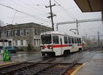 Image 16725 (90k, 820x620) Photo by: David Pirmann Location: Drexel Hill Junction | 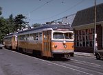 Image 16735 (212k, 1024x672) Photo by: Joe Testagrose Location: Orange Street/State Street | 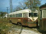 Image 88028 (152k, 757x527) Photo by: Brian J. Cudahy Location: Sharon Hill/Chester Pike |  Image 149728 (357k, 1044x595) Photo by: Bernard Chatreau Location: Scenic Road |  Image 152455 (401k, 1200x800) Collection of: David Pirmann Location: Sharon Hill/Chester Pike |
Photos By Location
101-102 Joint Segment
Photo locations: 69th Street, 69th Street Yard/Shops, Terminal Square, Fairfield Avenue, Walnut Street, Avon Road, Hilltop Avenue, Beverly Blvd./Beverly Hills, Beverly Hills Trestle (PRR), S. of Beverly Hills Trestle, Congress Avenue, N. of Lansdowne Ave., Lansdowne Avenue, Drexel Park, Irvington Road, N. of Drexel Hill Jct., Drexel Hill Junction
101
Photo locations: Huey Avenue, School Lane, Aronimink, Anderson Avenue, Drexelbrook, Drexeline, Darby Creek Bridge, Scenic Road, Springfield Road, Saxer Avenue, Leamy Avenue, Woodland Avenue, Thomson Avenue, Sproul Road Overpass, Springfield Mall, Crum Creek Bridge, Paper Mill Road, Near Paper Mill Road/Smedley Park, Pine Ridge, Beatty Road, Bowling Green, Manchester Avenue/State Street, Edgmont Street/State Street, Monroe Street/State Street, Jackson Street/State Street, Olive Street/State Street, Veterans Square/State Street, Orange Street/State Street
102
Photo locations: Garrettford, Drexel Manor, Marshall Road, Oakview, Baltimore Pike, Penn Street, Springfield Road/Madison Ave., Clifton-Aldan/Springfield Road, Shisler Avenue/Woodlawn Avenue, Wayne Avenue/Woodlawn Avenue, Providence Road/Woodlawn Avenue, Magnolia Avenue/Woodlawn Avenue, North Street/Woodlawn Avenue, Bartram Avenue/Woodlawn Avenue, Andrews Avenue/Woodlawn Avenue, Woodlawn Avenue, Collingdale/Macdade Blvd., Sharon Hill/Chester Pike, (Misc/Unknown), (Misc/Unknown)
Page Credits
By Bob Wright
| ||||||||||||||