SEPTA Broad Street Subway
![]()
SEPTA B-4 subway car at Walnut-Locust, Broad Street Subway. Photo by Brian Weinberg, February 2006.
Overview
The idea for a Broad Street subway line dates back to 1912 when Philadelphia appointed A. Merritt Taylor to study transit expansion in the city. Among the options he came up with were the Broad Street line and what became the Ridge Avenue Spur. Typical to big cities the ideas were studied, restudied and then changed and the process repeated.
The general arrangement of the as-built Broad Street Subway is a two and four track subway underneath Broad Street for its entire length, and a spur running southeasterly from Fairmount and Broad Streets. The spur runs underneath Ridge Avenue to 8th Street, where there is a grade separated junction, with tracks leading easterly to the Ben Franklin Bridge and south along 8th Street to Locust Street. At Locust the spur turns westerly to 15th/16th Street. The Ridge Spur was to have been part of a Center City loop. On the main line, flying junctions were built at Erie, Olney, and Snyder for future extensions.
Dirt is moved beginning in 1924, with the first trains operating between City Hall and Olney on September 1, 1926. service started from City Hall to Olney. The subway under Broad Street south of City Hall to Snyder was completed in 1933 but without tracks and stations left unfinished. Finances improved and in 1937 the South Broad line was finished. The first train to Snyder ran on 9/18/1938.
The Ridge Spur to 8th and Market was operational in 1932. The Locust Street subway beyond 8th and Market was completed as a bare tunnel from 8th to 18th Streets in 1931 but service didn't begin until 1952. Ideas were floated to extend the Locust Street tunnel across the Schuylkill River to 49th Street but the idea died due to lack of funding. The Locust Street subway was separated from the Ridge Spur at 8th and Market in 1968, when the Ben Franklin Bridge service was handed over to the new PATCO High-Speed Line.
Maps
Station by Station
South of Walnut-Locust, all stations are constructed with two tracks and an island platform. Most island platform stations have been redesigned with tile columns on the platforms, which match the mezzanine level's tile; this is meant for easy identification of your stop, as each station has a different color (though some are repeated further up the line). All stations from Walnut-Locust to Snyder have been additionally rehabilitated, with new signage and floor tile, and are aligned under the east side of Broad Street. This was done so that disruption to train and street traffic would be minimal if it were ever decided to open up Broad Street again and add two more tracks to the line through South Philadelphia.
Starting from the southernmost point on the line, the first stop is Pattison. This station was the last one constructed on this line, meant to serve the sports complex nearby, which once consisted of JFK Stadium (closed and demolished in the early 1980s) and Veterans' Stadium (demolished in March of 2004). At the time, Veterans' Stadium was new. Today, the station serves the Eagles' Lincoln Financial Field, the Phillies' Citizens Bank Park, and the Wachovia Complex (which consists of the Wachovia Spectrum (used mostly for special events) and the Wachovia Center (used for Philadelphia Flyers and 76ers games and other events). As such, the station doesn't get that much regular usage; even peak hour trains can be relatively empty at this stop. However, the station's design conceals that fact, as there are four large "glass house" surface entrances (the cashier's window and turnstiles are at street level, with the stairs leading directly to the platform), and the platform is much wider than any other island platform, as well as roughly twice as long. The station's walls are of cinderblock construction, and are glazed in a light yellow or "almond" color, with grey vertical stripes. The support columns are rounded concrete pillars, wrapped in stainless steel. Station signs are suspended from the ceiling, in front of fluorescent lamps. Additionally, there exists a lower level to this station; the tracks to access it are split off from Track 1 (the northbound track) just north of the station, but after the crossover switch in the tunnel. This level is rarely used, and very dimly lit, despite the newly installed bumpy tile edges. It is only used during major sporting events, and is otherwise closed and locked, only viewable from a train as it enters or leaves the station, or through the locked gates on the platform. There are four exits from the station, but the northernmost exits are used only when there are Phillies or Eagles games, or during major events, and are otherwise closed. The southernmost exit is open for use at all times, and includes an elevator for handicapped access. Pattison station opened April 8, 1973.
After a relatively long run (9 blocks, which is .9 miles in Philadelphia, to be exact), Oregon is the next station on the line. This station is architecturally similar to Pattison, with a concrete platform, cinderblock walls, and station signs in front of the lights. However, the wall color is a light shade of grey with darker vertical stripes, and the columns are built of cinderblock. The platform is also not as wide or long as the one at Pattison, and there is no lower level, nor as many exits. There are only two exits, one for each side of Oregon Avenue, but both lead directly to the street, as the entrances are once again in glass houses. At the time of this writing, SEPTA is having an elevator installed on the south side. The station itself (as well as Pattison) sits partly beneath the sidewalk of Broad Street, unlike those further north. Despite the residential neighborhoods near the station and the shopping plazas further to the east and west, this station doesn't get much walk-in traffic. Most passengers here are transferring from bus routes G, 7, and 68. Though there are many travelers through here during normal peak hours, the station's heaviest usage comes between 8:30 and 11:00 PM on weeknights; at that time, employees at the UPS Philadelphia Air Hub transfer here to the 68, which serves the facility. By the time they return, the trains have stopped running and the NiteOwl buses run in their place, so quite a few of them end up leaving the route 68 bus at Pattison to transfer instead. Oregon station opened April 8, 1973.
Snyder station is next on the line, and sits in a cluster of local attractions. Methodist Hospital, and South Philadelphia High School are nearby, with shops along Snyder Avenue itself. This sat as the southern end of the Broad Street Line for 34 and a half years, with extensions to Pattison opening in 1973. The station's columns are colored maroon, and the mezzanine level walls are yellow with maroon accents. Floor tile on the platform is light gray with maroon accents, and the station signs are located in a long band of stainless steel that runs the length of the center of the ceiling over the platform, broken only where the staircases are located. Originally, the silver parts of the steel band were covered with orange plastic strips, and the station signs referred to the stop as "Snyder Ave."; this was changed when the rehab work was done (before that, the maps had dropped the "Ave." from the station name, this was done at least since 1984). Exits lead to all four corners of Broad Street and Snyder Avenue, with the northeast corner having an escalator. Above, passengers can board the former trackless trolley (electric trolleybus) route 79 on Snyder, and the 37 bus on the west side of Broad (it terminates at the station). An odd thing about this station is its alignment under Broad Street. If you look north of the station, there's an oddly placed crossover switch. Track 2 (southbound) through this station is track 1 (northbound) through the next station, and track 1 through Snyder station (as well as southbound track 2 from further north) merges into the same through track, as well as crossing over to the southbound track from the next stop. Southbound trains must travel at reduced speeds when entering, while northbound trains departing leave at normal speeds. Additionally, there is an odd jog in the tunnel, as if it was once intended for the tracks to bypass the station; this is the location for an intended but never built spur under Passyunk Avenue (to probably the same areas served by Route 37). Snyder station opened September 18, 1938.
Tasker-Morris is next and has dark sea foam green columns. Mezzanine tile is light green with dark green tile accents. The mezzanine is full length, the south exit leading to Morris and the north to Tasker and a token booth. The ceiling over the platform has transverse metal slats. On the surface, transfer can be made to the route 79 Tasker-Morris electric trolley bus service. This station opened September 18th, 1938.
Ellsworth-Federal is next. The columns are tiled in blue. The full mezzanine has ochre tile with dark blue accents. The south exit leads to Federal while the north leads to the token booth and Ellsworth. This station opened September 18th, 1938.
Lombard-South is next and features red tiled columns. There are four exits leading to the full mezzanine which has red tile with cream accents. Vent chambers are at the south (South Street) end of the station. Lombard is at the North end. This station opened April 20th, 1930.
Leaving Lombard-South, the track bed widens to four, and the stub ends of the express tracks can be seen; the southbound track through the southern stations is aligned with the northbound Express track. Next station is Walnut-Locust/Avenue of the Arts, which was recently rehabbed. Once a dim station with concrete platforms, steel support beams, and tiled staircases, the stairs are now open air, and the columns are tiled, done in white but with a mixture of green and grey on the bottom third of each column. The station has four tracks with two island platforms, and serves as the terminal for weekday Express trains, which lay up on their stub tracks south of the station. Additionally, the Special Express (blue marker light) trains cross from the express to local tracks going southbound, and from the local to express track northbound. A double crossover switch sits immediately south of the station, and trains generally cross it before laying over and reversing directions. Rarely, a train may sit on this track, and the express trips will instead lay over on the southbound track, which is slightly shorter than the northbound (which reaches almost to Lombard-South). A pair of crossovers north of the station make a reverse movement of those to the south (allowing northbound expresses to access the local track, and southbound locals to access the express track) There are many exits from this station's platform. Starting from the north, Exit 1 leads to a high wheel turnstile with no free crossover between platforms. Exits 2 and 3 are the same, but with a crossover. Exit 4 was removed, and exits 5-7 lead to another free crossover, and an information and sales office. Exit 8 is at the south, a mirror of Exit 1, with no crossover. Locust Street is at the south end, with a connection outside the paid area to the PATCO line. Walnut is to the north end, and connects to bus routes 9, 12, 21, and 42 westbound. Outside of the paid area, there is a long underground walkway running from Chestnut Street to Spruce Street, known as the South Broad (Street) concourse; this has many exits and entrances to/from both sides of Broad Street, some of which are in the side walls of buildings. The concourse walls are mostly white, with two-tone green along the top, bearing the names of the streets nearby in white tile mosaic. It also connects into the Penn Center Concourse, serving the Regional Rail Lines' Suburban Station; and the Market East Concourse, alongside the Market-Frankford Line at 13th Street and 11th Street stations - you can actually walk from here to the Gallery Mall without setting foot on the surface. This is a popular station with both commuters and tourists; many hotels, cafes, and restaurants are in the area, as are Tower Records, the Academy of Music, and the Kimmel Center for the Performing Arts. Walnut-Locust station opened April 20, 1930.
Around a slight curve to the west from Walnut-Locust, the next station is a big one, and is both popular AND notorious. City Hall is next, the original southern terminal of the line. This stop is the ONLY one to not have any plastic wall or ceiling signs; the station name is found only on a new style of billboards on the walls, and in tile mosaic on the platform dividers. This is also one of only two stations on the main line to not be aligned physically beneath Broad Street (the other is Fern Rock, which is at 10th and Nedro, and not under Broad Street (or anything else, for that matter) at all), but instead sits under the west face of City Hall, at 15th and Market. The building foundations of the main center of government in Philadelphia extend into the station, dividing the two island platforms, and separating the northbound and southbound sides of the station. There are passages between them, however, allowing one to walk from one side of a platform to the other without going upstairs first, as both Express and Local trains stop here, and it's easier to see an approaching Local from the Express side, due to the curves. The tile on the walls is off-white, with red and maroon accents in the foundation walls between the tracks. These tiles are smaller, bathroom floor-stye tiles. Tile on the platform dividers is mostly white but with tones of cream and maroon coloring (not as deep red as Lombard-South, though). There are steel support columns visible at the extreme north and south ends of the station; these are painted orange and white. Market Street passes above the center of the station, as does the Market-Frankford Line, and you can easily hear and feel a train passing overhead. The Subway-Surface trolleys (routes 10, 11 13, 34, and 36) can be heard at the northernmost end of the station, and given the curves in the tunnel on the line at this point, it can be tough to tell if the sound of a train arriving is actually a trolley upstairs. There is capability for free interchange to the Market-Frankford line and the trolley routes here, and a total of four exits, though the construction and exit numbering of the stop shows evidence of six. There are narrow walkways above the central point of the platforms, where the stairs to and from the Market-Frankford Line are located; this is to prevent overcrowding on one staircase, as at least three on each side lead up to the mezzanine level. Exit 1 leads to the South Broad concourse and South Penn Square. There is a sign outside the paid area identifying this exit as "South-Penn", and it is exit only. Exits 2 and 5 have been removed. Exits 3 and 4 lead to the Market-Frankford Line free interchange, and to additional exits from the subway system to Richardson Dilworth Plaza (west face of City Hall) or into the City Hall courtyard, or Juniper Street (east face of City Hall), and into the Market East Concourse. Exit 3 leads to the trains eastbound to Frankford, Exit 4 leads to the trains westbound to 30th Street and 69th Street Terminal. Exit 6 leads to the Subway-Surface trolley lines, and a high wheel exit leading to the Penn Center Suburban Station Concourse and the Regional Rail Lines. Numerous bus routes connect here, and there are many municipal buildings in the area, as well as several shops, banks, and a few lunch spots, all leading to this being the most highly used station on the line. North of the station, the tracks make a right-left reverse curve to align themselves under North Broad Street before continuing on. City Hall station opened September 1, 1928.
After the tracks realign beneath Broad Street, the next station is Race-Vine. This stop is a short distance away from City Hall, but farther than Walnut-Locust. However, it's not close to many attractions; only the Pennsylvania Academy of the Fine Arts, the Pennsylvania Convention Center, and Hahnemann University Hospital (which has been proposed for closure, and bought and sold many times in the last decade, currently owned by Tenet Health systems and Drexel University) are nearby. The closest connecting routes are the NJ Transit buses, which board a half-block south at Broad and Cherry Streets. The 48 westbound is one block south on Arch, while the 27 enters Center City at Broad & Vine, but leaves on 16th Street, two blocks west, so this isn't a highly used station. The platforms are dual islands, with a steel band in the ceilings, covered by plastic strips of orange, some of which bear the station name. Though it hasn't been given a second rehabilitation as the South Philadelphia stops have, it is designed with tiled columns. The color is a deep green, and the floors are brick red tile. There are four exits on the platform, and they each face their respective direction (for example, both north exits face north, instead of standing face to face or back to back). The southernmost exits lead to Race Street, which was recently converted to an "exit-only" station. The mezzanine here is concrete, and the tile walls are two-tone green in addition to white. The exits lead to either side of Broad Street, but only the north side of Race, and all exits are high wheel, with the cashier's booth and turnstiles removed. There is a closed staircase (closed, boarded up, and very old in appearance) on the southeast corner of Broad and Race. The north exit mezzanine has red floors, and the tile scheme is similar to that at the Race Street end, but there is a "five-spot" pattern found on the walls, using green and white tiles. The center "spot" is orange in some places, a part of the design. This mezzanine serves the hospital and Vine Street, and is much more pleasing to view than the Race street exit, which more resembles the mezzanine at Walnut-Locust. This is the only entrance to the station, but there is no direct entrance to the hospital, nor staircase to the north side of Vine Street. However, one would need to tunnel under Broad Street, but OVER the Vine Street Expressway (U.S. 30/I-676) to get from the station to that side of Vine. The entrances from Vine Street are protected by glass canopies, giving the appearance of a greenhouse. Race-Vine station opened September 1, 1928.
Spring Garden is next, merely two blocks from Race-Vine. This is probably the third or fourth highest used station, following City Hall, Olney, and possibly Erie. The Philadelphia State Office Building is right at the station, with the Community College of Philadelphia only three blocks west and Benjamin Franklin High School one block north. This stop is very busy during the morning and afternoon hours, when school is just opening or dismissing for the day. It has two island platforms of concrete construction, with steel support columns and concrete staircases. The station signs are suspended from metal rods embedded into the ceiling. The walls, beams and ceilings were originally painted in cream color, but late in 2004, SEPTA's painters laid a new coat of white paint on the walls and beams. As of yet, the ceiling remains in cream, unlike Girard, which was completely painted white back in 1997. The station is also an inverse of Girard in terms of mezzanines. Exits 1 and 2 here lead to a high wheel exit, and a high wheel exit and the turnstiles, booth (and free crossover), respectively. Exits 3 and 4 are closed. The south mezzanine here is open, the north is closed, as are the stairs leading to it. This is reversed at Girard, with the south side being the closed mezzanine. The entrance at the SW corner of Broad and Spring Garden Streets is an attractive combination of steel and black glazed stone, most likely granite. This entrance is partly on the property of the State Office Building. The mezzanine has brown tile with yellow ochre accents on white. Oddly enough, though it's hard to tell, the now-closed and graffiti-laden station two blocks east under Ridge Avenue on the Spur had the same color scheme, but was a side/wall platform stop. This was the last station to be added to the list of stops served by Express trains; the change took effect in September of 1994 (Race-Vine was added in 1991, while North Philadelphia was added and dropped in 1997). Route 43 bus service runs along Spring Garden Street, with a few trips (mostly Sunday service) ending at the Market-Frankford line station further east. There are crossovers immediately north of here, facing point from Local to Express track, used mostly for emergency maneuvers. Spring Garden Station opened September 1, 1928.
Next up is Fairmount, which is a local-only stop. This is the first station on the line to have side/wall platforms, which are the reason it's local only - the Express tracks breeze right through, and don't touch the platforms. Technically, this station isn't "Local Only", as the Ridge Spur also stops here. However, that's on a lower level, and treated as a separate station. The platforms have two-tone blue on white for the tile scheme, and fare control is in the center of each platform, with older, wooden high wheels nearby for exiting purposes. You'll notice the platform's two oddities almost immediately. For one thing, the platforms are offset from one another, overlapping by about half in the middle. The other oddity is the curve of the northern half of the platforms. The Broad-Ridge Spur enters the main line at this point, and the tracks merge north of the station. So the Local tracks bend away from the Express tracks approximately one platform width to allow the Ridge tracks to rise from below and merge into both the Local and Express track between here and Girard. Signs on the platform walls and fence identify the station by name, but older signs (which once may have been illuminated) remain higher on the wall, as well as vent chambers. Additional signs on the northbound side point passengers in the direction of the Ridge trains. Apparently, the southbound side has no such connection. There is no free crossover here, and additionally, not much sealing - water damage on the walls and platform is quite evident. Route 61 connects overhead, running along Ridge Avenue. Whether it's Ridge Avenue itself or the presence of the diverging Spur that causes the slight offset in the platform alignment isn't quite known. There is wrought iron fence separating the paid area from space outside fare control. Fairmount station upper level opened September 1, 1928, and the lower level, for the Broad-Ridge spur, opened December 21st, 1932.
After the Ridge tracks have merged into the main tracks, the next station reached is Girard. This station's architecture is similar to that of Spring Garden, in that it has concrete floors and stairs, a concrete mezzanine, and four tracks with two island platforms. The station also has the same I-beam support pillars and hanging ceiling station signs as at Spring Garden. However, the walls and the odd sides of the beams are white instead of cream colored, and the mezzanine level has maroon tile with cream accents. All trains serve this station, with local trains operating on the outer tracks. Express and Ridge trains use the inner tracks, though various operations of the Broad-Ridge Spur have had some trains run as locals from here to Erie or Fern Rock, the last such instance being for a short two months in late 1997. Currently, Ridge trains run as express from here northward. Meets between same-direction Local and Express or Local and Ridge trains are frequent here, and trains will often hold to allow passengers to transfer. See below for more about the Broad/Ridge Spur.
There are four exits from the platform, but only two are open for use. In an inverse of Spring Garden, the south exits and mezzanine here are closed (with the entrance at the SW corner of Broad & Girard being totally removed during remodeling of a former shopping plaza), and the north end remains open. Exit 3 leads to the turnstiles and booth, and a free crossover, while exit 4 leads simply to a high wheel exit. The exit to the NW corner of the intersection has a stone setting around the entrance, unlike the iron and steel framework around most entrances on the line. Surface transfers are available to Route 15, a trolley line that had been bustituted but now operates with revived "PCC-II" cars. Girard station opened September 1, 1928.
North of here, there are five crossovers, in this order: Facing point from Local to Express tracks, trailing point between northbound and southbound Express track, and facing point from Express to Local tracks. The center crossover is used to terminate Ridge trains at times that the line runs as a shuttle and local service, the other tracks are used to maneuver trains off of blocked tracks in emergencies or during times of rail construction.
Returning to the Broad Street main line, the next station is Cecil B. Moore, formerly known as Columbia, which serves Temple University. The station has a two-tone green on white tile scheme, and there is no free crossover. The station has elevators and platform level fare control. The station played music from the University's radio station. This station opened September 1st, 1928.
Next up is Susquehanna-Dauphin, another local stop with two wall platforms. Fare control is at platform level in the center. There are north (Susquehanna) and south (Dauphin) exits which have high wheels only. Outside the main northbound fare control is a mosaic entitled City Diary 1997. This patchwork quilt mosaic is very colorful. Tile color is yellow ochre with brown accents. The name is in white. The station floor is red brick and the fare control is separated from the paid area via a fence. This station opened September 1st, 1928.
North Philadelphia is the next station, and at first glance, it looks to be a carbon copy of Girard or Spring Garden, minus the remaining cream coloring on the walls, ceiling, and beams here. The platforms here are concrete as they are at the other locations, and the beams are steel with no tile or concrete wrapping. However, the station has extended mezzanines, and the ceiling lights run the length of the platforms as opposed to the width of them. Both mezzanines have two-tone blue on white tile, similar to Fairmount and Wyoming stations. North Philadelphia Subway Station is placed in tile mosaic in both mezzanines, as well as the name of the streets above. This station opened September 1st, 1928.
Once a highly used station in the sprawling North Philadelphia center, this stop is now rather lightly used, at least compared to the stops serving all trains. The station is missing many signs, but those that remain are interesting. The sign panels were designed to fit around fluorescent lightbulbs, thus giving off a glow to the sign itself. None of the bulbs have been replaced recently, but SEPTA occasionally has them fixed. These signs, as well as those pointing passengers in the respective direction of the Lehigh Avenue and Glenwood Avenue mezzanines, are suspended by rods from the ceiling. Though the station sits between the two avenues, the platform does not extend the full distance. It's actually centered under Broad and Somerset Streets, and the mezzanines are extended to reach the streets above. Lehigh is to the south, while Glenwood is to the north. The staircases are at the extreme ends of the platforms, and trains stop in positions that favor Lehigh Avenue.
This station has two island platforms but is currently skipped by Express trains. Ridge trains (which normally use amber colored marker lights to identify themselves, but are forced to use green between Girard and Erie to stay on Express tracks northbound) operate on the express tracks, but DO stop here, and with north-bounds, this can get confusing.
The exit to the NW corner of Broad and Glenwood has been removed, while the exit at the SE corner remains open. Glenwood Avenue itself is exit-only, so anyone needing to enter the system here must use the Lehigh Avenue side. Both exits have wooden high wheels, but only Lehigh has any remaining turnstiles, and the booth and token machines. Aside from the Regional Rail service nearby, bus Route 54 connects above on Lehigh Avenue, and eventually reaches Somerset Station on the Market-Frankford line further east. Interestingly, the line here ducks under the former Reading trackage but those tracks duck under Broad Street itself. North of here, the trackbed shows evidence of removed crossovers between all tracks.
The Lehigh Avenue mezzanine has a false wooden wall which blocks off a corridor leading directly into North Broad Station on the Regional Rail Lines (formerly of Reading Railroad and now served by the R5 and R6 trains). As the station building at North Broad is now disused, the corridor likely goes nowhere, but when neighborhood fortunes changed initially, the corridor was closed due to crime concerns. Similarly, a gate blocks off the corridor from the Glenwood Avenue mezzanine which once lead to the former Pennsylvania Railroad station at North Philadelphia (from which this subway stop gets its name), now served by a few Amtrak trains, and SEPTA R7 and R8 Regional Rail Lines. This was also closed due to crime concerns, and as the North Philadelphia railroad station was rehabbed and a small shopping plaza built in place of the old station building (which was dilapidated and dangerous, and highly unsightly), the passage into the station was probably buried. North Philadelphia station opened September 1, 1928.
Allegheny, a local stop, is next and has two wall platforms. The station has a red tile floor and columns. Vent chambers are on the side walls. Exit is at the south end with no crossover or crossunder. This station opened September 1st, 1928.

General plan of the express station at Erie Avenue. In this station, as in most of the others mezzanines extend lengthwise to permit underground passage from any point of the subway platform to any of the exits. Another feature is the large number of air wells and smaller ventilating ducts. Source: Electric Railway Journal, February 9, 1929, pp. 240-248.
Erie is next, and one of the more heavily used stops along the line. The station is similar to the one at Race-Vine, right down to the deep green tile on the columns. The mezzanine level resembles that of Race Street. However, the station has been given a rehabilitation, and now has bumpy tile edges and grey tile floors with green tile accents on the two island platforms. The steel ceiling band, once covered completely by orange plastic strips (some of which had the station name) is now stainless steel, with the occasional orange station sign. The sidewalls are painted white, they were cream colored originally. This station opened September 1st, 1928.
The station's mezzanine level on the south end is currently closed at the time of this writing, and the exits and entrances are blocked. Exits 3 and 4 lead to the north end mezzanine, and a crossover, with Exit 3 leading to the booth and waiting area. The north end mezzanine has "ERIE" in tile mosaic, and interestingly enough, if you look north, above the tracks in the mezzanine level, the word "GERMANTOWN" appears in tile mosaic. There were once entrances to the station from Germantown Avenue at Broad Street (assumedly closer to Butler Street than to Erie Avenue), these have been closed for decades. Entrances now only exist on all corners of Broad & Erie, with the NE corner entrance being at Erie & Germantown.
All trains stop here, though this is the main terminal for local service on the Ridge line when it is operated as such. A diverging track north of the station leads to a small layup yard, and an intended flyover junction for service to Northeast Philadelphia, or Chestnut Hill. However, there also exists a double crossover between the express tracks north of the platform. Further north, there is a facing point switch, from Express to Local tracks, this was where the Express tracks ended from the time they were laid in 1959 until 1991, when the tracks were extended through Olney in prepartion for the RailWorks project (1992-1993), which completely rebuilt the old Reading RR line through North Philadelphia. All Regional Rail service was suspended between Market East and Fern Rock and regional rail passengers took the new express trains to Fern Rock to transfer. Because of the diverging tracks north of here, the platform ends are not tapered as they are at other stations.
Bus routes H, XH, 23, 53, and 56 connect here, the latter three being former trolley lines, and the 23 and 56 having most (all in the 23's case) of their wires and track intact. Signs in the mezzanine mention the E bus (route 65 today), but service to this station was truncated long ago. Erie station opened September 1, 1928.

The station at Hunting Park Avenue Extension is typical of the other local stations. Although trains at present have a maximum length of six cars it is planned to lengthen them as the traffic increases to eight cars, the number which the platforms were designed to accommodate. Source: Electric Railway Journal, February 9, 1929, pp. 240-248.
Hunting Park is next and features fare control at the center of the two brown-tiled wall platforms. No crossover was found. The sidewalls had vent chambers. This station opened September 1st, 1928.
Wyoming is next and has dark blue columns on the two wall platforms. Fare control is at the center at platform level. Transfer can be made on the surface to the route 75 Wyoming electric trolley bus service. This station opened September 1st, 1928.
Logan follows and is identical to Wyoming except for dark red columns. This station opened September 1st, 1928.
We reach the other original terminal at this point, at Olney station. The station sits under possibly the busiest intersection on North Broad Street, and likely the second busiest on all of the street itself (with the City Hall area being the busiest). It also serves the Philadelphia Girls High School, Albert Einstein Hospital, and nearby Moss Rehabilitation Center, local shops, and Central High School. It served as the northern terminal of the line for nearly 28 years, and is served by all trains today. In fact, the idea behind the Broad Street Line was for one to be able to get between here and City Hall in 20 minutes. As expected, it's highly used, with only City Hall itself having a higher passenger count. The station has four tracks, dual island platforms, and a total of six staircase exits from each platform, the first one on the northbound side being an escalator. Rehabbed in 1991, as part of a large project to revitalize Olney Terminal, this station has ADA compliant elevators, red tile floors, bumpy tile edges, and the tile columns are cobalt blue. However, the VERY top row of tile is orange. Signs are on a band of orange plastic set into the ceiling, as well as on either side of the ceiling around southernmost stairs. Stair risers are powder blue, and lead to a large mezzanine level with seven exits. Fare control is in the center, though the north bank of turnstiles and booth are closed during off-peak hours and weekends, blocked by a sliding steel gate. This part of the mezzanine is used as exit-only (via high wheel), or for free crossover at those times. Outside of fare control, there is a newsstand and snack bar, and the SEPTA sales office, both closed weekends. The seven exits are lettered, and empty above as follows: Exits A, B, and C lead into the Olney Terminal building, with A having an escalator and elevator, and access to the SE corner of Broad & Olney. Exit A serves bus routes 18 and 26 eastbound, and routes 22, 55, and 80 weekday express. Exit B leads to former trolley route 6 (which, in times past, was the famed Willow Grove trolley, scaled back to Ogontz & Cheltenham Loop when Willow Grove Park was closed and replaced with Willow Grove Park Mall). Exit C leads to routes L, 18 weekday express, and a sign in the mezzanine suggests the 22 once loaded here. Exit D leads to the intersection of Old York and Tabor Roads, Albert Einstein Hospital/Moss Rehabilitation Center, and routes C (north to Ogontz & Cheltenham) and 8 (weekday express to Frankford). Exits E, F, and G lead respectively to the SW, NW, and NE corners of Broad & Olney. Exit E serves Girls High School and route C (south to City Hall), and Exit G leads to routes 18 and 26 westbound. This station opened September 1st, 1928.
North and south of the station, there are crossover switches. To the south, there is a double crossover between the northbound tracks, and another immediately north of that between the two express tracks. On the southbound side, the double crossover is replaced by a facing point switch from Express to Local track; this is where the express tracks ended when initially laid (they would emerge again north of Erie). The trackbed shows evidence of a crossover that once spanned all four tracks, removed long ago. North of the station, the southbound Express track splits, and there is a facing point switch (going south) from Express to Local track. The northbound tracks had their double crossover removed sometime in 1999. There is also a raised trackbed, a provision for extension of the line further north (which never came about). The trackbed is empty on the Local side, but has a single track on the Express side, which stub ends a train length to the north. This has been used in the past to terminate Express trains without tying up the line (before the Express was extended to Fern Rock), and is currently used to terminate weekday Ridge service; weeknight (after 7:00 PM) and Saturday Ridge Spur trains operate to Fern Rock, as the Express does not run at those times. North of here, the tracks continue straight for two blocks before making a 90 degree turn to the right, heading east. Train speeds in this corridor are 12 MPH. Olney station opened September 1, 1928.
Fern Rock is next. This station is on the surface, the only such station on the line. Transfers are available to Regional Rail Lines. The station is on an embankment, and a loop track is at the north end. To the west of the station is a yard. There are three exits; the northernmost exit has a high wheel turnstile, the center (closer to the north) exit has a token booth, and the southern exit ramps down to a booth and the Regional Rail Lines at street level. The station has sodium lights. This station opened September 9th, 1956.
The Broad/Ridge Spur
The Broad/Ridge Spur was intended as part of a center city loop which was never completely built. SEPTA has tried to abandon this line at various times to no avail. The line's main use is as a shortcut to 8th and Market. Service on the Spur varies but the current pattern has the Spur trains continue on the express tracks to Olney. The stations on the Broad/Ridge Spur are as follows:
Fairmount. This station has a full mezzanine and connections to the Broad Street subway main line. There is one island platform with two tracks and no wall tile. There are two removed center exits as evidenced by the bottom tread still in the concrete. The active exit is at the north exit. The south end of the station has been shortened--more platform can be seen beyond the public area. The north end of the platform tapers slightly. This station needs tons of TLC and I was eager to leave.
Spring Garden. Opened December 21st, 1932, closed in 1991. This station was closed when overnight service ended on the Ridge Spur, and also due to low ridership. The Broad Street subway's main line Spring Garden Station is only a few blocks west. This station, while dimly lit, had enough light to see it is covered with graffiti.
Chinatown. Opened December 21st, 1932. This station has two tracks and two wall platforms. Wall tile is beige with a mid-level soldier course of orange tile bearing the station name in English and Chinese. The south exit has a crossover featuring skylights. The center exit is a high wheel at platform level and has no crossover. This station also has vent chambers in the side walls at the 8th and Race side of the station.
8th and Market. Opened February 15th, 1969, replacing the former 8th & Market (now PATCO station) which had opened December 21st, 1932. This station has one wall platform on the east side and one track, with a center exit two steps up from the platform. This is new construction due to PATCO having taken over the line south of this point (known as the Bridge Line) and severing track connections at this point. Further up the line a careful inspection will reveal the PATCO tracks approaching the closed Franklin Square Station which is described on the PATCO page.
Roster
Current Roster
| Numbers | Type | Manufacturer | Year Built | Status | Notes |
|---|---|---|---|---|---|
| 501-576 | B-4 | Kawasaki | 1982 | In service | Double Ended |
| 651-699 | B-4 | Kawasaki | 1982 | In service | Single Ended |
The stainless steel B-4 cars are 67' 6" long, 10' 1.5" wide, and 12' 3" high. Trains are marked via colored lights at the top corners of the lead car. Green denotes express, Yellow for Spur trains, Blue for special and white for local. Destination signs are shown via illuminated sections of the sign curtain which reads as follows:
- Fern Rock
- 8th/Market
- Olney
- Erie
- Pattison
- South Girard
- Walnut
- Snyder
- Special
- Local
- Express
The line uses 5 car trains normally with 6 as a peak length; the Broad-Ridge Spur runs two cars during off-peak hours. A local trip from Pattison to Fern Rock will take 35 minutes.
Past Roster
| Numbers | Type | Manufacturer | Year Built | Status | Notes |
|---|---|---|---|---|---|
| 1-150 | B-1 "Broad Street" | J.G. Brill | 1927-1928 | Retired | Preserved: #1 (SEPTA), 14 (Northern Ohio Railway Museum), 51 (SEPTA), 55 (Illinois Railway Museum) |
| 151-200 | B-3 "South Broad Street" | Pressed Steel | 1938 | Retired | Preserved: #166 (SEPTA) |
| 1001-1026 | B-2 "DRPA Bridge Line" | J.G. Brill | 1936 | Retired | Owned by DRPA and used on Bridge Line/Broad-Ridge Spur trains until Bridge Line severed in 1968; sold to SEPTA and used on all Broad Street services until B-4 fleet in service. Preserved: #1009 (Rockhill Trolley Museum), 1018 (Seashore Trolley Museum), 1023 (Seashore Trolley Museum), 1025 (SEPTA) |
Photos By Car Type
Photo Gallery
| Five Random Images | ||||
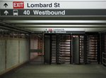 Image 62512 (106k, 800x600) Photo by: Dante D. Angerville Location: Lombard-South | 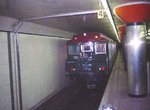 Image 70155 (145k, 1044x699) Photo by: Bob Wright Location: Pattison | 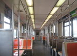 Image 94031 (207k, 1044x788) Photo by: Jorge Catayi Location: Broad Street Subway-Rolling Stock Interiors | 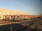 Image 99819 (229k, 1024x768) Photo by: Andre Samuel Location: Fern Rock Yard/Shops | 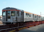 Image 128764 (320k, 1044x788) Photo by: Bob Wright Location: Fern Rock Yard/Shops |
Photos By Location
Photo locations: Pattison, Oregon, Snyder, Tasker-Morris, Ellsworth-Federal, Lombard-South, Walnut-Locust, City Hall, Race-Vine, Spring Garden, Fairmount, Girard, Cecil B. Moore, Susquehanna-Dauphin, North Philadelphia, Allegheny, Erie, Hunting Park, Wyoming, Logan, Olney, Fern Rock Transportation Center, Fairmount-Ridge, Chinatown-Ridge, 8th & Market-Ridge, Fern Rock Yard/Shops, Broad Street Subway-Rolling Stock Interiors, (Misc/Unknown)
Related Documents
Broad Street Subway News (1915-1931). A collection of news articles about the Broad Street Subway, from Electric Railway Journal, 1915-1931. Operating Contract Plan for Philadelphia's Broad Street Subway. Philadelphia Subway Cars Designed for Speed, Safety and Convenience. Electrical Equipment Specially Designed for Philadelphia Subway. Elaborate Shop and Yard Facilities Provided for Philadelphia Subway. New Philadelphia Subway a Vital Unit in City's Transportation System.
Page Credits
By Peggy Darlington, John Jones, George Metz and Bob Wright
| ||||||||||||||