63rd Street Tunnel and the Second Avenue Subway
Overview
As described elsewhere on nycsubway.org, the New York City subway system as we know it today was built primarily in three phases: the "First Subway" constructed by the Interborough Rapid Transit; the "Dual Contracts" undertaken by the Brooklyn-Manhattan Transit company and the IRT; and the city-owned and operated "Independent" subway. Nearly all of the lines in operation today fall into these three groupings and were mostly completed by 1940. Since then, most of the additions to the system, while not built under those three groupings, fall neatly into place: the Dyre Avenue extension linking to the IRT, the LIRR Rockaway branch connecting to the Independent, etc.
New construction projects in Manhattan since then have blurred the lines. Completed decades apart, the 63rd Street Tunnel and the Second Avenue Subway (Phase I) are interlinked and serve as extensions of lines originally considered BMT (Dual Contracts era) and Independent Subway.
Chrystie Street Connection
In 1968, major changes came to the 6th Avenue line as part of the so-called Chrystie Street Connection project. This relatively short stretch of new subway from the Manhattan Bridge to the Houston Street subway east of Broadway-Lafayette station had far-reaching implications to service throughout the system, but most directly to the IND 6th Avenue and to the BMT lines that crossed the Manhattan Bridge.
Essentially, the Manhattan Bridge had been built with two pairs of tracks, the "north side" and the "south side". When constructed, the Manhattan end of the north side tracks fed the BMT Broadway Subway via Canal Street, and the south side tracks fed the BMT Nassau Loop north of Chambers Street. This track map will illustrate the Manhattan Bridge connections prior to the Chrystie Street work. It was apparent, due to the rising importance of the midtown parts of Manhattan, that the bridge's south side, feeding toward downtown Manhattan, was being underutilized.
So it was decided to rearrange the Manhattan connections; the south side of the bridge would be connected to the BMT Broadway Subway at Canal Street and the connection to the Nassau Street line would be severed. A new subway would be constructed under the blocks between Chrystie Street and Forsyth Street from the Manhattan Bridge to Houston Street, connecting to the IND Sixth Avenue Line heading toward Broadway/Lafayette station. Connections were also made allowing trains from Brooklyn on the Williamsburg bridge to access the Sixth Avenue Line, providing a lot more potential for service to midtown. A new station was built along Chrystie Street at Grand Street, which opened November 28, 1967.
To accommodate all of this new traffic to be flowing along SIxth Avenue, the express tracks between West 4th Street and 34th Street were constructed. An extension northward past 47th-50th Street under Sixth Avenue was also constructed, and a station situated at 57th Street to terminate some of these new services. The 57th Street terminal station opened on July 1, 1968. It was expected that this stub would eventually be extended to...
The 63rd Street Tunnel
The earlier "Chrystie Street Connection" project, conceived in the 1950s to unify the BMT Southern Division lines and those of the Independent Subway in Manhattan (generally in order to put the four tracks on the Manhattan Bridge to fuller use), completed the Sixth Avenue Line's express tracks, and extended it to 57th Street to provide a new northern terminal for the additional trains running along Sixth Avenue into Chrystie Street.
To provide new service capacity to Queens, for both the subway and the Long Island Rail Road, the 63rd Street Tunnel project was designed to connect the IND 6th Avenue Line and BMT Broadway Line at their northern ends to the Second Avenue Subway and the IND Queens Boulevard Line. Each of the two Manhattan trunk lines was to be connected to a new tunnel running under Central Park and 63rd Street, via the East River and Roosevelt Island, to Queens. Construction on the 63rd Street Tunnel began on November 25th, 1969. Under the East River, trenches were dug in the riverbed for prefabricated concrete "tubes" that were sunk into place and connected. The under-river portion of the tunnel consisted of two levels: subway trains would run on the upper level and LIRR trains on the lower level (see below).
The 63rd Street Tunnel and connections in Queens added 3.2 miles of new subway and stations at 63rd Street/Lexington Avenue, Roosevelt Island, and 21st Street/Queensbridge. Service through the tunnel to 21st Street/Queensbridge began on October 29, 1989. From 1989 to 2001, with the "Q" train running on Sixth Avenue due to Manhattan Bridge work, the primary service pattern saw the "Q" train extended from 57th Street/Sixth Avenue running through the tunnel and terminating at 21st Street/Queensbridge during rush hours and middays, and the "B" train servicing the tunnel during evening and overnight hours. Despite there being a connection from 63rd Street to the BMT Broadway Line, no regular service from the BMT Broadway Line operated until 2017. There were instances of construction projects related to the Queens Boulevard junction requiring shuttle operation servicing the tunnel's stations from the Broadway line, terminating at 34th St. or 57th Street. The BMT connection appeared on subway maps for only brief periods between 1989 and 2017.
The 63rd Street Tunnel was designed in conjunction with the Second Avenue Subway and both were expected to be built simultaneously beginning in the 1970s. As a result, the 63rd Street Tunnel line is intricately interwoven with the plans for the Second Avenue Subway. Provisions for connection or cross-platform transfer between the Sixth Avenue line and the planned Second Avenue Subway happen at:
- 63rd Street/2nd Avenue tunnel junction. The 63rd Street Tunnel junction will allow Second Avenue and Sixth Avenue trains to head to Queens Boulevard, and Broadway trains to head north along Second Avenue. When the Second Avenue line is completed, its initial operation will involve an extension of a service from the Broadway line.
- 63rd Street/Lexington Avenue Station. Behind the platform wall on each level is a second track from the Broadway line intended for future connection to the 2nd Avenue line. The track is currently used for midday layups.
- Second Avenue Station. Provision for an upper level station serving the Second Avenue line, crossing the platforms of the Sixth Avenue/Houston Street line, was built during the original 1936 construction of this station.
- Grand Street Station. At Grand Street, there may or may not have been provision made for two additional tracks along the outside of Grand Street Station to serve the Second Avenue Subway. It's not clear if this was actually built despite the idea to do so.
The 63rd Street Tunnel is also playing a large role in the LIRR's grand plan to bring trains into Grand Central Terminal. As built, the 63rd Street Tunnel consists of two levels, two tracks on the upper level serving the subway lines as described above, and an as-yet-unused lower level designed for future LIRR use. The lower level was built with bellmouths at either end. In the spring of 2006, MTA awarded a contract to extend the LIRR tunnel under Northern Blvd. (necessitating the underpinning of the BMT subway, as well as constructing slurry walls to carry ground water away) and create the Queens Portal; in July of 2006, MTA awarded the consortium of Dragados Judlau a $439 million contract to extend the western end of the tunnel from Second Ave. and 63rd Street to Grand Central Terminal via deep boring. Dragados is procuring four tunnel boring machines for this purpose. The Grand Central Terminal portion would be new track construction on the lower level of the terminal, and would not tie in to the existing Metro-North trackage. The LIRR service would provide relief to the Queens Boulevard and Flushing lines for passengers traveling from eastern Queens to Grand Central.
 Location of Project (63rd Street Connections) under Central Park. Source: East 63rd St Line, Manhattan/Queens Boroughs, New York: Draft Environmental Statement. Page 48. |
63rd Street/Queens Boulevard Connector
The 63rd Street tunnel was left incomplete: a tunnel-to-nowhere terminating at 21st Street/Queensbridge. There were grandiose plans to construct a new Queens Super-Express line for the 63rd Street traffic, but fiscal tightening resulted in a scaled-back connection to the Queens Boulevard subway. Environmental and preliminary engineering work for a connection to the Queens Boulevard subway was completed in the summer of 1992 and a contract awarded to Parsons-Brinkerhoff for design and construction. Construction finally began in July 1994 after the Federal Transit Administration (FTA) concluded a Full Funding Grant Agreement with the MTA. The MTA spent a grand total of $645 million on the project, with the FTA's Section 5309 New Start program supplying $306.1 million and the MTA the remainder.
The Connector project actually consisted of several tasks involving significant engineering challenges:
- Extensive rehabilitation of eight miles of the existing 63rd Street tunnels, including new signals and track crossovers.
- Extending both levels of the 63rd Street tunnel 1300 feet and joining the upper level to existing subway lines by means of new ramps; the lower level, belonging to the LIRR, was extended as MTA proceeded with plans to connect this tunnel to the LIRR's Main Line and Port Washington Branch.
- Widening the main Queens Boulevard corridor line between 33rd and 36th Street to six tracks, two of which being ramps entering below the main line and rising to switches west of 36th Street station, allowing trains to access either local or express tracks.
- Constructing diversion tunnels to allow existing subway services to continue operating without interruption.
- Tunneling 20 feet under the Northern Boulevard subway, and underpinning, the existing Northern Boulevard roadway, buildings and express tracks. This required the contractors to cut deep shafts through 140 ft. of rock after slurry walls were built. The new tunnels then had to penetrate an inverted concrete plug.
- Providing up to 90-foot wide temporary roadway surfaces to allow automobiles to operate unimpeded.
- Integration of two four-story, 8,000 square foot ventilation buildings located at 29th Street and 39th Street.
- Lowering of a sewer siphon 50 feet to make room for a new tunnel.
- Mitigation of significant ground water.
- Construction of a new TA employee facility.
The 63rd Street line continues east under 41 Avenue, crossing 20 feet under the Queens Boulevard line at Northern Boulevard; each track turns northeasterly and climbs a ramp between newly designated local and express tracks west of 36th Street station.
MTA's service plan was designed to increase total train capacity between Queens and Manhattan by about 20%. It created an additional weekday local train, the V (now M), to replace the F train in the 53rd Street tunnel, and shifted the F train permanently to the 63rd Street tunnel. The F now operates as an express between 21 Street-Queensbridge and Roosevelt Boulevard stations, but can be easily diverted to the local track if needed. The G train was truncated to a new terminal at Court Square; in effect, the G represented passenger carrying capacity to Brooklyn which was redirected to Manhattan. To compensate G riders for this loss of direct Queens-Brooklyn service, a free MetroCard transfer was created between the 7, G and the E and V trains at 23rd-Ely Av station, and a moving sidewalk was installed; to mitigate the impact on F riders who normally used the 53rd-Lexington station's free interchange, another free MetroCard transfer was created between the IND 63rd-Lexington Av station and the IRT 59th-Lexington Ave. station. Future plans call for additional physical improvements to the stations in the Court Square area, to improve passenger comfort and provide ADA access. The 63rd Street tunnel also provides MTA with additional flexibility in the event of either scheduled or unscheduled closure of either the 60th Street or 53rd Street tunnels.
The connection between the 63rd Street Tunnel and the IND Queens Boulevard subway line was completed in 2001. Service changes after the September 11, 2001 destruction of the World Trade Center delayed the opening, and through service subsequently began on December 16, 2001, resulting in the service patterns operating now: the "F" train serves 63rd Street and all of the stations built as part of this project full-time.
 63rd Street Connector. Project Overview. Source: MTA. |
The Second Avenue Subway
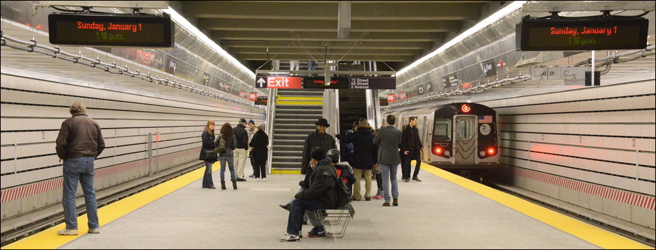
The Second Avenue subway has been in various stages of planning, funding, and construction since the 1920s. For various reasons, including the Great Depression, World War II, and the 1970s city fiscal crisis, only small portions were constructed. On March 20, 2007, the MTA awarded a $337 million tunnelling contract for the first phase of the Second Avenue Subway to the consortium of Schiavone/Shea/Skanska. A ceremonial ground-breaking took place on April 12, 2007. Finally, on January 1, 2017, the first phase of the line finally opened to passengers. This "Phase I" consists of three new stations, at 96th Street, 86th Street, and 72nd Street; two deep-bore tunnels of about two miles each; and renovations and expansion of the existing station at Lexington Avenue-63rd Street.
Phase 2 of the subway project will extend the Second Avenue Subway to a transfer point with the IRT East Side Line at 125th Street.
Opening/Closing Dates
| Station | Opened | Closed |
|---|---|---|
| Second Avenue Subway | ||
| 125th Street | Phase II-TBD | |
| 116th Street | Phase II-TBD | |
| 106th Street | Phase II-TBD | |
| 96th Street | 1/1/2017 | |
| 86th Street | 1/1/2017 | |
| 72nd Street | 1/1/2017 | |
| Lexington Ave-63rd Street (North Side) | 1/1/2017 | |
| 55th Street | Phase III-TBD | |
| 42nd Street | Phase III-TBD | |
| 34th Street | Phase III-TBD | |
| 23rd Street | Phase III-TBD | |
| 14th Street | Phase III-TBD | |
| Houston Street | Phase III-TBD | |
| Grand Street | Phase IV-TBD | |
| Chatham Square | Phase IV-TBD | |
| South Street Seaport | Phase IV-TBD | |
| Hanover Square | Phase IV-TBD | |
| 63rd Street Tunnel | ||
| 21st Street-Queensbridge | 10/29/1989 | |
| Roosevelt Island | 10/29/1989 | |
| Lexington Avenue-63rd Street | 10/29/1989 | |
| 57th Street Extension | ||
| 57th Street | 7/1/1968 | |
Track Maps
Station By Station
57th Street
Artwork Metropolitan Faces (Alex Katz, 2018)
F The 57th Street/6th Avenue station represents the end of one subway construction project (the "Chrystie Street Connection" and the completion of the Sixth Avenue express tracks), and the beginning of another subway construction project (the 63rd Street Tunnel). To handle the extra traffic flow along Sixth Avenue from Chrystie Street, a new terminal was required to handle one of the new express services. As it happened, provision for the extension from 47th-50th Street to 57th Street was built into the 53rd Street junction during the junction's original 1930s construction, and by 1968, the 63rd Street Tunnel project was in the planning stages. The 57th Street Station was thus built to connect the two projects.
57th Street/6th Avenue Station served as a terminal station from its opening in 1968 to October 1989. Various services were terminated here at different times of the day, including the short-lived "JFK Express" service. There is one extra-wide island platform and a mezzanine level typical of IND stations; however, the decor is spartan even by IND standards. There is no color tile band or other mosaic decoration. The trackside walls are furnished with light beige "subway tiles" oriented vertically and sans-serif "57th St." stenciled along the walls. At mezzanine level there is extensive use of glass partition walls, not common to other IND stations, making up the fare control areas. There are three fare control areas. Generally speaking, the station is very clean, well lit, well maintained and very plainly functional.
 Photo by: Doug Grotjahn |
 Photo by: Doug Grotjahn |
 Photo by: Stuart Gitlow |
 Photo by: John Barnes |
 Photo by: Jie Wen Li |
| More Images: 1-50 51-97 | ||||
Lexington Avenue/63rd Street
Artwork Elevated (Jean Shin, 2016)
FQ![]() The 63rd Street Tunnel project included three new stations. The major one, serving as a transfer point between services along 63rd Street to Queens Boulevard and services north along Second Avenue, is this bi-level station at Lexington Avenue/63rd Street. There are two tracks and two island platforms, one above the other, connected by stairways and an elevator. Trains bound for Second Avenue and Queens use the lower level (approx. 100 feet below street level), and Manhattan-bound trains use the upper level (approx. 80 feet below street level). From the west end upper level platform there are three long escalators and intermediate levels leading to the fare control at Lexington Avenue. All of the intermediate levels feature soaring high ceiling design. This station has full elevator access to all platforms and the street.
The 63rd Street Tunnel project included three new stations. The major one, serving as a transfer point between services along 63rd Street to Queens Boulevard and services north along Second Avenue, is this bi-level station at Lexington Avenue/63rd Street. There are two tracks and two island platforms, one above the other, connected by stairways and an elevator. Trains bound for Second Avenue and Queens use the lower level (approx. 100 feet below street level), and Manhattan-bound trains use the upper level (approx. 80 feet below street level). From the west end upper level platform there are three long escalators and intermediate levels leading to the fare control at Lexington Avenue. All of the intermediate levels feature soaring high ceiling design. This station has full elevator access to all platforms and the street.
From October 1989, when the station was first opened, the two platforms were divided by a curtain wall constructed of fairly hideous bright orange tile. As the Second Avenue Subway was still just imaginary in 1989, only the tracks bound for Queens were in use, and these are the ones on the south side of the station, situated east-west under 63rd Street. Behind the curtain wall on each level lay a second track intended for future connection to the Second Avenue Subway. At the west end, these tracks were connected to the BMT Broadway Line (and also by a pair of crossover switches to 57th Street/Sixth Avenue), and they were used for train layups and other temporary service diversions periodically until 2017.
The completion of the first phase of the Second Avenue Subway led to the removal of the curtain wall and a full renovation of the station. Gone were the hideous orange tiles and the curtain wall along the platform. The platform walls are now lined with horizontal "faceplating" attached to the concrete walls behind. This same design can be seen in the other modern MTA stations at South Ferry (new island platform station) and 34th Street/Hudson Yards on the IRT Flushing Line, as well as all three of the new stations on Second Avenue. At the east end of the station a provision for an entrance, left as a shaftway and temporary stairs after construction, was outfitted to become a new entry-exit and fare control located at Third Avenue. East of the station on the Queens tracks, sharp-eyed riders can spot turnouts heading south; these would connect to future phases of the Second Avenue Subway, such that a service may be operated between lower Manhattan and Queens.
New artwork by Jean Shin, located at the new Third Avenue entry and entitled "Elevated", draws on imagery invoking the days when the elevated train ran along Third Avenue. There are three different "parts" of the artwork, using different techniques of old photography and mosaic tile.
 Photo by: John Dooley |
 Photo by: Robbie Rosenfeld |
 Photo by: Robbie Rosenfeld |
 Photo by: Jose Garrido |
 Photo by: Jose Garrido |
| More Images: 1-50 51-100 101-139 | ||||
Roosevelt Island
Artwork Convex Disk at Roosevelt Island (Robert Hickman, 1996), Double Take (Diana Cooper, 2023)
F![]() Two side platforms, two tracks. At 100 feet below ground level, this
is one of the deepest stations in the system. Between the tracks
there is a low curtain wall between the two tracks with alternating
niches for transit workers. There are elevators and escalators up to
the fare control building at street level. The station building is a
large glass-enclosed space, giving us a view of the island and the
tram which is to the south of the subway station. Roosevelt Island
station is very "Parisien" (a side-platform station with no center
columns) and is similar to some of the deep tunnel IRT stations on the
West Side.
Two side platforms, two tracks. At 100 feet below ground level, this
is one of the deepest stations in the system. Between the tracks
there is a low curtain wall between the two tracks with alternating
niches for transit workers. There are elevators and escalators up to
the fare control building at street level. The station building is a
large glass-enclosed space, giving us a view of the island and the
tram which is to the south of the subway station. Roosevelt Island
station is very "Parisien" (a side-platform station with no center
columns) and is similar to some of the deep tunnel IRT stations on the
West Side.
 Photo by: David Pirmann |
 Photo by: David Pirmann |
 Photo by: Phillip Lee |
 Photo by: Roberto C. Tobar |
 Photo by: Anthony J. Liccese |
| More Images: 1-50 51-56 | ||||
21st Street-Queensbridge
Artwork Sorry, no artwork here.
F![]() Two tracks, two side platforms. There is a low crossover at the eastern end of the platform which gives us a view of the trains. The walls are brown brick with no mosaics. Past 21st Street-Queensbridge the line joins the Queens Boulevard subway.
Two tracks, two side platforms. There is a low crossover at the eastern end of the platform which gives us a view of the trains. The walls are brown brick with no mosaics. Past 21st Street-Queensbridge the line joins the Queens Boulevard subway.
 Photo by: Michael Hodurski |
 Photo by: David Pirmann |
 Photo by: Mark S. Feinman |
 Photo by: John Dooley |
 Photo by: Glenn L. Rowe |
| More Images: 1-50 51-55 | ||||
72nd Street
Artwork Perfect Strangers (Vik Muniz, 2016)
Q![]()
 Photo by: David Pirmann |
 Photo by: Brian Weinberg |
 Photo by: Robbie Rosenfeld |
 Photo by: Robbie Rosenfeld |
 Photo by: Robbie Rosenfeld |
| More Images: 1-50 51-60 | ||||
86th Street
Artwork Subway Portraits (Chuck Close, 2016)
Q![]()
 Photo by: David Pirmann |
 Photo by: Nicholas Noel |
 Photo by: Robbie Rosenfeld |
 Photo by: Robbie Rosenfeld |
 Photo by: Robbie Rosenfeld |
| More Images: 1-48 | ||||
96th Street
Artwork Blueprint for a Landscape (Sarah Sze, 2016)
Q![]()
 Photo by: David Pirmann |
 Photo by: John Dooley |
 Photo by: Nicholas Noel |
 Photo by: Robbie Rosenfeld |
 Photo by: John Dooley |
| More Images: 1-50 51-55 | ||||
Future Stations
This section will contain news and notes about future sections of the Second Avenue Subway.
125th Street
 125th Street - Conceptual Cross Section. Source: Second Avenue Subway, Supplemental Draft Environmental Impact Statement, Volume 1, March 2003, MTA New York City Transit. Figure 2-8. |
Grand Street
 Grand Street - Shallow Level (Island Platform) Chrystie Street Option. Source: Second Avenue Subway, Supplemental Draft Environmental Impact Statement, Volume 1. Figure S-3. |
 Grand Street - Deep Level Chrystie Street Option. Source: Second Avenue Subway, Supplemental Draft Environmental Impact Statement, Volume 1. Figure S-4. |
 Grand Street - Forsyth Street Option. Source: Second Avenue Subway, Supplemental Draft Environmental Impact Statement, Volume 1.. Figure S-5. |
Historical Documents
We have a collection of documents pertaining to the 1970s attempt at constructing the Second Avenue Subway.
- Second Avenue Subway: Route 132-A (34th Street to 126th Street) (Urban Mass Transportation Administration, Department of Transportation, Federal Transit Administration, August, 1971)
- Second Avenue Subway: Route 132-C (Whitehall Street to 34th Street) (Urban Mass Transportation Administration, Department of Transportation, Federal Transit Administration, March, 1973)
- Second Avenue Subway: Route 132-C Phase I Report, Second Avenue and Water Street Subway] (New York City Transit Authority, June, 1973)
- Second Avenue Subway: Route 132-B Study C Report, Second Avenue Subway, The Bronx, Study C] (New York City Transit Authority, April, 1975)
- Second Avenue Subway: The Line That Almost Never Was (New York City Transit Authority, 1972)
- Second Avenue Subway: Timeline
- IND Second System - 1929 Plan (New York Times)
- Proposed 2nd Avenue Subway Track Map (showing interconnections with the 6th Avenue line at 63rd St. and 2nd Ave./Grand Street.)
Completed Portions (1970s)
Construction contracts were let about 1974 for four sections, but the city budget crisis prevented further work. The contracts begun were completed and so these four bits have been completed:
- Chinatown, near the Manhattan Bridge: From the east side of the
Bowery along Division Street, to Chrystie Street. Passes in front of
Confucius Plaza (apartment tower), P.S. 124, under private property
(notice a ventilation structure aboveground), and then under Manhattan
Bridge plaza to near the north side of the plaza, ending a bit short
of the Chrystie St line. (This is a short distance, about 2 blocks
total.) The structure underpins the subway coming off of the Manhattan
Bridge (the existing "Canal Street Bridge Line" and the former
connection to the Nassau Street loop). North of here, contract
drawings indicate that the tunnel would continue to come into Grand
St. station on either side of the existing route, offering
cross-platform transfers. It is unknown whether the Chrystie Street
construction included the 2nd Avenue tunnels which would run along
Chrystie St. north and south of Grand Street for a few blocks. (See
the Proposed Track Map, 2nd Avenue Subway, 1970s
for the Grand Street track connections.) South of here, the likely
route would be St. James Place, Pearl Street, Water Street to
Whitehall Street terminal; or a connection to the unused Manhattan
Bridge approach from Nassau Street (which would provde a lower
Manhattan terminal without any lower Manhattan construction).
 1974 portion of 2nd Avenue Subway completed in Chinatown. Source: Second Avenue Subway Final Environmental Impact Statement (FEIS), May 2004. Figure 2-06.
 - Second Ave, from 2nd St to 9th St, 2 trackways. Rumors about this particular section claim alternatively that this section was filled back in after excavation; or that it wasn't excavated at all and that the only work actually performed was limited to utility relocation in the area.
- Second Ave, from 99th St to 105th St, 2 trackways.
- Second Ave, from 110th St to 119th St, 2 trackways.
- In addition to those four contracts, bellmouths for the connections at 63rd Street were incorporated into the construction of the 63rd Street Tunnel. It is unknown how much was actually built, but the bellmouths are clearly visible from trains passing through the 63rd Street Tunnel.
None of these sections included the stations, which were to be located near these segments at 96th-99th St., 105th St., and 125th St. In 2003, the MTA resumed planning and environmental analysis for a full-length Second Avenue Subway, from 125th Street to the Financial District in Lower Manhattan.
Further Reading
Second Avenue Subway, Supplemental Draft Environmental Impact Statement, Volume 1, MTA New York City Transit, March 2003. (a.k.a. Second Avenue Subway in the Borough of Manhattan, New York County)
Second Avenue Subway, Supplemental Draft Environmental Impact Statement, Volume 2 (Appendices), MTA New York City Transit, March 2003. (a.k.a. Second Avenue Subway in the Borough of Manhattan, New York County)
Second Avenue Subway Final Environmental Impact Statement (FEIS), MTA New York City Transit, May 2004.
East 63rd St Line, Manhattan/Queens Boroughs, New York: Draft Environmental Statement, Urban Mass Transportation Administration, U. S. Department of Transportation, January 1973.
Final Environmental Impact Statement for the 63rd Street Line Connection to the Queens Boulevard Line, Metropolitan Transportation Authority/US Department of Transportation, Federal Transit Administration, June 1992.