TTC Streetcar Lines
![]()
TTC CLRV no. 4144 on the 505-Dundas at Dundas/Yonge. Photo by David Pirmann, February 2001.
Overview
The TTC has a network of 11 streetcar routes and 248* streetcars that serve the heaviest surface routes in Toronto. There are 196 CLRVs (Canadian Light Rail Vehicles) - numbered 4000-4005 and 4010-4199 and 52 ALRVs* (Articulated Light Rail Vehicles) - numbered 4200-4251.
The CLRVs went into service between 1978 and 1980, but you would never know it to ride them. Most of them have been repainted within the last few years and are looking great. The ALRVs went into service between 1987-1989 - but they look older than the CLRVs. Some are now being repainted - but most are looking tired and they are not as smooth to ride as the CLRVs. The last PCCs were taken out of revenue service in December 1995 - but 4500 and 4549 are still available for charters.
Route Map
Track Map
Current Routes
501-Queen
The 501-Queen route runs along Queen St., the Queensway and Lakeshore Blvd. from Neville Park in the east to Long Branch in the West. On Queen St. and Lakeshore Blvd the Queen car runs along the street with traffic, but has a private ROW on the Queensway.
The Queen car travels through a variety of neighborhoods along Queen st. from the trendy "Beach" and "Queen West" areas to the more humble Leslieville and Parkdale neighborhoods. It also passes through the heart of downtown and a soon-to-be condo haven just west. The one thing all these parts of the Queen route have in common, is that they are very slow moving. The Queen streetcar is prone to delays and bunching - even though the headways (relative to other TTC streetcar routes) are wide.
A one way trip is over 15 miles and scheduled to take 90 minutes during the day (75 minutes after midnight). The route was extended west from Humber loop to Long Branch in 1994, incorporating the 507 route to provide a one seat ride from Long Branch to downtown. Still, there are long headways between Humber Loop and Long Branch since every second car runs from Neville Pk to Humber only.
From a railfan perspective the Queen car is rewarding since it passes both carhouses - Russell (at Connaught Ave.) and Roncesvalles. It also uses three off street loops (with Neville Park being the prettiest) for scheduled service and several others for short turns (Woodbine, McCaul, Wolseley). Service on Queen is provided by ALRVs with CLRVs on Sundays (except summer) and for occassional extras.
Also, railfans should note the short section of gauntlet track on Queen just east of Coxwell. The Queen-Coxwell Loop is used when a car coming south on the non-revenue track on Coxwell is to turn back north; its south side interlaces with the westbound track on Queen. Although streetcars on either track are going west while on the gauntlet, no crossover is provided between the two tracks; it isn't needed because the junction tracks in the Queen/Coxwell intersection provide the same moves. (Historically, until 1966 this loop was the southern terminus of a short streetcar route along Coxwell, just running to Danforth Ave. When the east-west subway was opened, the route was converted to buses. It's this same bus that's extended to Bingham Loop during the hours when the 502 does not run.)
Photo locations: Queen/Neville Park Loop, Queen/Neville Park, Queen/Silver Birch, Queen/Beech, Queen/Spruce Hill, Queen/Balsam, Queen/Maclean, Queen/Glen Manor, Queen/Scarboro Beach, Queen/Wineva, Queen/Lee, Queen/Waverly, Queen/Kippendavie/Elmer, Queen/Woodbine, Queen/Sarah Ashbridge/Lockwood, Queen/Woodbine Loop, Queen/Kingston/Eastern, Queen/Coxwell/Queen-Coxwell Loop, Queen/Woodward/Kent, Queen/Woodfield, Queen/Connaught/Russell Carhouse, Connaught/Eastern/Russell Carhouse, Queen/Vancouver/Russell Carhouse, Queen/Greenwood, Queen/Laing, Queen/Alton, Queen/Leslie, Queen/Jones, Queen/Caroline, Queen/Brooklyn, Queen/Winnifred, Queen/Pape, Queen/Carlaw, Queen/Logan, Queen/Booth, Queen/Empire, Queen/McGee, Queen/De Grassi, Queen/Boulton, Queen/Saulter, Queen/Lewis, Queen/Broadview, Queen/Hamilton, Queen/Carroll, Queen/Davies, Queen/Don River Bridge, Queen/King E., Queen/River, Queen/Sumach, Queen/Bright, Queen/Sackville, Queen/Power/Trefann, Queen/Parliament, Queen/Ontario, Queen/Sherbourne, Queen/George, Queen/Jarvis, Queen/Church, Queen/Berti, Queen/Victoria, Queen/Yonge, Queen/James, Queen/Bay, Queen/York, Queen/University, Queen/Simcoe, Queen/McCaul, Queen/John, Queen/Peter/Soho, Queen/Spadina, Queen/Augusta, Queen/Denison, Queen/Portland, Queen/Bathurst, Queen/Tecumseth/Palmerston, Queen/Claremont, Queen/Niagara, Queen/Bellwoods, Queen/Walnut, Queen/Strachan, Queen/Shaw, Queen/Ossington, Queen/Dovercourt, Queen/Abell, Queen/Beaconsfield, Queen/Gladstone, Queen/Dufferin, Queen/Brock, Queen/Cowan, Queen/O'Hara, Queen/Dunn, Queen/Lansdowne, Queen/Dowling, Queen/Sorauren/Beaty, Queen/Callender, Queen/Wilson Park, Queen/Triller, Queen/King W./The Queensway/Roncesvalles, The Queensway/Roncesvalles Carhouse, The Queensway/Sunnyside Loop, The Queensway/Glendale, The Queensway/Parkside, The Queensway/Colborne Lodge, The Queensway/Ellis, The Queensway/Windermere, The Queensway/South Kingsway, The Queensway/Humber River Bridge, The Queensway/between Humber River Bridge and Humber Loop, Humber Loop, Lake Shore/Brookers/Gardiner Expwy. ramp, Lake Shore/Park Lawn/Marine Parade, Lake Shore/Legion, Lake Shore/Louisa, Lake Shore/Burlington, Lake Shore/Superior, Lake Shore/Mimico, Lake Shore/Summerhill, Lake Shore/Hillside, Lake Shore/Norris, Lake Shore/Queens, Lake Shore/Symons, Lake Shore/Miles, Lake Shore/Lake, Lake Shore/Royal York, Lake Shore/First, Lake Shore/3rd, Lake Shore/5th, Lake Shore/Islington/7th, Lake Shore/10th, Lake Shore/13th, Lake Shore/15th, Lake Shore/Kipling/Col. Samuel Smith Park, Kipling Loop, Lake Shore/22nd, Lake Shore/23rd, Lake Shore/24th, Lake Shore/26th, Lake Shore/27th, Lake Shore/28th, Lake Shore/29th, Lake Shore/30th, Lake Shore/Long Branch, Lake Shore/37th, Lake Shore/Browns Line/39th, Lake Shore/Long Branch Loop, King/Shaw, King/Dufferin, Richmond/Yonge, Richmond/York, Roncesvalles/Westminster, Wellington/York, Richmond/Victoria, Adelaide/Peter, Parliament/Shuter, Richmond/Church, Shaw/Adelaide, Bingham Loop, Kingston/Waverly, Dundas/Arnold, Dundas/Victoria, Gerrard/Broadview, King/York, (Misc/Unknown)
502-Downtowner
The 502-Downtowner route starts at Bingham Loop at Victoria Park and Kingston Road, travels south and west along Kingston Rd. to Queen, and along Queen to McCaul St. downtown. It loops in an offstreet loop on McCaul St. a few hundred feet north of Queen. The facade of a Chicago trolley is part of the diner that faces the street from the loop. Mainly the Downtowner car is used to boost service on the Eastern part of the 501-Queen route as well as providing service to the residential neighborhood along Kingston Rd.
Unfortunately, the service is generally very poor. Cars run every 12-15 minutes in rush hour and 20 minutes middays. There is no evening or weekend service. The Kingston Rd. part of the route is served by buses at other times, while the 501 cars pick up the slack on Queen. When the cars do run, the route is subject to delays and bunching that occurs on Queen St.
This route was previously called Kingston Road (today's 503-Kingston Road was considered a branch of it). The name was changed to Downtowner in 1974 when it was extended via Queen and Bathurst to Bathurst station. This extended service lasted only a few years.
From a railfan perspective, McCaul and Bingham loops are quite nice and there are some nice spots on Queen street.
Photo locations: Bingham Loop, Kingston/Victoria Park, Kingston/Bingham, Kingston/Scarborough, Kingston/Beech, Kingston/Malvern, Kingston/Glen Manor, Kingston/Walter, Kingston/Main/Southwood, Kingston/Lee, Kingston/Waverly/Brookside, Kingston/Elmer, Kingston/Woodbine, Kingston/Rainsford, Kingston/Columbine, Kingston/Dundas/Dixon, Kingston/Woodbine Loop, Queen/Kingston/Eastern, Queen/Coxwell/Queen-Coxwell Loop, Queen/Woodward/Kent, Queen/Woodfield, Queen/Connaught/Russell Carhouse, Connaught/Eastern/Russell Carhouse, Queen/Vancouver/Russell Carhouse, Queen/Greenwood, Queen/Laing, Queen/Alton, Queen/Leslie, Queen/Jones, Queen/Caroline, Queen/Brooklyn, Queen/Winnifred, Queen/Pape, Queen/Carlaw, Queen/Logan, Queen/Booth, Queen/Empire, Queen/McGee, Queen/De Grassi, Queen/Boulton, Queen/Saulter, Queen/Lewis, Queen/Broadview, Queen/Hamilton, Queen/Carroll, Queen/Davies, Queen/Don River Bridge, Queen/King E., Queen/River, Queen/Sumach, Queen/Bright, Queen/Sackville, Queen/Power/Trefann, Queen/Parliament, Queen/Ontario, Queen/Sherbourne, Queen/George, Queen/Jarvis, Queen/Church, Queen/Berti, Queen/Victoria, Queen/Yonge, Queen/James, Queen/Bay, Queen/York, Queen/University, Queen/Simcoe, Queen/McCaul, McCaul/Stephanie, McCaul Loop, Queen/John, Queen/Peter/Soho, Queen/Spadina, Queen/Augusta, Queen/Denison, Queen/Portland, Queen/Bathurst, Bathurst/Queen, Bathurst/Wolseley Loop, Bathurst/Eden Place, Bathurst/Carr/Robinson, Bathurst/between Dundas and Carr, Bathurst/Dundas, Bathurst/Nassau, Bathurst/College, Bathurst/Ulster, Bathurst/Harbord, Bathurst/Herrick, Bathurst/Lennox, Bathurst/Bloor, Bathurst Station, Richmond/Bay, Richmond/York, Church/Richmond, (Misc/Unknown)
503-Kingston Road
The 503-Kingston Road route starts at Bingham Loop at Victoria Park and Kingston Rd., just like the 502. It proceeds down Kingston Rd. to Queen and along Queen to King Street, sharing track with the 502 (and the 501 for the Queen portion). It then turns on to King and shares track with the 504 car until it reaches Church Street downtown. The 503 then turns south on Church, west on Wellington and north on York to King where the loop is complete and it starts east again.
The areas the 503 serves are briefly described on the 501, 502 and 504 pages, except for the on-street loop downtown. Church and Wellington is the heart of old Toronto and home to the famous Flatiron building. West of here, Wellington passes through the heart of the business district.
Since the 503 runs on the same rails as 501, 502, and 504 cars, the service is confined to rush hours only Monday to Friday and 12 - 15 minute headways at that.
Photo locations: Bingham Loop, Kingston/Victoria Park, Kingston/Bingham, Kingston/Scarborough, Kingston/Beech, Kingston/Malvern, Kingston/Glen Manor, Kingston/Walter, Kingston/Main/Southwood, Kingston/Lee, Kingston/Waverly/Brookside, Kingston/Elmer, Kingston/Woodbine, Kingston/Rainsford, Kingston/Columbine, Kingston/Dundas/Dixon, Kingston/Woodbine Loop, Queen/Kingston/Eastern, Queen/Coxwell/Queen-Coxwell Loop, Queen/Woodward/Kent, Queen/Woodfield, Queen/Connaught/Russell Carhouse, Connaught/Eastern/Russell Carhouse, Queen/Vancouver/Russell Carhouse, Queen/Greenwood, Queen/Laing, Queen/Alton, Queen/Leslie, Queen/Jones, Queen/Caroline, Queen/Brooklyn, Queen/Winnifred, Queen/Pape, Queen/Carlaw, Queen/Logan, Queen/Booth, Queen/Empire, Queen/McGee, Queen/De Grassi, Queen/Boulton, Queen/Saulter, Queen/Lewis, Queen/Broadview, Queen/Hamilton, Queen/Carroll, Queen/Davies, Queen/Don River Bridge, Queen/King E., King/River, King/St. Lawrence, King/Sumach, King/Virgin, King/Sackville, King/Trinity, King/Parliament, King/Berkeley, King/Ontario, King/Sherbourne, King/George, King/Jarvis, King/Church, Church/Wellington, Wellington/Yonge, Wellington/Bay, Wellington/York, King/York, King/Bay, King/Yonge, King/Victoria, Broadview/Dundas, (Misc/Unknown)
504-King
King is a U-shaped route that runs from Broadview Station to Dundas West Station via Broadview, Queen, King, Roncesvalles and Dundas. A trip is scheduled for 116 minutes at peak and 90 minutes at night. Even though the route is well used, it runs at a decent pace most times. The exception is the part on King between Church and Spadina. This is the heart of the central business district and in rush hours there are both heavy loads and heavy traffic.
King is a good route for railfans. From Broadview Station to Gerrard, the tracks twist and turn every couple hundred feet on the edge of the Don Valley. A magnificent view of the city skyline can be seen as the 504 and 505 cars pass alongside a park. As Gerrard approaches, so does Chinatown east. The Gerrard/Broadview intersection is always busy with streetcars and pedestrians and is a major transfer point between the 504/505 cars and the 506. Turning onto Queen, the 504 joins the 501, 502, and 503 cars. Two stops after Queen, the cars cross the Don River, and then turn on to King Street. King east is mostly old industrial and not too great for ridership. Short turns are frequently made at Church and Parliament to bypass the eastern part of the route. At Yonge Street, the financial sector starts, with King and Bay recognized as the Wall St. of Canada. West of University, theatres, pubs and trendy restaurants abound. At Spadina, 510 cars come out of Charlotte loop and on to King for one short block. King cars use this loop once in a while as well.
From Spadina to Dufferin, the neighborhood is fast becoming a high tech Mecca - with lots of lofts and condos springing up. When the streetcar crosses Dufferin, railfans should look north along the non-revenue tracks, for a glimpse of the TTC's only example of a streetcar track used for two-way travel with a crossover connecting the two tracks.
A few blocks later King St. turns north and runs along side Lake Ontario - providing another great view. After crossing Queen, the 504 car runs up Roncesvalles - another great place to ride a streetcar. The stops are far enough apart to allow for some speed and the street is very lively and full of character. Just before Bloor St., Roncesvalles turns into Dundas St. and the 505 car shares the tracks into Dundas West Station.
Photo locations: Broadview Station, Broadview/Danforth, Broadview/Dearbourne, Broadview/Wolfrey, Broadview/Hogarth, Broadview/Millbrook, Broadview/Bain, Broadview/Withrow, Broadview/Riverdale, Broadview/Langley, Broadview/Simpson/Jack Layton, Broadview/Gerrard, Broadview/Mt. Stephen, Broadview/Dundas, Broadview/Kintyre, Broadview/Queen, Queen/Hamilton, Queen/Carroll, Queen/Davies, Queen/Don River Bridge, King/Queen E., King/River, King/St. Lawrence, King/Sumach, King/Virgin, King/Sackville, King/Trinity, King/Parliament, King/Berkeley, King/Ontario, King/Sherbourne, King/George, King/Jarvis, King/Church, King/Victoria, King/Yonge, King/Bay, King/York, King/University, King/Emily, King/Simcoe, King/Ed Mirvish (formerly Duncan), King/John, King/Blue Jays/Peter, King/Charlotte/Charlotte Loop, King/Spadina/Charlotte Loop, King/Brant, King/Portland, King/Bathurst, King/Tecumseth, King/Niagara, King/Strachan, King/Shaw, King/Sudbury, King/Atlantic, King/Jefferson, King/Joe Shuster, King/Fraser, King/Dufferin, King/Spencer, King/Cowan, King/Dunn, King/Close, King/Jameson, King/Springhurst, King/Dowling, King/Wilson Park, King/Triller, King/Queen W./Roncesvalles/The Queensway, Roncesvalles/Roncesvalles Carhouse, Roncesvalles/Marion, Roncesvalles/Galley, Roncesvalles/Garden, Roncesvalles/Fern, Roncesvalles/High Park/Fermanagh, Roncesvalles/Grenadier, Roncesvalles/Constance, Roncesvalles/Howard Park, Roncesvalles/Ritchie, Roncesvalles/Boustead, Roncesvalles/Dundas, Dundas/Bloor, Dundas/Vincent Loop, Dundas West Station, Dufferin/Melbourne, Parliament/Queen, York/Adelaide, Parliament/Richmond, Bingham Loop, Queen/Connaught/Russell Carhouse, Church/Richmond, The Queensway/Roncesvalles Carhouse, Dufferin/Springhurst, Queen/Logan, (Misc/Unknown)
505-Dundas
The 505-Dundas is a U-shaped route that runs from Broadview Station to Dundas West Station (like the 504-King). It runs down Broadview (with King) to Dundas and along Dundas to Dundas West. Despite the fact that the Dundas car only runs on two streets, it is far from a straight route. Dundas Street jogs in several places (Victoria, McCaul and Bathurst come to mind). After Lansdowne, Dundas Street curves north and the 506-Carlton joins the 505-Dundas for a few blocks.
The 505-Dundas car has the distinction of passing through the heart of both Chinatowns (at Gerrard and Broadview, and at Dundas and Spadina). It is notable for the spectacular run along Broadview (discussed in the 504-King section), the Don Bridge in the East End, the bridge over the railway tracks between Lansdowne and Sorauren, and the corners where it merges with the 504-King and 506-Carlton routes.
A trip on the 505-Dundas is a 40-50 minute ride one way, depending on the time of day, and is operated on 5-7 minute intervals on the weekdays from dawn to late evening. The 505-Dundas runs entirely in mixed traffic, but moves along fairly well. The greatest exception to this is the part from Yonge to west of Spadina where passenger loads are very heavy and there is a high volume of pedestrian and vehicular traffic. With construction underway to make Yonge and Dundas "Toronto's Times Square" that situation is likely to get worse not better. To maintain service, Dundas cars are often short turned at Parliament, Church and Lansdowne.
The Dundas route formerly ran from Runnymede and Dundas to City Hall Loop, an on-street downtown loop via Bay, Louisa, James, and Albert. Service to Broadview station was added in 1966; City Hall Loop became a secondary branch and closed in 1975. In the west, service was cut back to Dundas West station in 1968 when the subway was extended from Keele to Islington.
Photo locations: Broadview Station, Broadview/Danforth, Broadview/Dearbourne, Broadview/Wolfrey, Broadview/Hogarth, Broadview/Millbrook, Broadview/Bain, Broadview/Withrow, Broadview/Riverdale, Broadview/Langley, Broadview/Simpson/Jack Layton, Broadview/Gerrard, Broadview/Mt. Stephen, Broadview/Dundas, Dundas/Munro, Dundas/Don River Bridge, Dundas/River, Dundas/Sumach, Dundas/Sackville, Dundas/Regent, Dundas/Arnold, Dundas/Parliament, Dundas/Ontario, Dundas/Seaton, Dundas/Sherbourne, Dundas/Jarvis, Dundas/Church, Dundas/Bond, Dundas/Victoria, Dundas/Yonge, Dundas/Bay, Bay/Louisa/City Hall Loop, Louisa/James/City Hall Loop, James/Albert/City Hall Loop, Albert/Bay/City Hall Loop, Dundas/Chestnut, Dundas/University, Dundas/Simcoe, Dundas/St. Patrick, Dundas/McCaul, Dundas/Beverley, Dundas/Huron, Dundas/Spadina, Dundas/Denison, Dundas/Carlyle, Dundas/Bathurst, Dundas/Palmerston, Dundas/Euclid, Dundas/Bellwoods, Dundas/Gore Vale, Dundas/Grace, Dundas/Crawford, Dundas/Shaw, Dundas/Ossington, Dundas/Dovercourt, Dundas/Lisgar/Rusholme, Dundas/Gladstone, Dundas/Dufferin, Dundas/Sheridan, Dundas/Brock, Dundas/St. Clarens, Dundas/Lansdowne, Dundas/College, Dundas/St. Helens, Dundas/Sterling, Dundas/Sorauren, Dundas/Morrow, Dundas/Howard Park, Dundas/Roncesvalles, Dundas/Bloor, Dundas/Vincent Loop, Dundas West Station, Dundas/Chelsea, Dundas/Glenlake, Dundas/Jerome, Dundas/Humberside, Dundas/Dupont/Annette/Old Weston, Dundas/Indian Rd. Cr., Dundas/Indian Grove, Dundas/Keele, Dundas/Pacific, Dundas/Quebec, Dundas/St. Johns Rd., Dundas/between St. Johns Pl. and Gilmour, Dundas/Gilmour, Dundas/Runnymede Loop, McCaul/Orde, McCaul/Elm, McCaul/Baldwin, Queen/Broadview, Queen/Lewis, Church/Shuter, Parliament/Oak, Gerrard/Sackville, Bay/College, Spadina/College, Church/Gould, Queen/Connaught/Russell Carhouse, (Misc/Unknown)
506-Carlton
The 506-Carlton is a crosstown route that starts at Main Street Station on the Bloor/Danforth line and travels south on Main Street, west on Gerrard, south on Coxwell, west on Gerrard, north on Parliament, west on Carlton (which turns into College at Yonge St.) to Dundas, northwest on Dundas to Howard Park and west on Howard Park to High Park loop. Late nights and overnights the 506 (306) cars continue up Dundas to Dundas West Station instead of turning on to Howard Park. The route is a two hour round trip and goes through a mix of commercial and residential neighborhoods, including classy High Park, a very trendy strip along College by Grace, Little Portugal, Little Italy, Gay Toronto, Chinatown east, Little India and polyethnic Riverdale.
Even though the route is long, entirely street running, and carries heavy loads, it seems to move along at a better pace then Dundas, Queen or King. Great service is provided with four minute service in rush hours and ten or better until 2:00 AM. Overnight is every 30 minutes. Short turns are frequently made at Coxwell loop (Queen and Coxwell) in the east end and Lansdowne Ave. in the west.
The 506-Carlton is very interesting for railfans due to it's great landmarks, the interesting neighborhoods it passes through, and the many turns it makes. At Gerrard and Broadview, the 506 crosses the 504 and 505 cars at one of the city's best streetcar intersections in the centre of Chinatown East. Right after that, it crosses the Don River Bridge providing great views of the other Don bridges and the valley itself. At Church and Carlton the 506 stops in front of Maple Leaf Gardens, a very important building in a city that loves hockey. At College and University, the 506 crosses Queen's Park (the provincial legislature). High Park loop is probably the most picturesque streetcar loop I have ever seen, located inside the park itself.
Photo locations: Main Street Station, Main/Danforth, Gerrard/Main, Gerrard/Norwood, Gerrard/Glenmount, Gerrard/Golfview, Gerrard/Woodbine, Gerrard/Glenmore, Gerrard/Kingsmount Park, Gerrard/Bowmore, Gerrard/Beaton, Gerrard/Coxwell/Fairford (upper Gerrard), Gerrard/Coxwell/Eastwood (lower Gerrard), Gerrard/Rhodes, Gerrard/Craven, Gerrard/Ashdale, Gerrard/Hiawatha, Gerrard/Woodfield, Gerrard/Highfield, Gerrard/Greenwood, Gerrard/Prust/Alton, Gerrard/Hastings, Gerrard/Leslie, Gerrard/Jones, Gerrard/Marjory, Gerrard/Pape, Gerrard/Carlaw, Gerrard/Logan, Gerrard/Howland, Gerrard/Degrassi, Gerrard/Broadview, Gerrard/Hamilton, Gerrard/Jack Layton (formerly Don Jail Roadway), Gerrard/Blackburn, Gerrard/Don River Bridge, Gerrard/River, Gerrard/Sumach, Gerrard/Sackville, Gerrard/Parliament, Carlton/Parliament, Carlton/Ontario, Carlton/Bleecker, Carlton/Sherbourne, Carlton/Jarvis, Carlton/Church, Carlton/College/Yonge, College/Bay, College/Elizabeth, College/University/Queen's Park, College/McCaul, College/Henry, College/Beverly/St. George, College/Huron, College/Spadina, College/Augusta/Major, College/Borden, College/Lippincott, College/Bathurst, College/Markham, College/Palmerston, College/Euclid, College/Clinton, College/Grace, College/Crawford, College/Shaw, College/Ossington, College/Dovercourt, College/Rusholme, College/Havelock, College/Gladstone, College/Dufferin, College/Sheridan, College/Brock, College/St. Clarens, College/Lansdowne, College/Dundas, Dundas/St. Helens, Dundas/Sterling, Dundas/Sorauren, Dundas/Morrow, Dundas/Howard Park, Howard Park/Roncesvalles, Howard Park/Sunnyside, Howard Park/Indian Rd., Howard Park/Indian Grove, Howard Park/Parkside/High Park Loop, Queen/Coxwell/Queen-Coxwell Loop, Dundas/University, Dundas/Spadina, Dundas West Station, Connaught/Eastern/Russell Carhouse, Broadview Station, Ossington/Shannon, Dundas/Bathurst, Kingston/Pickering, Bathurst Station, Parliament/Oak, Dundas/Denison, Queen/Connaught/Russell Carhouse, Bay/Walton, Kingston/Glen Manor, Dundas/Seaton, The Queensway/Roncesvalles Carhouse, (Misc/Unknown)
508-Lakeshore
The 508-Lakeshore route was Toronto's newest streetcar route until Harbourfront appeared in July 2000. Lakeshore is really a combination of the Queen and King streetcars in the west end of the city. The route starts at Long Branch loop at the far west end of the city and parallels the 501 car along Lakeshore Blvd. and the Queensway to King St. Here the car turns on to King and shares tracks with the King car into downtown. The 508-Lakeshore then loops via Church, Richmond, Victoria, Queen and Church. In the mornings during the school year, the car continues to Parliament. There are only 7 daily round trips needed as the route is well served by King and Queen cars most of the day. CLRVs from Roncesvalles carhouse are used on this route, though ALRVs have stood in occasionally.
Photo locations: Queen/Victoria, Queen/Church, Church/Richmond, Church/Adelaide, Church/King, King/Parliament, King/Berkeley, King/Ontario, King/Sherbourne, King/George, King/Jarvis, King/Church, King/Victoria, King/Yonge, King/Bay, King/York, King/University, King/Emily, King/Simcoe, King/Ed Mirvish (formerly Duncan), King/John, King/Blue Jays/Peter, King/Charlotte, King/Spadina, King/Brant, King/Portland, King/Bathurst, King/Tecumseth, King/Niagara, King/Strachan, King/Shaw, King/Sudbury, King/Atlantic, King/Jefferson, King/Joe Shuster, King/Fraser, King/Dufferin, King/Spencer, King/Cowan, King/Dunn, King/Close, King/Jameson, King/Springhurst, King/Dowling, King/Wilson Park, King/Triller, King/Queen W./Roncesvalles/The Queensway, The Queensway/Roncesvalles Carhouse, The Queensway/Sunnyside Loop, The Queensway/Glendale, The Queensway/Parkside, The Queensway/Colborne Lodge, The Queensway/Ellis, The Queensway/Windermere, The Queensway/South Kingsway, The Queensway/Humber River Bridge, The Queensway/between Humber River Bridge and Humber Loop, Humber Loop, Lake Shore/Brookers/Gardiner Expwy. ramp, Lake Shore/Park Lawn/Marine Parade, Lake Shore/Legion, Lake Shore/Louisa, Lake Shore/Burlington, Lake Shore/Superior, Lake Shore/Mimico, Lake Shore/Summerhill, Lake Shore/Hillside, Lake Shore/Norris, Lake Shore/Queens, Lake Shore/Symons, Lake Shore/Miles, Lake Shore/Lake, Lake Shore/Royal York, Lake Shore/First, Lake Shore/3rd, Lake Shore/5th, Lake Shore/Islington/7th, Lake Shore/10th, Lake Shore/13th, Lake Shore/15th, Lake Shore/Kipling/Col. Samuel Smith Park, Kipling Loop, Lake Shore/22nd, Lake Shore/23rd, Lake Shore/24th, Lake Shore/26th, Lake Shore/27th, Lake Shore/28th, Lake Shore/29th, Lake Shore/30th, Lake Shore/Long Branch, Lake Shore/37th, Lake Shore/Browns Line/39th, Lake Shore/Long Branch Loop, (Misc/Unknown)
509-Harbourfront
July 23, 2000 was the first day of revenue service on the new 509-Harbourfront line. The 509 starts at Union Station, runs south through the Bay Street tunnel to Queens Quay, and west along Queens Quay to Bathurst. It jogs up Bathurst to Fleet and along Fleet to the Exhibition. The part from Union Station to Queens Quay and Spadina is shared with the 510-Spadina route and the part between Fleet and Bathurst and the Exhibition is shared with 511-Bathurst. Only half a mile of connecting track is new to the streetcar network. This allows a direct ride, almost exclusively along private right of way, from Union Station to the Exhibition.
Many railfans joined the thousands of residents and tourists who crowd Queens Quay every summer day for the opening. The streetcars were very well used on their first day and looked good in the median zipping by traffic that was in gridlock all afternoon.
Photo locations: Union Station, Bay St. Tunnel, Queens Quay Station, Queens Quay Portal, Queens Quay/York, Queens Quay/Simcoe, Queens Quay/Rees, Queens Quay/Spadina/Queens Quay - Spadina Loop, Queens Quay/Dan Leckie (formerly Portland), Queens Quay/Bathurst, Bathurst/Lake Shore, Bathurst/Fleet, Fleet/Bastion, Fleet/Fleet Loop, Fleet/Fort York, Fleet/Strachan, Old Exhibition Loop, Manitoba/Canada, Exhibition Loop, King/Shaw, (Misc/Unknown)
510-Spadina
The 510 route opened in two parts - the Harbourfront LRT from Union Station to Queens Quay and Spadina in 1990 and along Spadina Ave. from Bloor to Queens Quay in 1997. The Queen's Quay part was opened as part of the waterfront redevelopment. It is amazing that in a few years, Queen's Quay went from grimy rust belt industrial to trendy condo and antique mecca. The route was originally operated with rebuilt PCCs and operated from an underground loop at Union Station south under Bay Street in Toronto's only streetcar subway to an underground station at Queen's Quay and Bay. The streetcars then turned west and emerged from the portal to run along the centre of Queen's Quay in a private right of way. Six stops later, the line ended at Spadina in an off street loop. The noise the PCCs made in the loop irritated the condo dwellers who convinced the TTC to change to CLRVs in 1993. Most railfans wonder about this since the PCCs are no noisier and in fact weigh less than the CLRVs. There was a right of way to connect the Harbourfront LRT to the rest of the streetcar system along Spadina from Queen's Quay to King.
When the 510 line was opened along Spadina in 1997, the Harbourfront LRT (including the tracks between King and Queen's Quay) were incorporated into the route. The 510 cars start at an underground loop in Spadina Station and emerge on to a private right of way down Spadina Avenue to meet the aforementioned Harbourfront tracks. The main attraction on Spadina is Chinatown, which is centered at Spadina and Dundas. The other parts of Spadina also provide plenty of riders for the 510 car. Half the cars (at most times) run from Spadina Station to King where they loop via Adelaide, Charlotte and King streets. The other cars continue south along Queen's Quay. Service on the 510 between King and Spadina station is better than every four minutes during rush hours, middays, and even on Saturdays and Sundays. No other route can match that. Although there are a lot of traffic lights on Spadina the cars keep moving since the whole route is private right of way. When the route first opened, there were gaps in the green posts along the right of way to allow cars to turn at unsignalled intersections. Apparently the drivers could not see those huge red streetcars coming and there were a lot of accidents. A photo below shows three cars waiting for an accident to clear after a motorist has turned into the lead streetcar. Now only one unsignalled intersection remains and there are far fewer accidents.
The 510-Spadina is great for railfans due to the tight headways, the grand unions at Spadina/King and Spadina/Queen, Chinatown, the CN tower and Skydome and the underground loops. Usually CLRVs are used on 510, but ALRVs have been used on some occasions. On July 21, 2000, the 509 route opened, paralleling the 510 along Queen's Quay, but continues past Spadina to Bathurst, joining the 511 route along Fleet Street to the Exhibition. This route gives Yonge subway riders a direct connection to the exhibition grounds and helps the development along Fleet Street.
The rider is left with the impression that even with private right-of-way, this route is fairly slow. There are too many traffic lights and the ridership is so heavy that stops are long. In addition, the stops along Spadina are poorly placed; too many of them are after the respective intersections and not all that close to them either.
Photo locations: Spadina Station, Spadina/Sussex, Spadina/Harbord, Spadina/Willcocks, Spadina/Spadina Cr., Spadina/College, Spadina/Oxford, Spadina/Nassau, Spadina/St. Andrew, Spadina/Dundas, Spadina/Sullivan, Spadina/Queen, Spadina/Richmond, Spadina/Adelaide/Charlotte Loop, Adelaide/Charlotte/Charlotte Loop, Charlotte/Oxley/Charlotte Loop, Charlotte/King/Charlotte Loop, Spadina/King/Charlotte Loop, Spadina/Clarence Sq., Spadina/Front, Spadina/Blue Jays, Spadina/Bremner, Spadina/Gardiner Expwy./Lake Shore, Queens Quay/Spadina/Queens Quay - Spadina Loop, Queens Quay/Rees, Queens Quay/Simcoe, Queens Quay/York, Queens Quay Portal, Queens Quay Station, Bay St. Tunnel, Union Station, Queen/Peter/Soho, The Queensway/Roncesvalles Carhouse, Queen/Broadview, Connaught/Eastern/Russell Carhouse, (Misc/Unknown)
511-Bathurst
The Bathurst streetcar loops at Bathurst station on the Bloor/Danforth subway line, then travels down Bathurst to Fleet Street and along Fleet into the Canadian National Exhibition grounds where it loops beside the GO commuter platform. Bathurst street is a mixture of residential dwellings and businesses - but in general is not a street with heavy pedestrian traffic or lots of shoppers. Fleet Street features an old grocery warehouse that is now a food bank, an abandoned brewery and an armory, but it's not as bad as it sounds. The development boom is heading west from Queen's Quay and may soon hit Fleet Street. That's what planners were thinking when they designed the new 509 car line that will go along Queen's Quay and then Fleet Street.
From a railfan perspective, Bathurst is not the most interesting route - except when there is something big on at the Exhibition. When the Exhibition is on for three weeks in August, or the Molson Indy in July - the streetcar sights are spectacular. Often dozens of cars (both CLRVs and ALRVs) as well as some buses are lined up to handle the masses. At Exhibition loop (shared with the 509), its approach side the track splits into two, with crossovers, allowing many cars to be stored to clear special events at the Exhibition. On its departure side the track again splits into two, with crossovers, allowing two independent stopping points to be operated. In between the two sides are the pillars supporting the elevated Gardiner Expressway. And finally, turnstiles are provided so that at busy times (i.e. during the Ex) fares can be collected before passengers go to the loading area, and they can then board through all doors.
Another interesting point is that the 511's tracks cross those of 4 other streetcar routes within a few minutes' journey. (Also true of the 510.)
Ordinarily the service on 511 is not very good for a streetcar route - never better than 6 minute headways and 9 minutes in middays. Like the other street running routes, Bathurst is prone to delays at times. ALRVs are used for regular service (hence the wide headways).
Before the Spadina line was built, King and Bathurst had the only grand union in North America. There are two off street loops on Bathurst as well. Wolseley loop just north of Queen allows northbound cars to return to the Exhibition. It is used frequently as a short turn loop for 501 cars as well. Fleet (Lighthouse) loop in front of Fort York serves as turn back loop as well as a loop for the Exhibition. A trip from Bathurst station to the Exhibition is scheduled for 20 minutes even in rush hour.
Until 1966 the Bathurst route continued north to St. Clair, terminating in a triangular on-street loop via Vaughan.
Photo locations: Wychwood/Benson/Wychwood Carhouse, St. Clair/Wychwood, Bathurst/Melgund, Bathurst/St. Clair, Vaughan/St. Clair, Vaughan/Ellsworth, Vaughan/Hocken, Bathurst/Vaughan/Helena, Bathurst/Alcina, Bathurst/Nina, Bathurst/Austin Terr., Bathurst/Davenport, Bathurst/Hillcrest Complex, Bathurst/Dupont, Bathurst/Olive, Bathurst/Wells, Bathurst/Barton, Bathurst Station, Bathurst/Bloor, Bathurst/Lennox, Bathurst/Herrick, Bathurst/Harbord, Bathurst/Ulster, Bathurst/College, Bathurst/Nassau, Bathurst/Dundas, Bathurst/between Dundas and Carr, Bathurst/Carr/Robinson, Bathurst/Eden Place, Bathurst/Wolseley Loop, Bathurst/Queen, Bathurst/Richmond, Bathurst/Portugal, Bathurst/Adelaide, Bathurst/King, Bathurst/Wellington, Bathurst/Front, Bathurst/Fort York, Bathurst/Fleet, Fleet/Bastion, Fleet/Fleet Loop, Fleet/Fort York, Fleet/Strachan, Old Exhibition Loop, Manitoba/Canada, Exhibition Loop, The Queensway/Roncesvalles Carhouse, Spadina/Sussex, Spadina/Harbord, Spadina/College, College/Lippincott, Queens Quay/Spadina/Queens Quay - Spadina Loop, Queens Quay/Bathurst, (Misc/Unknown)
512-St. Clair
The St. Clair route is the only TTC streetcar route that does not run into downtown (except to get to and from the carhouse). It runs along St. Clair Ave. from St. Clair station on the Yonge subway line to Gunn's loop, just west of Keele St., a distance of just over 4 miles. The round trip is scheduled for just over an hour in peak periods and 50 minutes Sunday mornings. St. Clair uses CLRVs exclusively and runs on fairly tight headways at all times and never over 10 minutes.
St. Clair is all street-running and subject to the bunch ups and delays that trouble other streetcar lines - but less so than most. For the bulk of the route, St. Clair Avenue is six lanes wide, allowing the traffic and streetcars to move along. There are also four points where a short turn can be made mid-route (all off street loops), allowing the 512-St. Clair more flexibility than most routes. The route is quite well managed and short turns are regularly made to keep service as even as possible. The biggest problem for St. Clair streetcars is that autos have to turn left from the streetcar tracks and the city of Toronto has not seen fit to install advanced greens at these intersections, so the streetcars wait and wait for the autos to turn.
The St. Clair night car (312) was recently replaced by buses and nervous railfans fear that the same fate may one day condemn day service to buses. However, the reason the 312 night car was converted to buses was so its route could be extended to improve the interconnectivity of the Blue Night Network.
St. Clair is a heavily used route, but it is miles from the carhouse. To come into service, cars travel from Queen and Roncesvalles, along King to Bathurst, and up Bathurst to St. Clair. Depending on the time of day, the trip from Roncesvalles to St. Clair can take over an hour. St. Clair carhouse on Wychwood Ave. was closed in 1978 after the Rogers Rd. and Mt. Pleasant routes were abandoned.
It would be a shame if 512 were abandoned, as it is the author's favourite route. It is so for three reasons - 1) the neighborhoods it passes through 2) the speed at which it travels and 3) St. Clair West Station.
St. Clair is mainly known for being the "corso Italia." From Dufferin to Lansdowne, Italian shops, restaurants and cafes abound. The street is practically shut down every time Italy wins a world cup soccer match. Also the finest gelato can be found at La Paloma beside Lansdowne loop. The section of St. Clair from Yonge to Bathurst is for the well off - with the stylish Forest Hill neighborhood to the north and Casa Loma to the south. There are lots of nice condos on this stretch. From Lansdowne to Keele, the street is somewhat industrial and run down - but a resurgence seems to be occurring - even at the former slaughterhouse lands by Gunn's loop.
St. Clair is well laid out for streetcars in that there is a long distance between traffic lights (and therefore streetcar stops). Outside of rush hour, the cars really have a chance to get up to speed (even more so than on Spadina where the lights are closer together). For the true feel of being on a streetcar - St. Clair is unmatched (the Queens Quay part of the 510 is second best).
St. Clair West Station is possibly the best part of the route. This is the eastern terminus for the 512 St Clair streetcar; the platforms are located on a rectangular loop within the station's fare-paid zone. Typical of grade-level TTC streetcar terminals, the platforms are outdoors, covered by canopies. The offloading platform is oriented north-to-south adjacent to the fare control, and holds two traditional cars, or one low-floor LRV. The loading platform is oriented west-to-east, and is unusually long. This is because St Clair originally handled additional streetcar routes: Earlscourt, Rogers Road (during rush hours), and later Mount Pleasant. None of these other routes exist today. Mount Pleasant and Rogers Road were both "bustituted" in the 1970s; traces of the tracks still remain. St Clair is the only streetcar terminal connected to the subway to have completely separate platforms for offloading and loading – all other subway connections within the fare-paid zone have separate offloading and loading areas on the same platform. There are also four bus routes that loop here, one level above the Spadina subway platforms.
Circa 2006-2007, the 512 route was converted into 6.7 km of private right-of-way, as already exists on the Spadina/Harbourfront routes. The tracks are quiet, and the ride is smooth, and intersections have been installed with signal priority.
Photo locations: Mt. Pleasant Loop, Mt. Pleasant/Eglinton, Mt. Pleasant/Soudan, Mt. Pleasant/Manor, Mt. Pleasant/Belsize, Mt. Pleasant/Davisville, Mt. Pleasant/Merton, Mt. Pleasant/between Merton and Moore, Mt. Pleasant/Moore, Mt. Pleasant/Heath, St. Clair/Mt. Pleasant/Moore Park Loop, St. Clair/Inglewood, St. Clair/Avoca, St. Clair Station, St. Clair/Yonge, St. Clair/Deer Park, St. Clair/Avenue, St. Clair/Dunvegan, St. Clair/Russell Hill, St. Clair/Parkwood, St. Clair/Spadina, St. Clair/Walmer, St. Clair/Tweedsmuir, St. Clair West East Portal, St. Clair West Station, St. Clair West West Portal, St. Clair/Bathurst, St. Clair/Vaughan, St. Clair/Kenwood, St. Clair/Wychwood, Wychwood/Benson/Wychwood Carhouse, St. Clair/Christie, St. Clair/Arlington, St. Clair/Atlas, St. Clair/Winona, St. Clair/Robina, Oakwood Loop, St. Clair/Oakwood, St. Clair/Glenholme, St. Clair/Lauder, St. Clair/Northcliffe, St. Clair/Westmount, St. Clair/Dufferin, St. Clair/Boon, St. Clair/Earlscourt, St. Clair/Greenlaw, St. Clair/Nairn, St. Clair/Lansdowne/Earlscourt Loop, St. Clair/Caledonia/Caledonia Park, St. Clair/Prescott, St. Clair/Laughton, St. Clair/Hounslow Heath, St. Clair/Old Weston/Townsley Loop, St. Clair/between Old Weston and Keele, St. Clair/Keele/Weston, Weston/Keele Loop, St. Clair/Old Stock Yards/Gunns/Gunns Loop, Dundas/College, Dundas/Lansdowne, Bathurst/Vaughan/Helena, Vaughan/Hocken, Rogers/Weston/Avon Loop, Bathurst Station, Bathurst/Nina, King/Queen W./Roncesvalles/The Queensway, (Misc/Unknown)
Former Routes
The TTC has operated many other streetcar routes in the past. We have photos of streetcars on the following routes that no longer exist. For more detailed information about TTC streetcar route histories, visit Transit Toronto - Streetcar Route Histories.
507-Long Branch
Until 1995 the western section of today's 501-Queen route, from Long Branch Loop as far as Humber Loop, was a separate route 507-Long Branch. Until 1970 some rush-hour streetcars duplicated the Queen route as far as Church, but otherwise, through passengers had to transfer at Humber Loop unless they were lucky enough to catch a car that was running into or out of service. Under the zone fare system in use until 1973, the loop, located near what was then Toronto's city limit, was also a fare boundary.
Photo locations: Queen/Church, Queen/Berti, Queen/Victoria, Queen/Yonge, Queen/James, Queen/Bay, Queen/York, Queen/University, Queen/Simcoe, Queen/McCaul, Queen/John, Queen/Peter/Soho, Queen/Spadina, Queen/Augusta, Queen/Denison, Queen/Portland, Queen/Bathurst, Queen/Tecumseth/Palmerston, Queen/Claremont, Queen/Niagara, Queen/Bellwoods, Queen/Walnut, Queen/Strachan, Queen/Shaw, Queen/Ossington, Queen/Dovercourt, Queen/Abell, Queen/Beaconsfield, Queen/Gladstone, Queen/Dufferin, Queen/Brock, Queen/Cowan, Queen/O'Hara, Queen/Dunn, Queen/Lansdowne, Queen/Dowling, Queen/Sorauren/Beaty, Queen/Callender, Queen/Wilson Park, Queen/Triller, Queen/King W./The Queensway/Roncesvalles, The Queensway/Roncesvalles Carhouse, The Queensway/Sunnyside Loop, The Queensway/Glendale, The Queensway/Parkside, The Queensway/Colborne Lodge, The Queensway/Ellis, The Queensway/Windermere, The Queensway/South Kingsway, The Queensway/Humber River Bridge, The Queensway/between Humber River Bridge and Humber Loop, Humber Loop, Lake Shore/Brookers/Gardiner Expwy. ramp, Lake Shore/Park Lawn/Marine Parade, Lake Shore/Legion, Lake Shore/Louisa, Lake Shore/Burlington, Lake Shore/Superior, Lake Shore/Mimico, Lake Shore/Summerhill, Lake Shore/Hillside, Lake Shore/Norris, Lake Shore/Queens, Lake Shore/Symons, Lake Shore/Miles, Lake Shore/Lake, Lake Shore/Royal York, Lake Shore/First, Lake Shore/3rd, Lake Shore/5th, Lake Shore/Islington/7th, Lake Shore/10th, Lake Shore/13th, Lake Shore/15th, Lake Shore/Kipling/Col. Samuel Smith Park, Kipling Loop, Lake Shore/22nd, Lake Shore/23rd, Lake Shore/24th, Lake Shore/26th, Lake Shore/27th, Lake Shore/28th, Lake Shore/29th, Lake Shore/30th, Lake Shore/Long Branch, Lake Shore/37th, Lake Shore/Browns Line/39th, Lake Shore/Long Branch Loop, (Misc/Unknown)
521-King/Exhibition
This was one of two special routes that served the Canadian National Exhibition fairgrounds (the Ex or CNE), operating only during the Ex or other special events. In later years, it followed the 511-Bathurst route from Exhibition Loop as far as King, then east to Church, looping on-street via Richmond, Victoria, Queen, and Church. Service was abandoned when the 509-Harbourfront route opened.
Photo locations: Church/Richmond, King/Church, King/Victoria, King/Yonge, King/Bay, King/York, King/University, King/Emily, King/Simcoe, King/Ed Mirvish (formerly Duncan), King/John, King/Blue Jays/Peter, King/Charlotte, King/Spadina, King/Brant, King/Portland, King/Bathurst, Bathurst/Wellington, Bathurst/Front, Bathurst/Fort York, Bathurst/Fleet, Fleet/Bastion, Fleet/Fleet Loop, Fleet/Fort York, Fleet/Strachan, Old Exhibition Loop, Manitoba/Canada, Exhibition Loop, Bathurst/Hillcrest Complex, Parliament/Adelaide, Adelaide/Toronto, (Misc/Unknown)
522-Dundas/Exhibition
This route also operated only during the Ex or special events. It ran from the Dufferin Loop north to King, then followed the 504-King route to Dundas West station. It was terminated in 1986, but returned for one year in 1995 due to a shortage of buses.
Photo locations: Dufferin Loop, Dufferin/Springhurst, Springhurst/Tyndall, Dufferin/Liberty, King/Dufferin, King/Spencer, King/Cowan, King/Dunn, King/Close, King/Jameson, King/Springhurst, King/Dowling, King/Wilson Park, King/Triller, King/Queen W./Roncesvalles/The Queensway, Roncesvalles/Roncesvalles Carhouse, Roncesvalles/Marion, Roncesvalles/Galley, Roncesvalles/Garden, Roncesvalles/Fern, Roncesvalles/High Park/Fermanagh, Roncesvalles/Grenadier, Roncesvalles/Constance, Roncesvalles/Howard Park, Roncesvalles/Ritchie, Roncesvalles/Boustead, Roncesvalles/Dundas, Dundas/Bloor, Dundas/Vincent Loop, Dundas West Station, (Misc/Unknown)
Belt Line Tour Tram
This was a regular-fare summer service designed for tourists, operated from 1973 to 1975, using historic Peter Witt streetcars. In the first two summers it ran every 45 minutes on a clockwise rectangular loop via King westbound, Spadina, Queen eastbound, and Church.
In the Belt Line's final year it ran only on weekends (except during the CNE, when it was daily) and had a more complicated route. It started by running east on Queen from Bay to Church, then turned south, west on Wellington, north on York, west on Queen, north on McCaul, east on Dundas, south on Church, and back west on Queen to Bay. Since there is no trackwork at this point where the cars could have reversed, they must then have run out of service, either wying at Queen and York or west to McCaul to turn at McCaul Loop, before starting the next trip.
The name Belt Line was previously used for a rectangular regular-service streetcar route that operated from 1891 to 1923 along King, Spadina, Bloor, and Sherbourne, looping in both directions. (Another Belt Line in 1890s Toronto was a short-lived commuter railroad that optimistically connected some existing railways to form two awkward loop routes.)
Photo locations: King/Church, King/Victoria, King/Yonge, King/Bay, King/York, King/University, King/Emily, King/Simcoe, King/Ed Mirvish (formerly Duncan), King/John, King/Peter, King/Charlotte, King/Spadina, Spadina/Adelaide, Spadina/Richmond, Queen/Spadina, Queen/Peter/Soho, Queen/John, Queen/McCaul, Queen/Simcoe, Queen/University, Queen/York, Queen/Bay, Queen/James, Queen/Yonge, Queen/Victoria, Queen/Berti, Queen/Church, Church/Richmond, Church/Adelaide, Church/Wellington, Wellington/Yonge, Wellington/Bay, Wellington/York, York/King, York/Adelaide, York/Richmond, McCaul Loop, Dundas/McCaul, Dundas/Simcoe, Dundas/St. Patrick, Dundas/University, Dundas/Chestnut, Dundas/Bay, Dundas/Yonge, Dundas/Victoria, Dundas/Bond, Dundas/Church, Church/Shuter, (Misc/Unknown)
Bloor
The Bloor streetcar ran from Jane and Bloor to Danforth and Luttrell, near today's Jane and Victoria Park subway stations respectively. When the Bloor-Danforth subway opened from Keele to Woodbine in 1966, the route was reduced to a stub service from Jane Loop to Keele station, and a similar Danforth streetcar from Woodbine to Luttrell Loop. These services were eliminated in turn in 1968 when the subway was extended at both ends to run from Islington to Warden.
Photo locations: Danforth/Luttrell Loop, Danforth/Dawes, Danforth/Main, Danforth/Oak Park, Danforth/Woodbine, Danforth/Glebemount, Danforth/Hillingdon Loop/Danforth Carhouse, Danforth/Coxwell/Danforth Carhouse, Danforth/Linsmore, Danforth/Greenwood, Danforth/Donlands, Danforth/Jones, Danforth/Pape, Danforth/Carlaw, Danforth/Logan, Danforth/Chester, Danforth/Broadview, Prince Edward Viaduct, Bloor/Bayview, Bloor/Castle Frank, Bloor/Rosedale Valley, Bloor/Parliament, Bloor/Sherbourne, Bloor/Mt. Pleasant, Bloor/Jarvis, Bloor/Church, Bloor/Yonge, Bloor/Bay, Bloor/Avenue/Queen's Park, Bloor/Bedford Loop, Bloor/St. George, Bloor/Huron, Bloor/Spadina, Bloor/Brunswick, Bloor/Bathurst, Bloor/Euclid, Bloor/Christie/Grace, Bloor/Crawford, Bloor/Ossington, Bloor/Concord, Bloor/Dovercourt, Bloor/Bartlett, Bloor/Dufferin, Bloor/Brock, Bloor/Lansdowne, Bloor/Symington, Bloor/Dundas, Bloor/Indian Rd., Keele Station, Bloor/Keele/Parkside, Bloor/Park Loop, Bloor/Clendenan, Bloor/Runnymede, Bloor/Windermere, Bloor/Jane Loop, (Misc/Unknown)
Earlscourt
For most of the decades that the route name Earlscourt was used, it was simply a shortened version of the St. Clair route, terminating at Earlscourt Loop, near Lansdowne. Its final version had the eastern terminus at St. Clair West station and operated only in rush hours. With the introduction of route numbers in 1980, the Earlscourt route was subsumed into the 512-St. Clair.
Photo locations: Mt. Pleasant Loop, Mt. Pleasant/Eglinton, Mt. Pleasant/Soudan, Mt. Pleasant/Manor, Mt. Pleasant/Belsize, Mt. Pleasant/Davisville, Mt. Pleasant/Merton, Mt. Pleasant/between Merton and Moore, Mt. Pleasant/Moore, Mt. Pleasant/Heath, St. Clair/Mt. Pleasant/Moore Park Loop, St. Clair/Inglewood, St. Clair/Avoca, St. Clair Station, St. Clair/Yonge, St. Clair/Deer Park, St. Clair/Avenue, St. Clair/Dunvegan, St. Clair/Russell Hill, St. Clair/Parkwood, St. Clair/Spadina, St. Clair/Walmer, St. Clair/Tweedsmuir, St. Clair West East Portal, St. Clair West Station, St. Clair West West Portal, St. Clair/Bathurst, St. Clair/Vaughan, St. Clair/Kenwood, St. Clair/Wychwood, Wychwood/Benson/Wychwood Carhouse, St. Clair/Christie, St. Clair/Arlington, St. Clair/Winona, St. Clair/Robina, Oakwood Loop, St. Clair/Oakwood, St. Clair/Glenholme, St. Clair/Lauder, St. Clair/Northcliffe, St. Clair/Westmount, St. Clair/Dufferin, St. Clair/Earlscourt, St. Clair/Nairn, St. Clair/Lansdowne/Earlscourt Loop, (Misc/Unknown)
Harbord
This route followed a stairstepped V shape to run generally northeast and northwest from downtown. Only a short section was actually along Harbord. The longest version of the route operated from 1947 to 1957 and used 13 different streets: starting at Lipton Loop north of Danforth, it ran south on Pape, west on Riverdale, south on Carlaw, west on Gerrard, south on Broadview, west on Dundas, north on Spadina, west on Harbord, north on Ossington, west on Bloor, north on Dovercourt, west on Davenport, and north on Old Weston Rd. to terminate at Townsley Loop just north of St. Clair. Following this route in 2012 would involve four buses and three streetcars: 72-Pape, 506-Carlton, 505-Dundas, 510-Spadina, 94-Wellesley, 161-Rogers Rd., and 127-Davenport. Harbord service ended in 1966 when the Bloor subway opened and the Dundas streetcar was extended to Broadview station.
Photo locations: Pape/Lipton Loop, Pape/Danforth, Pape/Harcourt, Pape/Wroxeter, Pape/Bain, Pape/Riverdale, Carlaw/Riverdale, Carlaw/Victor, Gerrard/Carlaw, Gerrard/Logan, Gerrard/Howland, Gerrard/Degrassi, Gerrard/Broadview, Broadview/Mt. Stephen, Dundas/Broadview, Dundas/Munro, Dundas/Don River Bridge, Dundas/River, Dundas/Sumach, Dundas/Sackville, Dundas/Regent, Dundas/Arnold, Dundas/Parliament, Dundas/Ontario, Dundas/Seaton, Dundas/Sherbourne, Dundas/Jarvis, Dundas/Church, Dundas/Bond, Dundas/Victoria, Dundas/Yonge, Dundas/Bay, Dundas/Chestnut, Dundas/University, Dundas/Simcoe, Dundas/St. Patrick, Dundas/McCaul, Dundas/Beverley, Dundas/Huron, Dundas/Spadina, Spadina/St. Andrew, Spadina/Nassau, Spadina/Oxford, Spadina/College, Spadina/Spadina Cr., Spadina/Willcocks, Harbord/Spadina, Harbord/Robert, Harbord/Brunswick, Harbord/Bathurst, Harbord/Euclid, Harbord/Grace, Harbord/Crawford, Harbord/Ossington, Ossington/Hepbourne, Ossington/Bloor, Bloor/Concord, Dovercourt/Bloor, Dovercourt/Northumberland, Dovercourt/Shanly, Dovercourt/Hallam, Dovercourt/Dupont, Dovercourt/Geary, Dovercourt/Davenport, Davenport/Salem, Davenport/Dufferin, Davenport/Lightbourn, Davenport/Greenlaw, Davenport/Primrose, Davenport/St. Clarens Loop, Davenport/Lansdowne, Davenport/Caledonia Park, Davenport/Symington, Davenport/Laughton, Davenport/Osler, Davenport/Old Weston, St. Clair/Old Weston/Townsley Loop, (Misc/Unknown)
Mount Pleasant
Until 1975 the 512-St. Clair streetcar (or sometimes the Earlscourt streetcar) continued east of St. Clair station to Mt. Pleasant and ran north to Eglinton. This section of the route was then split off as a separate Mt. Pleasant route, which remained a streetcar route for only a little over a year before being replaced by trolleybuses (and later by buses).
Photo locations: Mt. Pleasant Loop, Mt. Pleasant/Eglinton, Mt. Pleasant/Soudan, Mt. Pleasant/Manor, Mt. Pleasant/Belsize, Mt. Pleasant/Davisville, Mt. Pleasant/Merton, Mt. Pleasant/between Merton and Moore, Mt. Pleasant/Moore, Mt. Pleasant/Heath, St. Clair/Mt. Pleasant/Moore Park Loop, St. Clair/Inglewood, St. Clair/Avoca, St. Clair Station, (Misc/Unknown)
Rogers Road
In its final version this route operated from Bicknell Loop near Weston Road, east along Rogers and south on Oakwood as far as St. Clair, continuing east in rush hours to St. Clair station. The route was replaced by trolleybuses in 1974 (and later by buses).
Photo locations: St. Clair Station, St. Clair/Yonge, St. Clair/Deer Park, St. Clair/Avenue, St. Clair/Dunvegan, St. Clair/Russell Hill, St. Clair/Parkwood, St. Clair/Spadina, St. Clair/Walmer, St. Clair/Tweedsmuir, St. Clair/Bathurst, St. Clair/Vaughan, St. Clair/Kenwood, St. Clair/Wychwood, Wychwood/Benson/Wychwood Carhouse, St. Clair/Christie, St. Clair/Arlington, St. Clair/Winona, St. Clair/Robina, Oakwood Loop, Oakwood/St. Clair, Oakwood/Glenhurst, Oakwood/Conway, Oakwood/Earnscliffe, Oakwood/Earlsdale, Oakwood/Holland Park, Rogers/Oakwood, Rogers/Blandford, Rogers/Rockvale, Rogers/Glenholme, Rogers/Lauder, Rogers/Northcliffe, Rogers/Westmount, Rogers/Dufferin, Rogers/Sellers, Rogers/Day, Rogers/Boon, Rogers/Earlscourt, Rogers/Nairn, Rogers/Harvie, Rogers/between Harvie and McRoberts, Rogers/McRoberts, Rogers/Caledonia, Rogers/Gilbert, Rogers/Bronoco, Rogers/between Bronoco and Blackthorn, Rogers/Blackthorn, Rogers/Silverthorn, Rogers/Rosethorn, Rogers/Chambers, Rogers/Kane, Rogers/Old Weston/Watt/Hillary, Rogers/Scott, Rogers/Regent, Rogers/Keele, Rogers/Bicknell Loop, Rogers/Forbes, Rogers/Weston/Avon Loop, (Misc/Unknown)
Photo Gallery
| Five Random Images | ||||
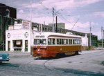 Image 19365 (221k, 1024x684) Photo by: Joe Testagrose Location: Dundas/Vincent Loop | 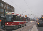 Image 41348 (110k, 720x478) Photo by: Peter Ehrlich Location: Spadina/College | 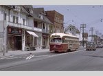 Image 80699 (198k, 1024x648) Photo by: Joe Testagrose Location: Dundas/Gore Vale | 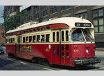 Image 128629 (70k, 900x534) Photo by: Robert Callahan |  Image 145466 (352k, 1044x788) Photo by: Ian Folkard Location: Spadina/Queen |
Page Credits
By Rob Hutchinson.