PSNJ Hoboken-Jersey City Elevated
![]()
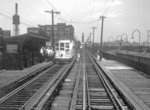
Public Service of NJ elevated trestle leading up to Jersey City Heights from Hoboken. Collection of David Pirmann.
Overview
Between 1886 and 1949, there was an elevated railroad for trolley car service between Hoboken Terminal and Jersey City. The line was built by the North Hudson Railway Company and eventually became part of Public Service of New Jersey's operations. The line was initially operated by cable ("transit chains") and beginning in 1892, electric traction. The line was authorized in 1883, and the first pile driven February 19, 1884 (NY Times). Opening day was January 28, 1886, and service on the elevated ceased on August 7, 1949.
The route was as follows: From present day Hoboken Terminal's upper level trolley terminal; westward along the north side of present day Observer Highway (at time of construction, Observer Hwy. was known as Ferry Street) to approximately the corner of Observer, Monroe Street, and Paterson Avenue (Paterson Plank Road); at which corner the elevated structure turned slightly to the right (north), and ran over midblock easements in between Observer Hwy. and Paterson Ave., rising in elevation to crest the palisade into Jersey City at Ogden Avenue between Ferry St. and Wood Pl. From this point, tracks split from the elevated structure to join street trackage at Palisade Avenue, and the elevated structure continued west, directly over rooftops of buildings between Ferry St. and Ravine Avenue to Webster Avenue; then over Ravine Avenue to Abbett St. and then between rows of houses facing Ferry Street on the north and Booraem Avenue on the south. The el turned south over the lot on the northeast corner of Central and Booraem Aves. then ran south along Central Avenue, crossing the State Highway and entering private right of way at Central and Hoboken Avenue, resuming over-street running at Newark Ave and Central Ave. The elevated structure came to an end at a ramp at approximately Central Avenue and Lott Street, half a block short of the major intersection of Summit, Central, and Pavonia Avenues.
Elevated stations were located at: Hoboken Terminal (upper level); Washington Street (westbound only); Bloomfield Street (eastbound only); Willow Avenue (both directions); Henderson Street (both directions); Palisade Avenue (both directions); Ravine Ave between Webster and Forest (both directions); Central & Reservoir (both directions); Central & Jefferson (both directions); Central & Beacon (both directions); Central & Fleet (northbound only); Central between Fleet and Hoboken Ave (southbound only); Court House (both directions; south side of Newark Ave over PRW, which is today's Central Ave.). Station data from detailed lot maps of Jersey City and Hoboken available at Princeton University Jersey City, Hoboken). The 1896 map at Princeton shows an elevated terminal station at Pavonia Avenue instead of a ramp to the street (See Jersey City link above, 1896 map, sheet 15).
The photos below depict the elevated structure from Hoboken Terminal to its Jersey City terminus. Most of the photos are from the George Conrad collection with a few postcard views and others thrown in. Some were saved from other web sites some time ago and I cannot find them again now - If the photos are yours please, please let me know. Thanks!
Photo Gallery
| Five Random Images | ||||
 Image 116235 (165k, 1024x594) Collection of: George Conrad Collection Location: Between Willow and Henderson (Neumann Leathers) |  Image 116238 (41k, 975x557) Collection of: The photographer info for this photo was misplaced-use Feedback if it's yours! Location: Foot of Hudson Street |  Image 144193 (217k, 1024x695) Collection of: David Pirmann Location: Henderson Street Station |  Image 144203 (204k, 1024x674) Collection of: David Pirmann Location: Hoboken-Heights Trestle |  Image 144207 (134k, 1024x695) Collection of: David Pirmann Location: Hoboken-Heights Elevated, Location Unknown |
Links
Rapid Transit In Hoboken. NY Times, 1883.
City And Suburban News; The first pile for the Hoboken elevated road... NY Times, 1884.
Hoboken's Elevated Railroad. NY Times, 1886.
Crowded Car Saved From 100 Feet Plunge.; Stopped on the Brink of Jersey City Heights -- Left the Track and Bumped Over Ties of Trestle. NY Times, 1902.
The Hoboken Inclined Cable Railway. Scientific American, February 20, 1886.
"Conquest of the Palisades: A Triumph of Victorian Traction Technology". Al Mankoff, Electriclines, March/April 1992.
Trolley Treasures, Volume 1. Al Mankoff and & C.D. Wrege.
The Public Service Trolley Lines in New Jersey, Edward Hamm, Jr., Transportation Trails Publishing.
Maps at Princeton: Jersey City, Hoboken.