Minneapolis, Minnesota
![]()
Minneapolis "Hiawatha" light rail trains in test operation at Warehouse District/Hennepin Avenue. Photo by Gary Ulmer, June 24, 2004.
Overview
Minneapolis' new light rail project, the "Hiawatha Line", opened June 26, 2004, after three and a half years of construction. The line is 12 miles long, connecting downtown Minneapolis to the Mall of America via the Minneapolis/St. Paul Airport and the Minnesota Twins Metrodome. The light rail vehicles were manufactured by Bombardier, with 24 cars ordered and 2 more on option. The articulated cars are 94 feet long with passenger capacity of 187, including room for luggage racks and bicycle storage, and are of low-floor, ADA-compliant design. Service patterns have a train arriving every 7.5 minutes during rush hour, 10 minutes between trains midday, 15 minutes evenings til 9:00 pm, and 30 minutes during early mornings and late evenings. The route includes some street running, some tunnel, and some private right of way. The Airport stations are located in a tunnel segment.
The stations are as follows: Warehouse District/Hennepin Ave; Nicollet Mall; Government Plaza; Downtown East/Metrodome; Cedar-Riverside; Franklin Avenue; Lake Street/Midtown; 38th Street; 46th Street; 50th Street/Minnehaha Park; V. A. Medical Center; Fort Snelling; Airport-Lindbergh Terminal; Airport-Humphrey Terminal; Bloomington Central; 28th Ave; Mall of America. Fort Snelling is the temporary outer terminal. Starting in December, trains will operate further south Minneapolis/St. Paul International Airport and Mall Of America. A 26 acre maintenance facility is located at Franklin Ave., Minneapolis.
2009 Updates
Those stations which were originally long enough only for two-car trains are being lengthened to fit three-car trains.
The northward extension from the present downtown terminus (Warehouse District/Hennepin Avenue) to the new stadium and commuter rail station is nearing completion. The new terminus is now officially named Downtown Minneapolis / Ballpark. The signs are installed, and the adjacent commuter rail station on a BNSF main line shares the same name and signage graphic format. The commuter rail line is expected to begin service in November 2009, it is expected that the opening of the Hiawatha extension will coincide.
There is a three-block stretch of what will be non-revenue track extending beyond Downtown Minneapolis / Ballpark which will allow for layover of numerous trains in waiting for rush hours and the ends of ball games.
A new station is being built at the intersection of American Boulevard and 34th Avenue South in Bloomington, just north of Bloomington Central. As the tracks are in the median of 34th Avenue and there is an existing intersection which will not be reconfigured, designers have placed separate platforms on the far sides of the intersections. This will be the fifth station with separate platforms for each direction (all the others have a single center platform) and the only such station in which the two platforms are not directly across the tracks from each other.
This summer there have been, and will continue to be, numerous partial shutdowns of the line on weekends to allow for the construction. Rarely-used crossovers thus become regular reversal and layover points for a day or two, while dedicated buses cover the affected parts of the line.
Route Map

Photo Gallery
| Five Random Images | ||||
 Image 33467 (112k, 720x478) Photo by: Peter Ehrlich Location: South of Franklin Avenue |  Image 33496 (132k, 720x478) Photo by: Peter Ehrlich Location: Fort Snelling |  Image 42759 (141k, 720x482) Photo by: Peter Ehrlich Location: 28th Ave. | 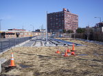 Image 103478 (327k, 1044x780) Photo by: Duncan Moffitt Location: Target Field |  Image 103483 (197k, 1044x780) Photo by: Duncan Moffitt Location: Target Field |
Photos By Location
Photo locations: Target Field, Warehouse District/Hennepin Ave, Nicollet Mall, S. 5th Street/Marquette Avenue, Government Plaza, S. 5th Street/Between 2nd & 3rd, S. 5th Street/3rd Avenue, S. 5th Street/4th Avenue, S. 5th Street/5th Avenue, S. 5th Street/Park Avenue, U.S. Bank Stadium, 11th Ave Grade Crossing, Blue/Green Line Junction, Cedar-Riverside, Riverside Maintenance Facility, Franklin Avenue, South of Franklin Avenue, Lake Street/Midtown, 38th Street, 46th Street, S. of 46th Avenue, 50th Street/Minnehaha Park, Minnehaha Avenue/52nd Street, Minnehaha Avenue/53rd Street, Minnehaha Avenue/54th Street, South of 54th St., V. A. Medical Center, Viaduct north of Ft. Snelling station., Fort Snelling, Portal north of Lindbergh Station, Airport-Lindbergh Terminal, Airport-Humphrey Terminal, 34th Avenue/nr. Ft. Snelling National Cem., 34th Avenue/American Blvd., 34th Avenue/Appletree, Bloomington Central, 28th Ave., 24th Ave., Mall of America
Links
Minnesota Transportation Museums. Photos and descriptions of streetcar operations at the Minnesota Streetcar Museum and the Ironworld Discovery Center.
Official Site - Metro Transit. Official site of the Minneapolis/St. Paul Metro Transit, including schedules, maps, fares, and more!