MBTA Silver Line
Overview
Boston's MBTA counts its 'Silver Line' as its newest form of rapid transit. The project is one of the Federal Transit Administration's showcase projects for bus rapid transit (BRT). Two of the ultimate three phases of the project were operating as of April 15, 2005:
Phase I is a 2.2-mile surface bus operation, largely along Washington Street, extending to a terminal at Dudley Street in Roxbury. Service began on July 20, 2002. Phase I is intended to replace rail service lost to this corridor when the Orange Line elevated rapid transit was removed in 1987. Service is provided by a fleet of Neoplan AN460LF single-articulated compressed natural gas (CNG) buses. These 60-foot buses use dedicated street lanes for much of their route, but are slowed by operation on the city streets in the downtown; the route's average speed is about 8 mph in peak periods, and 10-11 mph when traffic is minimal. Curbside Stations are bus 'superstops' with a higher level of shelter and amenities than most local stops; they average about 1,000 feet apart.
Phase II, opened on December 17, 2004, is a separate segment between South Station and an interim terminal at Silver Line Way in South Boston. This 1.5-mile segment includes three underground stations (South Station, Courthouse, and Word Trade Center) and one surface station (Silver Line Way). A fleet of 13 single-unit straight Neoplan electric trolleybuses (ETBs) was acquired for the initial service. This route, including the extensive underground section under Fort Point Channel, is operated line-of-sight, with relatively modest maximum authorized speeds (10-20 mph); average speed is about 12-13 mph. Bus speed is governed to a maximum of 20 mph under the wires. In March, 2005, local service to Boston Marine Industrial Parks (Route SL 2) and City Point (Route SL2) began, using some of a fleet of 32 Neoplan dual mode articulated (DMA) buses (similar to the Phase I vehicles). The ETBs provide additional frequency on the initial section. The extension of Phase II service to Boston's Logan Airport as Route SL1 via the Ted Williams Tunnel is planned for June, 2005; 18 of the DMA's have been specially configured to accommodate air travelers' bags. An additional DMA-operated branch (SL4) to Andrew station on the Red Line subway is planned. Average speeds of the extended surface routes (13-15 mph) are actually higher than for the tunnel-only section.
The planned Phase III of the Silver Line will connect Phases I and II via an additional one-mile tunnel section, perhaps as early as 2010. The routing will provide direct connections with both the Orange and Green Lines in the downtown area. The dual-mode buses will permit through operation between Dudley and the airport and other northerly points.
Route Map
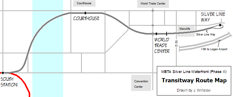
Photo Gallery
| Five Random Images | ||||
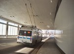 Image 12088 (90k, 820x553) Photo by: Douglas Carrier Location: ManuLife Building |  Image 12100 (107k, 820x553) Photo by: Douglas Carrier Location: World Trade Center | 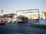 Image 37175 (89k, 820x551) Photo by: Duncan Allen Location: D Street |  Image 37179 (81k, 820x551) Photo by: Duncan Allen Location: World Trade Center |  Image 37340 (72k, 691x518) Photo by: Jon Winslow Location: Courthouse |
Photos By Location
Photo locations: Dudley, Washington St., Mass Ave., Downtown Crossing-Temple Place, South Station, Courthouse, World Trade Center, D Street, ManuLife Building, Silver Line Way
Page Credits
By Duncan Allen.