Calgary, Alberta
Overview
- Operated on honor system (proof of payment)
- System first proposed as a heavy-rail system (subway) in the 1960's
- ...But changed to an LRT system during the late 1970's.
- Later used as a part of the transport network for the 1988 Winter Games.
- First leg: 10th Street West to Anderson Station: 1980
- Northwest leg built 1988 to the University of Calgary
- Northeast leg built in mid-1980's to Whitehorn
- Next extensions: Somerset-Bridlewood (South, tentative June 2004); Prairie Winds (NE 2010); Crowfoot (2013-2016)
- Plans currently exist for three more new wings...but none are scheduled to be opened before 2020.
- Downtown Core Line = Fare-Free (Isn't that wonderful?)
- Downtown platforms staggered...city center stations serve one direction only
- All trains manufactured by the German manufacturer Siemens-Duewag, based in Frankfurt
- Calgary Transit's LRV fleet consists of 82 U2-DC's (numbered 2001-2083 minus 2010 which was wrecked in a derailment), 2 U2-AC's and 32 SD160's. The 32 SD160's started to arrive in 2000, with delivery completed late 2003.
- All stations are wheelchair accessible.
Station By Station
Northwest-South Line
Our journey begins at the new Dalhousie station, which opened on December 15, 2003. This new station is all black with tinted windows, with an open split level concourse and metallic platform structures.
Next up is Brentwood. An island platform in the median of Crowchild Trail (Northwest Calgary's main artery road to the city center), and opened in an 1.1-km extension in 1990. The mezzinane is under a glass and steel roof, with two giant clocks on each side overlooking pedestrian bridges over Crowchild and to the bus stops on Brentwood Road and the Brentwood bus terminal.
Leaving Brentwood, we travel down Crowchild Trail to University. Serving the University of Calgary, this station was formerly the terminal of the Northwest-South line until 1990, when Brentwood opened. The island-platform station is heavily used, and is in a rather shoddy state of disrepair due to the high traffic.
Dipping into a tunnel, the line now leaves the median of Crowchild Trail, and enter a stretch of residential-backdrop ROW. Once clear of the tunnel, we arrive at Banff Trail, the stop serving MacMahon Stadium, the home of the CFL's Calgary Stampeders, and the site of the opening and closing ceremonies of the 1988 Winter Olympic Games. The station sports two side platforms, with a grade-level pedestrian crossing at the north end of the platform.
As the train leaves Banff Trail, the route now passes a bevy of motels lining the street adjacent to the ROW. This area has been dubbed by locals as Motel Village. At the Trans-Canada Highway (16th Avenue), the train takes a sharp 120 degree curve down into a tunnel that takes the route under the Trans-Canada, and emerge at Lions Park. Two side platforms, with grade-level pedestrian crossings at both ends of the station. A mostly residential area, so nothing much to see.
The next stop is S.A.I.T./A.C.A.D./Jubilee, the name that could win the title of longest LRT stop name in the world hands down. In full, the name of this island-platform station is "Southern Alberta Institute of Technology/Alberta College of Art and Design/Jubilee Auditorium". Quite a mouthful, eh? Serving the two post-secondary institutions, as well as an auditorium popular with local high schools for their graduation ceremonies, this station has a grade crossing at the north end of the station.
Leaving S.A.I.T., the train now descends down a 6.5% slope past Riley Park (a popular local place for wedding photos), cuts behind some condominiums, and arrive at Sunnyside. Two side platforms with a separate grade-level crossing at the south end of the station, it is also a residential-area station, but also serving the popular Kensington shopping district.
Now, the train ascends up onto a bridge across the Bow River, and into the downtown section, which the Northwest-South Line shares with the Northeast-City Center Line. Since city center stops are staggered (one-way only stations), I will discuss the eastbound stations. The westbound stops will be discussed in the Northeast Line-by-Line.
Entering the downtown core, the line now merges with the Northeast-bound tracks on 7th Avenue, the Transit Corridor. 8th Street West, 6th Street West, and 3rd Street West are all one-way island platforms. At Center Street, the platform is connected to the Telus Convention Center. The last Eastbound stop is City Hall. Rumors are abound that during the 80's, when the LRT was being planned, a section of tunnel was actually dug in preparation for the downtown section to be placed underground. That plan was deemed too expensive by the provincial government, and today, the line runs at-grade and controlled by traffic lights, instead of railway signals underground.
The South Line now curves off 7th Avenue, and into a tunnel. When the train is in the tunnel, face backwards and look to the left. If you look carefully, you will see a bellmouth that would lead to the rumored section of dug tunnel if the concrete wall is demolished. No new plans have been placed to put the downtown section underground, so the bellmouth is more than likely to remain as is for many years to come. Once out of the tunnel, the line now runs beside MacLeod Trail, to Victoria Park-Stampede. This is the only stop with three platforms. Track A is southbound to Fish Creek-Lacombe, Track B is northbound to City Center and Brentwood, and Track C is mostly unused, gated off, and isolated from the rest of the station. It is used after Calgary Flames hockey games to serve an express train to the northeast (Whitehorn) line.
The line now continues down MacLeod Trail, across the Elbow River, and to the south end of Stampede Park, and Erlton-Stampede station. The auxilliary station to Victoria Park-Stampede, this island platform station has a long wheelchair access at the south end of the station. Like Brentwood, University, S.A.I.T. and all stations south of 39th Avenue, the main mezzinanes are on an upper level at the end of the platforms (north or south ends, it varies).
Departing from hugging MacLeod Trail, the ROW now enters the Cemetery Hill Tunnel, and emerges in the north end of Calgary's industrial belt, and arrives at 39th Avenue. A rather windswept station with two side platforms slanting down into a short tunnel. If you're looking for a more barren and inarticulate station, you can't go farther than this.
Continuing down the Industrial belt, the train now joins the Canadian Pacific ROW, past factories, refineries and warehouses to Chinook. This stop serves the popular Chinook Center shopping mall, which is located about 5 blocks away from the station-- a lack of foresight by Transit planners who didn't realize how popular Chinook Center was for a shopping complex. From Chinook to Southland, all platforms are now with raised mezzinanes at the north end, island platforms with the northbound track next to the CP ROW, and grade-level pedestrian crossings at the south end.
Heritage is the next stop. The station has a large park-and-ride lot, with bus access to a local historical-theme park named Heritage Park. South of the station, lies the Haysboro Storage Facility, where some of the LRVs are stored. Along with the Storage, there is a switch that allows work locomotives access to a small CP railway siding where the new SD-160's will be delivered to on flatcars, and towed to Anderson Shops for assembly.
Past the Haysboro storage, the train arrives at Southland. The industrial complex now gives way to mega-sized food stores, professional buildings and car dealerships to one side, and residential areas on the other.
After a long ride, the trip is almost coming to an end. For 21 years, Anderson has been the end of the line for the South Line. With an island platform, raised mezzinane to the south end, and a grade-level crossing to the north, the tracks that led south once curved into the Anderson Shops and Garage. The shops are where LRVs are assembled, maintained, and for the AC-type fleet cars in about 3 years, refurbished. With the opening of the extension, there is access to the yards thru a third track that almost extends down to Canyon Meadows. What its purpose is currently unclear, but it may be used for storage and lay-up during rush hours.
Rejoining the side of MacLeod Trail, the line now arrives at the first of the two new stations, Canyon Meadows. With a small raised mezzinane and no grade-level crossing, this station is designed to serve the residential area. Despite protests by locals about the noise from passing LRT trains and the worries of raised crime in the immediate station area, the two levels of governments ignored the NIMBY protestors, and went ahead with building the station at its present location. Also at this station is the system's only park-and-ride garage.
Leaving Canyon Meadows, the line bridges over Fish Creek Provincial Park, and to the final station of the line, Fish Creek-Lacombe. After over 20 years of squabbling and C$80.1 million later, the station opened much to the relief of far south commuters. The station's island platform is adorned with an old-west railway station design, as local residents, digging into community history, requested to Transit planners that they wished for the station to be modeled after an old Canadian Pacific station that once stood in nearby Midnapore.
Leaving Fish Creek-Lacombe, the train continues along the CP tracks and arrives at a staggered platform station, Shawnessy. The first of the two new stations in the 2004 southern extension, the two platforms are connected with a grade-level pedestrian crossing, which links the south end of the southbound platform and the north end of the northbound platform together.
The next and final stop in the line is Somerset-Bridlewood. With a distinct architecture and all-glass shelters, Somerset-Bridlewood finally brings the LRT to the deep south of the city of Calgary. Pedestrian grade-level crossings sit on both ends of the platform, with the switchover to the north of the station. The tracks cross Shawville Gate and forms into two stub tracks, which is used for layups and will be the starting point for the next extension, which is not scheduled until 2030.
The trip, barring no major delays and all lights on 7th Avenue are green, from Dalhousie to Somerset-Bridlewood, should take about 50 minutes.
Northeast-City Center Line
Our trip begins at Whitehorn, an island platform with a raised mezzinane to the south end of the station, and wedged in the median of 36th Street Northeast. The next two stations, Rundle and Marlborough are all of the same motif, and they all share the same exterior color and the same style. The 36th Street section of this line is mostly uninteresting, as it runs mostly down the median of a busy Northeast Calgary arterial road. The only bright spot is a steep drop after leaving Rundle Station, then a slope up onto a bridge over the Trans-Canada Highway, and down again to a flat section to Marlborough.
Leaving the 36th Street Corridor thru a tunnel, the line now emerges onto another median, this time on Memorial Drive. The first stop on this section is Franklin, which is in the same style at the stations on the 36th Street Corridor, but it is now a medium shade of green for the exterior. In fact, all stations on the Memorial Drive corridor from Franklin to Bridgeland sport the green motif.
Once clear of Franklin, trains down descend down a long slope to Barlow/Max Bell Arena. Island platform with an underground mezzinane, this plaform is sloped to the south, and is on a slight curve. Tunnels from the mezzinane leads to Max Bell Arena, a popular site for junior league hockey games and some minor acts holding their concerts.
The line now steeply dips, and into the Bow River Valley, over Deerfoot Trail (the city's super-expressway), and curves to a stop at Zoo. As its name implies, this island platform, underground mezzinane station serves the Calgary Zoo.
Continuing down Memorial Drive, the line now pulls into Bridgeland, a stop mostly serving the residential neighbourhood nearby. Not much to see once again.
Leaving the Memorial Drive corridor, the line now flies over a busy intersection between Memorial Drive and Edmonton Trail (No, Edmonton Trail does NOT go to Edmonton...sorry, insider thing.), crosses the Bow River, and enters the Downtown area. The first stop in the downtown core is 3rd Street East, a Westbound Northeast Line Train-only stop that lies on the fringe of downtown. This is a very quiet station, and usually not crowded.
Merging with the Northwest-South Line coming out of the tunnel, the train now runs down the 7th Avenue corridor to Olympic Plaza (where the Olympic medals in 1988 were handed out), 1st Street West, 4th Street West, and 7th Street West.
Finally, after the Northwest Line turns off to the Northwest, the Northeast Train finally arrives at its terminal stop, 10th Street West. A simple, narrow island platform, with a shed for a mezzinane and two concrete blocks for bumpers at the west end of the station. In other words, this is not your ordinary terminal station! Serving the new downtown condo complexes to the west, this station is the end of the Northeast Line.
Route Map

Track Map

Photo Gallery
| Five Random Images | ||||
 Image 36307 (100k, 997x535) Photo by: John Leung Location: 1st Street West | 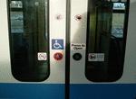 Image 36313 (114k, 903x759) Photo by: John Leung |  Image 36318 (154k, 811x645) Photo by: John Leung Location: Dalhousie | 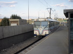 Image 41146 (401k, 1200x800) Photo by: Ed Davis, Sr. Collection of: David Pirmann Location: Dalhousie |  Image 152152 (447k, 1200x800) Collection of: David Pirmann |
Photos By Location
Photo locations: Dalhousie, Brentwood, University, Banff Trail, Lions Park, S.A.I.T./A.C.A.D./Jubilee, Sunnyside, 10th Street West, 8th Street West, 7th Street West, 6th Street West, 3rd Street West, 3rd Street East, 1st Street West, Centre Street, Olympic Plaza, City Hall, Victoria Park-Stampede, Erlton-Stampede, 39th Avenue, Chinook, Heritage, Southland, Anderson, Canyon Meadows, Fish Creek-Lacombe, Shawnessy, Somerset-Bridlewood, Whitehorn, Rundle, Marlborough, Franklin, Barlow/Max Bell Arena, Zoo, Bridgeland
Page Credits
By John Leung.