BART Bay Area Rapid Transit
![]()
BART car #317 leading a train at Lafayette on the Richmond Line. Photo by Peter Ehrlich, June 2006.
Overview
Described by a staffer as more like the LIRR than the New York Subway, BART is the first of the hi-tech mass transit systems in the US. A pioneer in Automatic Train Control, magnetic farecards, no overnight service, and fares based on distance traveled, BART opened its first segment in September, 1972. The system can be described as "X" shaped, with three legs in the East Bay. The fourth leg is the trans-bay line into the City of San Francisco and down the peninsula. Recently a branch off the southern leg was opened creating a fifth line.
With the exception of special event trains such as for the "Bay to Breakers" annual runner extravaganza, all trains are locals. Although a few short turns are scheduled, most trains run from end to end. There is no service overnight. During rush hour, each of the four East Bay lines has direct service to San Francisco, in addition to an all-East Bay service from Richmond to Fremont. In the evening, direct service to San Francisco from Richmond and Fremont ceases, and does not run on Sundays at all. Service to San Francisco during this period is provided by trains between Daly City and Concord/Bay Point. During times when no direct service to San Francisco is scheduled on a particular line, the trains are timed to meet at MacArthur inbound and at 12th St./Oakland outbound to facilitate transfers.
All stations are ADA compliant, although this has been a matter of litigation as elevators to street level are often awash in urine and frequently inoperative. The platform edges are finished in "Lego"-style semi-soft plastic in bright yellow with black sections to indicate train door locations.
Each station has a set of four illuminated signs at each platform which announce the train as it enters the station; in the downtown San Francisco stations, some of these first-generation signs were replaced with TV type displays in the early 1990s, and again replaced with red LED-dot signs in late 1998/early 1999. While at first no attempt was made to display destination on the actual trains, a tiny sign can be seen on the operator's console designating the destination of each train.
All ticketing is magnetic stripe card stock purchased from vending machines or a very limited number of human staffed ticket kiosks. With the exception of service within San Francisco there are no flat rate tickets.
Route Map

Track Map

Station By Station
The Initial Operating Segment - MacArthur to Fremont
The line from MacArthur in Oakland to Fremont was the first segment to open and is a mix of elevated, subway, and at grade trackage. The MacArthur station is in the median of a major freeway interchange, and consists of two island platforms and four tracks (the only such station in the entire system). The MacArthur station is a primary transfer point for riders from the Richmond branch to change for San Francisco-bound trains during mid-day and late evenings. Immediately east of the freeway supports is a large parking lot. Most BART stations offer park-and-ride facilities. With the exception of the two downtown stations in Oakland, all others on this line have lots.
South of the station, heading toward downtown Oakland, the four tracks converge to three, with a siding where the fourth main should continue. Only three tracks enter the downtown Oakland tunnel; one on the lower level and two on the upper. The original plan was to have four tracks into Oakland, but budget constraints during construction eliminated the four track idea, and in fact only two tracks were built initially, with room left for addition of a third track at a later date. This third track was installed during the 1980s.
The next stations along the line, at 19th/Broadway and 12th/Broadway in the Oakland central business district, were planned to have all four tracks, with an island platform on each of two levels. Trains on the upper level would run north/east, and those on the lower level south/west. But, as noted above, the stations were constructed with only three tracks. The three-track service is operated with one single south/west-bound track on the lower level and two north/east-bound tracks on the upper level. (Rumors have been spread that the fourth track was actually installed and is hidden behind the platform wall on the lower level, but staff at the Lake Merritt control center confirmed that it does not exist.) The two stations are tiled in very contrasting monotones; dark blue at 19th and a red-orange at 12th. The upper platform is open to the fare control/concourse mezzanine giving a pleasant effect.
South of 12th St., two tracks turn east to the Lake Merritt station. This island platform station serves a community college and the BART headquarters building for the system which includes the central train control. Leaving Lake Merritt, the tracks rise to the surface and run on an elevated structure of pre-cast concrete. From the portal to a point near the Fremont Station, the right of way is located next to the former Western Pacific railroad.
The first elevated station is Fruitvale, with two side platforms. The architectural style of these Fremont line stations is generally concrete half-walls topped with metal framing, which supports partial sheet-metal canopies. The platforms are served by stairs, escalators, and elevators. Fare control, including the agent's booth, is generally at ground level and includes restrooms within fare control and the various change-making and ticket vending machines. Most stations also have bus platforms adjacent to the ground level areas.
The next station is Coliseum, an island platform station, which serves the Oakland Coliseum complex of ballpark, indoor arena, and exhibition hall, as well as the bus connection to the nearby Oakland Airport. Curiously, no provisions were made for laying up trains for large events.
Leaving the city of Oakland, the next station, San Leandro is again two side platforms. Between this station and the next the tracks ramp down to a fenced surface right of way.
The next station, Bayfair, is an island platform. When BART opened this station it was merely adjacent a mall, and a short siding existed south of the station. With the recent addition of the Dublin/Pleasanton line, this is now a transfer station and there is a complex of sidings between the station and the actual junction.
Proceeding south the next station is Hayward; again, two side platforms with concrete half walls and sheet metal partial canopies. The South Hayward station is much the same but directly adjacent to the south is a large yard complex. This facility makes up, stores, cleans, and repairs cars. Note that the first generation of cars required addition of no-cab "B" cars into the middle of a train, so all consist changes were done within yards. The newer "C-1" and "C-2" cars allow trains to be cut/joined at stations.
The Union City station is next and is unremarkable as another at-grade side platform installation. South of Union City, the right-of-way diverges from the former Western Pacific line, rises to cross Alameda Creek and terminates at an elevated island station in Fremont. Fremont station is served by many local buses and an express bus service southward to San Jose. In 1972, Fremont was the site of the "Fremont Flyer" accident, where a train overshot the end of track and ran into the parking lot, with several injuries. (See Oakland Tribune, 10/2/1972, for details.)
Dublin/Pleasanton Branch
The newest addition to the BART system is the short Dublin/Pleasanton extension, which leaves the Fremont line just south of Bayfair station. This line tunnels into the median of a freeway where it remains as it passes one station, Castro Valley at the foot of the hills and then crosses the range of hills to the valley beyond where it terminates at Dublin-Pleasanton station. The entire branch is two tracks with one central siding and crossovers near the crest of the grade. Both stations are island and include parking and bus platforms.
Richmond Line
The northern branch to Berkeley and Richmond opened shortly after the initial segment, in December, 1972. This line diverges from the freeway median immediately north of the MacArthur station through a very short tunnel and proceeds north as a concrete elevated in the center of the former Grove Street (now M. L. King Jr. Way).
Just south of the border with Berkeley the right-of-way dives to become subway again as it enters Ashby station. The Ashby station is a concrete island platform in a fairly tall space with windows on one side letting in natural light at concourse/fare control level. This portion of the line was originally planned to be elevated, but the city of Berkeley decided to pay the extra cost to build it as a subway. The city then objected to the redesigned Ashby station claiming the planned skylights meant it was not a true "subway" station. The station was again redesigned and built with out skylights.
Historical note: for the roughly one mile from Ashby to downtown Berkeley, the BART subway is directly below streets where Southern Pacific and Key System electric lines ran during the first half of this century.
Proceeding north, the next station is Berkeley. This station serves the large nearby University of California/Berkeley campus. Architecturally, the station is vaguely similar to others in the system, but is more interesting for its above-ground glass rotunda escalator entrance. BART is monumentalist by design in some places, and this is one. The fare control mezzanine is a pleasant arched area with several fare gates. In a style reminiscent of some New York City IND subway stations, provisions were made for more platform to mezzanine stairs than usage has dictated. The southernmost gates, booth, and stairway has been gated off. The primary booth is adjacent the escalator bank and features computer display of schedules for connecting local buses. As a design note the elevators were an afterthought and so the platform to concourse unit is outside fare control.
From downtown Berkeley, the line turns northwest, and there is a crossover before the next station, North Berkeley. This station is a fairly plain concrete island platform, but at ground level the fare control area is in a polygon of 40' diameter, surrounded by parking, and a bus stop.
Rising from the tunnel the concrete elevated ROW is directly over a onetime Santa Fe ROW heading northwest. The next station is El Cerrito Plaza. This side platform elevated station has its own parking lot as well as serving a dying shopping center. Several local bus lines connect here.
El Cerrito Del Norte is next and is a major transfer hub. A side platform elevated station is now dwarfed on the east side by a huge multi-story parking structure which fills each morning. At ground level there is an extensive set of bus platforms serving local buses and those from several outlying counties.
From here the right-of-way turns to continue following the Santa Fe at ground level and then turns again to parallel the Southern Pacific to the Richmond station. This northernmost terminal is a ground level island platform and is adjacent to the Amtrak station which handles California intrastate services (the San Joaquin and Capitol trains). Directly north of the station is BART's Richmond Yard.
Returning to the MacArthur station in Oakland, we transfer to a train heading northeast to Concord/Bay Point. Traveling in freeway median, the first stop is at Rockridge. This station is an island platform in the middle of an elevated freeway and directly over a major commercial arterial in a neighborhood of mostly single family houses. There is a ground-level parking lot. This station is in the vicinity of the old Sacramento Northern railroad.
Leaving Rockridge there is a crossover before the tracks enter a tunnel through the hills. As the tracks exit the tunnel to Orinda station, they are again in the median of a freeway. Orinda is a center island platform, and at ground level there is a parking lot and bus platform area. Continuing east, the next station is Lafayette, also an island platform in the freeway median. There are crossovers and a center siding here just east of the station.
The approach to Walnut Creek (from the south) is one of the most interesting track alignments on the system. Soon after leaving Lafayette, the tracks duck into a tunnel to leave the freeway median and emerge in the hills. The tracks then come out of the hills on a curved elevated structure over a major freeway interchange before heading straight to the station. The Walnut Creek station stands on the former yard of the Sacramento Northern.
Leaving Walnut Creek, the elevated concrete structure heads northeast to Pleasant Hill, another side platform structure. Returning to grade level, the right-of-way is nearly on the alignment of the Sacramento Northern, an interurban line built a century ago and abandoned in the 1940s. The Concord Yard is east of the right-of-way at this point.
Continuing northeast, the Concord station was the terminal of this branch from its opening in 1973 until the North Concord and Pittsburg/Bay Point stations were opened in 1995/1996. Concord is an elevated station with island platform, and parking lot and bus platforms below. There are not too many distinguishing details.
The grade level track between Concord and North Concord is anchored in an unusual way. The track is anchored to square concrete slabs about a foot thick under the track. The concrete slabs are laid on a concrete bed with rubber spacers between the slabs and between the slabs and the bed. North Concord (Martinez) is next, an island platform station in at grade level (in a sort of open cut). This station served duty as the terminal until the Pittsburg station opened.
Next up, the Pittsburg/Bay Point station is now the terminal on this line and is a two-track island platform in a cut with the tracks extending some distance as layup/short term storage. There is also a set of non-revenue sidings adjacent the right-of-way, perhaps for delivery of new cars. (The most recent contract specified final assembly within the service area, and was a Morrison-Knudsen project. The builders plates in the first twenty or so of these new cars originally read MK Hornell, with the balance of the order reading MK Pittsburg.)
San Francisco/Transbay Tube Line
Returning once again to the central location of MacArthur station, we now board a train bound for San Francisco. We'll pass through the two downtown Oakland stations at 19th and 12th Streets, and take the right-hand turn at the switch south of 12th St, and rise from the west portal of the downtown Oakland tunnel. The elevated West Oakland station is next. This station, originally named Oakland West, is a two side platform concrete station. Although the neighborhood is quite depressed, the parking lot fills each morning as all trains from here run to San Francisco. Recently a second set of escalators were added to facilitate throughput from ground level fare control.
Leaving the station there are crossovers and then the right-of-way dives to the Transbay Tube, emerging in San Francisco on the third level down from street level at Embarcadero station. The downtown San Francisco stations all have a fare control/concourse mezzanine on the first level down, a two-track "local" level operated by San Francisco MUNI as its Metro Subway on the second level down, and finally the two-track island platform BART tunnels. The MUNI level was originally intended to be operated by BART, but plans changed early on in construction. At each of these stations, there are separate fare control areas in the mezzanine, and direct stairways/escalators to each platform. These stations are under Market Street, which was once the domain of two competing streetcar systems with four streetcar tracks (now just two tracks).
The Embarcadero station, the last of the San Francisco stations to open, has more glass, chrome, and indirect lighting than the others. In addition, there are openings in the ceiling which allow one to view the MUNI Metro operations above. The interior finish includes circular patterns on the side walls at track level and marble flooring on the concourse.
Departing Embarcadero, immediately west there is a scissors crossover, and then the next station is Montgomery. This is the most used station on the system, adjacent to the downtown financial district. Unfortunately, the station's architectural detail is completely unremarkable.
The next station, Powell is virtually identical to Montgomery. Both the Montgomery and Powell stations have concourse connections to adjacent buildings and direct entrance to retail establishments.
Next up, Civic Center station, is the last station served by both BART and MUNI. It has several interesting details. As a decorative motif there are reproductions of classical (Greek, Roman) political faces on the side walls at track level. This station was apparently designed and constructed before it was decided to have the upper level operated by MUNI; the stairs from the bottom platform land at the intermediate platform and then were later fenced off with steel bars.
From this point BART turns to run under Mission Street through one of the older and more interesting neighborhoods of San Francisco. There are stations at 16th St./Mission and at 24th St./Mission. At each, the architecture is identical although the color accents in the tiles are different. The fare control mezzanine is full length and arched like the station at Berkeley. At platform level the side walls opposite the island platform have niches built in which are more visually interesting than the flat walls of other stations. Both of these stations are in dense urban areas where ridership is heavy. None of these stations have any parking facilities.
The tunnel next turns from Mission St. to a station at Glen Park, a neighborhood on the back side of one of the many hills in town. This station is perhaps the most pretentious with expensive stonework, extremely high ceilings at the ground level fare control and floors to match. The station has a plaza fronting on it stretching to the actual street corner. There is a tiny parking lot across the street but most passengers arrive by one of several city bus lines.
Leaving Glen Park, the tunnel rises to open cuts along an urban freeway then dives through a short tunnel to arrive in the Balboa Park station. This island platform station is major transit hub, with many local bus lines dropping off passengers here for the fast ride downtown. A short walk away is MUNI's Geneva Yard and Terminal, which serves three of the five LRV streetcar routes (the J-Church, M-Ocean View, and K-Ingleside). These streetcar routes take separate paths to downtown San Francisco and all end up running in the upper level of the tunnel described above.
From Balboa Park the right-of-way is at grade next to the freeway all the way into the elevated three-track Daly City station. As one approaches Daly City station there are crossovers and a third main track. This station has one island platform and one side platform. Originally the end of the line, this station now serves as a terminal for some trains and merely a stop for others. The Daly City station is at the city border, and includes many bus bays both for San Francisco and suburban buses.
Colma, the current southwest end of the line, lies in a valley where a parking structure has been built over the yard and station. A three-track station with one island platform and one side platform for terminating trains, the tracks continue some distance for layup. Beyond Colma is the very controversial, phenomenally expensive extension to the airport.
On June 22, 2003, BART officially opened an extension south of Colma on the San Francisco peninsula to Millbrae, with intermediate stops at South San Francisco, San Bruno, and San Francisco International Airport. (An "open house" was held on June 21.) Departing Colma, the line runs in tunnel to an island platform at South San Francisco, and continues to a similar station at San Bruno. Departing San Bruno, the line emerges onto an elevated structure, and splits into two branches, one swinging east to the airport and one continuing direct to Millbrae. There is a similar wye arrangement south of the airport so that trains from Millbrae can also serve the airport.
Approaching the San Francisco International Airport station, the tracks are joined by Millbrae leg of the wye. The station at SFO is configured as a terminal, not a through station, with two island platforms and three tracks. Exiting the station, the SFO Sky Train airport circulator is one level up. The fare from SFO to any of the downtown San Francisco stations is $4.70 (as of this writing).
Departing SFO on the Millbrae branch we swing west and then south on elevated structure as we approach the CalTrain right of way. Entering a short tunnel, this leg of the wye rejoins the "mainline" from San Bruno and the right of way expands to three tracks. Emerging from the short tunnel, the tracks directly enter the Millbrae station, also three tracks with two island platforms. The CalTrain tracks are directly to the west, and the western platform has fare gates allowing direct connection. The station headhouse is several flights up and has an elevated walkway to a large parking structure.
The service pattern between San Francisco downtown and the Airport and Millbrae stations has changed several times since the opening of the line. Refer to the official service guide for services presently operated.
Roster
Cars are from 70' to 75' long, seat 64-72 riders (see table), and include space for wheelchairs and bicycles. All cars feature cushioned seating and carpets. Trains vary from 3 to 10 cars. Trains are OPTO (One Person Train Operation), but are in fact mostly run by the central train control computer. Occasionally trains are run in manual due to some malfunction. The track gauge is an unusual 5'6" widegauge, precluding connection to other mainline railroads for expansion purposes.
There are four types of cars. The first several orders, all built by Rohr, were late and overweight. They came as cab cars with the fiberglass slant fronts. The "B" center cars have no cabs, but have control cabinets with hostler controls for moving the cars around the yards (and perhaps could be used in emergency situations). The third group, "C" cars, from GEC Alstom, have flat fronts on the cabs and can run mid-train. The fourth order, C-2 cars, are like the GEC cars but add metal stanchions and were built by Morrison-Knudsen. Currently, Adtranz is rehabbing the original cars.
| Length | A cars = 75 feet B/C cars = 70 feet | Weight | 56,000 lbs |
| Width | 10 feet 5 inches | Seats | A/B cars = 72 C cars = 64 |
| Height | 10 feet 5 inches | Manufacturer | A/B (450 cars) Rohr C1 (150 cars) Soferval C2 (80 cars) Morrison-Knudsen |
| Propulsion | 150 hp motor on every axle, every car | Motors | "A/B" cars being rebuilt with AC motors, all others DC |
| Interior Height | 6 feet 9 inches | Speed | Up to 80 mph (130km/h) (particularly in the
Transbay Tube) with an average speed of 36mph (58km/h) ; 20 second max. dwell time at stations |
An order for new rolling stock has been placed, and a mockup of the new cars was on display in April, 2014.
| Five Random Images | ||||
 Image 143681 (198k, 1044x596) Photo by: David Ng |  Image 143682 (212k, 1044x596) Photo by: David Ng |  Image 143683 (282k, 1044x596) Photo by: David Ng |  Image 143684 (246k, 1044x596) Photo by: David Ng |  Image 143685 (280k, 596x1044) Photo by: David Ng |
Photo Gallery
| Five Random Images | ||||
 Image 19642 (105k, 824x573) Photo by: Eric Haas Location: North Concord | 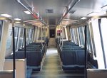 Image 19674 (96k, 824x569) Photo by: Eric Haas | 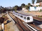 Image 19728 (149k, 824x581) Photo by: Eric Haas Location: Daly City | 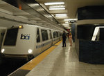 Image 50869 (186k, 864x574) Photo by: Peter Ehrlich Location: 19th Street Oakland |  Image 50882 (139k, 864x572) Photo by: Peter Ehrlich Location: Bayfair |
Photos By Location
Oakland-Fremont/Dublin-Pleasanton
Photo locations: MacArthur, 19th Street Oakland, 12th Street Oakland, Lake Merritt, Bet. Lake Merritt & Fruitvale/14th St., Fruitvale, Coliseum, San Leandro, Bayfair, Hayward, Hayward Shops/Yard, South Hayward, Union City, Fremont, Castro Valley, West Dublin, Dublin/Pleasanton
Richmond Branch
Photo locations: MLK Way, Ashby, Berkeley, North Berkeley, El Cerrito Plaza, El Cerrito del Norte, Richmond
Pittsburg Branch
Photo locations: Rockridge, Orinda, Lafayette, Walnut Creek, Pleasant Hill, Concord Yard, Concord, North Concord, Pittsburg/Bay Point
Transbay/City Branch
Photo locations: Near 14th St. Oakland, West Oakland, Embarcadero, Montgomery, Powell, Civic Center, 16th Street/Mission, 24th Street/Mission, Glen Park, Balboa Park, Bet. Balboa Park & Daly City, Daly City, Colma, Colma Yard, South San Francisco, San Bruno, Millbrae, San Francisco Int'l Airport
Page Credits
Maps by Michael Calcagno.