Atlanta, Georgia
Overview
The Metropolitan Atlanta Rapid Transit Authority operates the subway and bus system in the City of Atlanta, Fulton and DeKalb counties. The rail system currently has 36 stations with 46 route miles. MARTA carries about 250,000 rail passengers on weekdays. Fare is $1.50 ($1.75 beginning Jan. 1, 2001) one way. Single rides are usually tokens and daily, weekly, monthly and tourist passes are available.
All trains are controlled by Automatic Train Control. An operator at the front of the train controls the doors and makes station announcements. Each line runs at 8 minute intervals, translating into 4 minute headways on main line portions of routes. During special events trains may run as little as 2 minute headways. The system is open from approximately 5:00 am to 1:00 am on weekdays and from 5:00 to 12:30 am on weekends and holidays. Major events can and have required MARTA to run 24 hours a day.
The system is made up of four lines: North-South, Northeast-South, East-West, and Proctor Creek lines. Routes are not referred to by the color on the map. The North-South line is typically called the North Springs line, and the Northeast-South line is usually called the Doraville line. All southbound trains terminate at the Airport. East-West trains run from Hamilton E. Holmes to Indian Creek. Trains on the Proctor Creek line typically run from Bankhead to King Memorial. At night, this line terminates at Vine City.
Timeline
| 1975 | February
19: Construction begins on the East line. |
| 1979 | June
30: East line opens from Georgia State to Avondale. December 22: West line opens, Five Points to Hightower (now, Hamilton E. Holmes) Five Points was almost delayed in opening due to safety concerns because lower level of station was still under construction. |
| 1981 | December
4: North-South line opens from Garnett to North Ave., bypassing Peachtree Center. |
| 1982 | September 11: Peachtree Center and West End stations
open. December 18: Midtown and Arts Center open. |
| 1984 | December
15: Lakewood/Fort McPherson, Oakland City, Lindbergh Center, Lenox, Brookhaven stations open. |
| 1986 | August
16: East Point opens. |
| 1987 | December
19: Chamblee opens. |
| 1988 | June
18: College Park and Airport open. |
| 1992 | December
29: Proctor Creek line opens, Bankhead station & Doraville station opens. |
| 1993 | June
26: Kensington and Indian Creek open. |
| 1996 | June
8: North line opens, Buckhead, Medical Center, Dunwoody stations |
| 2000 | December: Sandy Springs and North Springs open. |
1960's Plan
In the 1960's, the Atlanta Regional Metropolitan Planning Commission planned that MARTA would have routes which are similar to the routes that exist today. The original plan called for lines that extended from Five Points the outer reaches of Atlanta at the time. The total mileage of this system would be 66 miles and would have been completed by 1980.
One line, the Northeast Line, would go to Norcross, about seven miles northeast of the present-day Doraville station. Another line, the Northwest Line, would go to Marietta, about 20 miles northwest of Five Points. The South line would extend all the way to Forest Park, a city a few miles southeast of Hartsfield International Airport. The East-West line would stretch to I-285, on the east and west sides of Atlanta. A spur off the East line going in a northeast direction would go to an area called North Druid Hills, about halfway between the Northeast and East rail lines.
Norcross, Marietta and Forest Park are in Gwinnett, Cobb and Clayton counties, respectively. These counties voted not to have MARTA run in their counties, so rail lines were not built there. In 1968, Fulton and Dekalb counties voted not to have MARTA, but in 1971 both counties approved a 1% sales tax that would fund MARTA construction. At this time a spur off the West line to Bankhead was planned.
1979 Plan
MARTA finally opened in 1979 with just the East line segment completed. At this time, the future plans for MARTA were different than in the 1960's. These plans were almost identical to the current day system. Some of the differences between the 1960's plans and the 1979 plan was that the Northwest line to Marietta was cut back to just two stations north of Arts Center. A provision for this line was constructed the tunnel north of Arts Center, there are no tracks in these stub tunnels. The northeast line was cut back to Doraville, about two miles from Gwinnett county. The South line would end at the Airport instead of going to Forest Park. Another plan was a Hapeville branch, just south of East Point, on the South line. This line would have terminated at around the east side of the Airport. The Hapeville branch probably would have went to Forest Park if the 60's plan had been implemented.
The East-West line would have been almost the same as it is today, except that there would be one more station on the West line called Fairburn Rd. Evidence of this planned extension can be seen in the fact that Hamilton E. Holmes station, the present day terminal, has side platforms, island platforms are generally more appropriate for terminal stations. Another extension would be off the Bankhead (Procter Creek) Branch, to Perry Homes. The East line would have a spur with two stations called the Tucker-North Dekalb line to North Druid Hills. The spur would have been in between Edgewood-Candler Park and East Lake. There is a three track section between these two stations which would have been used for this spur.
Two busways were planned. One would go from Lindbergh Center to Sandy Springs. This has now been built as the North line of the system. Another busway would have went from Edgewood-Candler Park to Thomasville, south of the station. This busway has not been built, nor are there any plans to do so.
Other Proposals and Current Future Plans
Over the years, other proposals for rail lines have come and gone. One proposal that was on the table was a line to Lithonia, on the east side of town. This line would have gone from Edgewood, turned south until I-20, then followed the interstate for about nine miles. This proposal died in 1999 by neighborhood activists saying that the line would divide their neighborhood in half. The Tucker-North Dekalb line also died in 1999 for the same reason. At one point a light rail line was considered as an alternative for the North Druid Hills area. The line would have run from Lindbergh Center to Edgewood-Candler Park.
There is a light rail proposal for Midtown which most likely will be built and completed by 2003. This line would run from the Arts Center station, go west across a currently unbuilt bridge over I-75/85 to the Atlantic Steel Redevelopment, on the west side of Midtown. The developers of Atlantic Steel are pushing hard to get this light rail approved. The light rail line may also be extended by turning south past the Redevelopment and heading towards Omni/Dome/GWCC station. This would bring rail transit to the west side of Midtown and Downtown. It is not yet known whether MARTA or another agency will run it.
Currently, there are two major extensions on the drawing board. The MARTA board in February 2000 approved two extensions. The first extension, with the highest priority is the West line extension to Fulton Industrial Boulevard, about four miles. This would complete the 1979 West line plan. The right-of -way already exists and construction can start once federal funding is approved. The other extension, with a lower priority is a North line extension to Windward Parkway, about 11 miles north of the North Springs station. This extension has three stations planned so far. Environmental studies must still be done before construction can begin.
A little known extension plan is for another station at Hartsfield Airport. The airport is currently planning another terminal south of the current ones, and the plans call for a provision for a MARTA station in the new terminal. The date for this station is unknown.
A full discussion and illustrated list of Provisions for Future Extensions is available.
Maps
Route Map

Track Map
Station By Station
East-West Line
Hamilton E. Holmes. Formerly Hightower. Two side platforms, two tracks, elevated. This station was opened on December 22, 1979. Each platform has a roof area, with the supports arching over the tracks. There is a bus area next to the mezzanine.
West Lake. Two side platforms, two tracks, ground level. This station was opened on December 22, 1979. The walls along the platforms are tiled and colored in a way that makes wide, diagonal stripes along them, the colors are a rainbow of warm colors. There is a blue strip along the tops of the walls with the station name written out and "All stations are under camera surveillance." (The only station I've seen with this written, draw your own conclusions.) There is a steel truss roof.
Bankhead. Single island platform, two tracks, elevated. This station was opened on December 12, 1992. This is a one station spur off the main line. The station is only 150 feet long, enough only for a two car train. I believe that it is expandable to make a four car train. There is a red gabled roof over the platform. There is a bus area outside fare control. Since Bankhead is a terminal station, a track is provided to both store a two car train and turn back a second two car train at the same time.
Ashby. The Ashby station is an unusual configuration. It is an underground station on two levels, with one track on each level. (If both tracks were on the same level, it would resemble one island platform and a side platform on the eastbound side.) The tracks are nearly over one another. You can see the tunnels split right past the west end of the station. The walls along the platform are marble, and the walls next to the track are blue tile. The ceiling is a waffle design painted white. There is a painting on the westbound platform, on the blue tile. This mural depicts the city of Atlanta and Atlanta University Center. The railing that keeps you from falling down to the lower level is painted blue. This station was opened on December 22, 1979.
Vine City. Single island platform, two tracks, underground/ground level. The west end of the station is above ground, and the remaining 3/4 is fairly deep underground, it has somewhat long stairs to reach the platform. The columns and floor of the platform is made of brick. The walls along the tracks have rectangular panels that are painted in shades of gray and blue. The mezzanine has brick columns and a steel roof. This station was opened on December 22, 1979.
Dome/GWCC/Philips Arena/CNN Center. Single island platform, two tracks, underground. The ceiling over the mezzanine and platform is waffled, and in each of the squares inside of them, there is an orange panel. Part of the ceiling over the platform is an arched waffle. Everything is made of cement. The west end of the station is briefly at the surface, covered by road bridges. Just past the station, the train goes back underground. This station has the most number of faregates and escalators to handle the crowds for events at the former Omni and Georgia World Congress Center. Today it services the new Phillips Arena, Georgia World Congress Center and Georgia Dome. While travel up or down the escalators there is concrete mural depicting the industrial revolution. This station was opened on December 22, 1979.
Five Points. This is the main transfer point between the North-South and East-West lines of the MARTA system. Five Points is a subway station and was opened in December 1979, serving the East-West line only. The North-South Line level was opened on December 4, 1981. The station is built on four levels, the topmost level being a plaza area on the surface, down from which one can view the mezzanine. The mezzanine has the faregates, as well as an underground passageway outside the paid area to Underground Atlanta. Below this, the East-West line platform, and finally, the bottom level, the North-South line platform. Both East-West and North-South lines have an island platform and two side platforms serving two tracks. The walls along the side platforms have an red tile that goes up to about 9 feet high, after that, the walls are white. All the columns are made of marble imported from Italy around them. There are LED scrolling signs referred to as a Visual Public Address System (VPAS) along all the platforms. These signs display work in conjunction with a audion public address system to display recorded messages to passengers. At the ends of the platforms of the north/south level, there is the original facade of the Eiseman Building from downtown Atlanta preserved and reconstructed with around false windows. They go up is high as the east/west platforms, so that you can see them from there. All signs on the North-South line are orange, while the signs on the East-West are blue.
Georgia State. Two side platforms, two tracks, elevated. The station is below the Twin Towers State buildings (Sloppy Floyd Building), next to the lobby. The mezzanine is below the platforms. The walls of the station are all brick. There is "basket weave" artwork on the walls of the mezzanine. The west end of the station is over Piedmont Ave. The train becomes elevated going eastbound. This station was opened on June 30, 1979.
The section between Georgia State east to Avondale was the first section of the line to begin operating, with Decatur the only subway station in the stretch.
King Memorial. Two side platforms, two tracks, elevated. This is the highest station in the system, being 51 feet above the ground. The roof of the station is steel with skylights in them. Columns supporting the roof are round, made of cement, and are covers with stainless steel. The walls along the platform are cement, painted yellow and about 7 or 8 feet high, so you can't see through them, except through narrow gaps between each section. The walls curve inward toward the top. There are emergency staicases that run fron the platform to the street. Freight lines run along the eastbound side of the tracks from here until East Lake station. When you are traveling westbound past this station, you get a nice view of Downtown and Midtown with Buckhead in the distance. The route serving the Bankhead station normally terminates here. This station was opened on June 30, 1979.
Inman Park/Reynoldstown. Two side platforms, two tracks, ground level. This station is setup like Lakewood-Fort McPherson. Entrances on either side of the station have bus areas and a pedestrian bridge to the turnstiles at the mezzanine. The walls of the mezzanine and platforms are made of brick. This station was opened on June 30, 1979.
Edgewood/Candler Park. Single island platform, two tracks, ground level. Also set up like Lakewood. The mezzanine has a blue ceiling. On the platform, the ceiling over the track is orange in color. The ceiling above the platform is a big skylight as wide as the platform. This station has cement decorated to appear like wood on its walls. The roof over the platform is supported by cement columns that are on the outside of the tracks. This station was opened on June 30, 1979.
Between Edgewood/Candler Park and East Lake stations, the tracks separate to distinct rights-of-way, plus a middle track. This area is known as North Druid Hills Junction which is an interlocking for a North Dekalb Line that was never built.
East Lake. Single island platform, two tracks, ground level. Also set up like Lakewood. Fare control is at the mezzanine level. The ceiling over the platform is waffled. The mezzanine roof is supported buy steel columns. Cement columns support the mezzanine over the platform. Toward the outer portions of the platform that not below the mezzanine, the roof over the platform is supported by steel beams and has a steel roof. This station was opened on June 30, 1979. MARTA's opening cermonies and speeches took place in the south parking lot at this station.
Decatur. Two side platforms, two tracks, underground. This station has what I call a futuristic 1980's look to it. It has mirrored columns and ceilings. Brown square tiles on the walls of the middle of the station. The walls towards the ends of the station are "rippled" and are yellow. There are round orange air ducts that run above the platform edges. The middle of the station has a painting on both sides of the station that runs from the floor to the top of the mezzanine above. This station was opened on June 30, 1979.
Avondale. Two island platforms, four tracks, ground level. This is the only station configured this way. Currently, only the inside two tracks are being used for mainline service to Indian Creek. There is roof renovation work going on the outer side of the west platform, plywood runs down the middle, cutting the westbound platform in half. Towards the ends of the platforms, roof is supported by I-beams. There are skylights over middle portions of platforms. Westbound trains crawl into the station, most likely because of all the switches it crosses. The Avondale Yard is visible past the east end of the station. The yard is accessible from all four tracks.
Kensington. Single island platform, two tracks, ground level. This station is in a trench like Lindbergh. Everything is made of cement. Sides of the trench have granite rock and grass. The roof is cement and gabled at a shallow angle. There is a bus area, above the eastbound side of the station. This station opened in June 1993.
Indian Creek. Single island platform, two tracks, ground level/trench. Indian Creek is a terminal station. The station has arched roof, with a wood ceiling, supported by steel beams. On the eastbound side of tracks, there is a wavy granite wall that runs from the ground, and up to the top of the mezzanine. Between this wall and the tracks, there is 3D artwork, which are colored silhouettes of dancing people. Much of the station's walls have rectangular blue tile on them. There was a runaway train at this station which plowed through the bumper post and derailed. This happened during the 1996 Olympics in Atlanta in July of 1996. This station was opened in June, 1993.
Photo locations: Hamilton E. Holmes, West Lake, Bankhead, Ashby, Vine City, Dome/GWCC/Philips Arena/CNN Center, Five Points, Georgia State, King Memorial, Inman Park/Reynoldstown, Edgewood/Candler Park, East Lake, Decatur, Avondale, Avondale Yard/Shop, Kensington, Indian Creek
North-South Line
North Springs Branch
North Springs. Elevated, two tracks, island platform. Terminal station on the North Springs line. Opened December 16, 2000. This station has an arched copper colored roof which covers the middle portion of the platform. Columns in the station are shaped like inverted cones. The columns contain round metal objects that look like the planets. Some columns contain concrete that give the illusion of orange peeling with the metal object inside. The columns represent that rapid transit cause no pollution and pollution is leaving the station into space. The lower level of the station houses the mezzanine and a bus to rail transfer area. There is a central cashiering area outside fare control for paying for long term parking. Tail tracks extend beyond the station, their only purpose is to allow room if a train overshoots the platform. The primary purpose of this station is to serve southbound commuters from the northern suburbs. The station has a massive six story parking deck with 2,200 spaces which serves commuters exiting from GA Route 400 on a dedicated off ramp from the highway.
Sandy Springs. Underground, two tracks, side platforms. Opened December 16, 2000. This station has white tile walls with colored tile patterns repeated throughout the station. The ceiling has a thick waffle design to it, and is relatively high, compared to many other underground stations. The station has glass elevator shafts from street level to the mezzanine and from there to the platform. A pedestrian tunnel is on the north side of the station, crossing underneath the road. The south side of the station has a parking deck for 1,100 cars, and a bus area outside fare control. This station also has a central cashiering area like the one at North Springs.
Dunwoody. The Dunwoody station is elevated, with an island platform. It opened on June 8, 1996. This station has three levels to it. The first level allows for bus loading/unloading; the second level has the faregates; the third level consists of the island platform and trackways. There are walkways to two parking decks and Perimeter Shopping Mall. The wall opposite the faregates is curved glass with abstract art etched in it. The platform-level roof is red and gabled and in the center, instead of a point, it is domed like a semicircle. The roof supports are painted red, and the rest of the station is also accented in red. The station is made of cement. From the platform, you can see the tops of the parking decks on both sides.
Medical Center. The Medical Center station is at ground level, with two side platforms. It opened on June 8, 1996. This station has an arched copper roof that covers the huge mezzanine that is above the platform. The roof trusses have the appearence of the structure of a steel roller coaster and are painted in dark red. The mezzanine has the faregates and a bus loading/unloading area. There is a round "hole" in the mezzanine floor, through which you can see the tracks below. The platform is at ground level, with walls along the platform edges (about four feet high on the southbound side, six feet high on the northbound side). The ceiling above the platform has a square waffle design on it. Except for the arched roof, everything is made of cement. There are scrolling marquees along the platform. On June 2, 1996 the American Public Transit Association (APTA) and MARTA had a big gala reception on the mezzanine level of Medical Center. In December, 1999 a new diamond crossover interlocking was placed into service at Medical Center.
Buckhead. The Buckhead station consists of an island platform with two tracks, located in the median of Georgia Route 400. It was open on June 8, 1996, with Opening Cermonies conducted by Joseph Lowery, a MARTA Board Member and civil rights advocate. From the street, you have to descend a set of stairs to reach the station. From the platform you can't see the highway, because the cement walls are high, but you can hear it. The walls of the mezzanine are square white tiles with pink and burgundy square tiles patterned on it. Toward the top of the walls, there are big tiles with abstract artwork painted in mainly primary colors, this same artwork is also found on the walls of the platform. The only access to the platform is on the south end of the station. The north end has an emergency exit. A roof covers the platform from the south end to a little over halfway down the platform. The roof has four spires spaced evenly that are shaped like pyramids with square bases that are as wide as the platform. The sections of the roof between the spires have a rectangular waffle design to them. There are scrolling marquees along the platform.
Doraville Branch
Doraville. The Doraville station is elevated with a single island platform between two tracks. This is the last stop on the northeast Doraville line. It opened in December, 1992. The station has a gabled green metal roof over the middle portion of the platform and it goes down to cover the rail to bus area, also. All the columns and walls are made of cement. Facing the southbound side, you can see freight line tracks that run parallel to the line, and just beyond that is the GM Doraville Assembly Plant. Facing the northbound side, you can see the roof of the bus to rail transfer area. Looking also on the northbound side, toward the south end of the station, you can see the parking deck for commuters and long term parking. The two parking decks can hold 1,100 cars.
Chamblee. The Chamblee station is elevated with a single island platform between two tracks. It opened on December 19, 1987. The roof of this station covers the entire platform. A feature of this station is the ends of it, which has an angled glass roof that goes from the roof of the station to the ground level entrance. Underneath the glass is where the stairs and escalators are to access the platform. There is a rail to bus transfer area on the north side of the station. There is a train storage track north of the station platform, and a shop building containing two tracks with pits.
Brookhaven-Oglethorpe University. Opened December 15, 1984. This elevated station consists of an island platform between two tracks. A roof covers the middle portion of the station. The roof is shaped like a rounded rectangle at the top made from corrugated steel. A portion of the top of the roof has what can be described as a quarter of a cylinder on top of it. A bus to rail transfer area is below the station platform at street level, along with the entrance.
Lenox. The Lenox station is underground, with an island platform between two tracks. This station is somewhat dimly lit, but there is no sense of danger. The station is presently undergoing a ceiling replacement and lighting is much improved. The walls of the station are grey but station lighting makes it appear to be a light brown-yellowish color. There is a bus to rail transfer on both sides of the station. The station signs on the platform hang from a metal framework, which hangs high above from the ceiling of the bus to rail area. Escalators go from the platform to the bus area, which is below the south entrance. Other escalators go to the station entrance. The north entrance is inside an office building and the south entrance is on Lenox Road. The south entrance has a skylight shaped like half a cylinder. There are two marble plaques mounted in the middle of the platform. One plaque commemorates MARTA and state officials and other entombs a time capsule. This is probably the only time capsule entombed in a transit system.
Main North-South Line
Lindbergh Center. The Lindbergh Center station is in an open trench below ground level, and has an island platform between two tracks, and a side platform serving the northbound track. (Northbound trains open their doors on both sides.) The station opened on December 15, 1984. This is the last station heading northbound before the two branches above diverge at Centerbury Junction. The northbound side platform wall is at an angle, with rocks and some landscaping on it. The southbound side has a regular wall, up to the upper level bus transfer area. There is a roof, made of corrugated steel and supported by I-beams, covering half of the station. There is a skylight in the roof, where each glass panel is stained a different color of the spectrum. When the sun shines through, it creates a rainbow on the platform. On the upper level of the station is a rail to bus transfer area inside the fare paid area. On the south end of the station, the train runs on ground level, and on the north end, the train goes into a tunnel.
In between Lindbergh Center and Arts Center is located MARTA's Armour Yard, opened May 23, 2005. The MARTA press release for the opening ceremonies of the yard notes that Armour Yard "will maintain and store over 100 rail cars on 12,000 feet of track.... [it] includes a 208,000 sq. ft. Maintenance and Overhaul Facility, Control Tower, Traction Power Substation, Gap Breaker Building, Train Wash, Cleaner Building, Blow Down Pit, Maintenance of Way Building, and Petroleum Oils and Lubricants Building."
Arts Center. The Arts Center station is a underground subway station with an island platform between two tracks. Along the platform walls, there is a brownish abstract art molded into the walls. The rest of the walls in the station are made of cement designed to look like wood. (Look close, you have to feel it to notice!) There are other paintings found throughout the rest of the station, all are of different things, fitting for a station called "Arts Center." "Arts Center" signs hang from the ceiling. At the ground level of the station there is a rail to bus transfer inside the paid area. The Arts Center station opened on September 11, 1982.
Midtown. Midtown station is underground subway station, with two side platforms surrounding two tracks. The walls are plain white rectangular tile. "Midtown" signs are near the top of the wall. The walls at the ends of the station, where the tunnels are, and the walls in the middle of the station, where the elevators and escalators are located, are made of the same type of "wood-decorated" cement as found at Arts Center. The Midtown station opened on September 11, 1982.
North Avenue. The North Avenue station is underground with two side platforms surrounding two tracks. It was opened on December 4, 1981. This station has a painting that covers most of the walls on both platforms. The paintings are basically the same: clouds with a blue sky and green hills. It is not a realistic painting, it's more abstract, but still attractive. Near the tops of the walls, there is an air vent that runs along the whole station. Orange "North Avenue" signs are placed on the vents. The north entrance is inside of the BellSouth building, just next to the street. The south entrance has a rail to bus transfer area outside the paid area. Similar paintings to those on the platforms are on the walls of the south station entrance. The mezzanine inside the paid area allows access to both platforms.
Civic Center. The Civic Center station is underground subway station with two side platforms surrounding two tracks. It was opened on December 4, 1981. A feature of this station is that it is directly over Interstate 75/85. Above the station is West Peachtree Street. It is the only subway station in the world that is above a highway. From the area outside the faregates, you can see the interstate though the windows. There is an orange railing in between the tracks. The station walls are a plain white rectangular tile, with orange "Civic Center" signs along them. Seats along the platforms have high backs to them, because they divide the paid and non paid areas. There is an underpass to get to the opposite platform. Civic Center serves the Peachtree Summit bulding primarily and not the Civic Center which is at least 1/2 mile away. The station has very little ridership.
Peachtree Center. Peachtree Center is an underground subway station with an island platform in between two tracks. The station was bypassed as part of the North-South Line opening of December 4, 1981. It is probably one of the most attractive subway stations anywhere. The floor is made of gray tile, and the walls made of the exposed rock which are the veins of Stone Mountain out of which the station was carved. You can see where the holes for dynamite were drilled. The ceiling panels of the station are made of steel. The contour of the ceiling is reminiscent of a Washington, D.C. Metro station, but the design and materials are clearly different. There is use of indirect lighting coming from the ceiling. From between the walls and both tracks, there are columns that support air vents that run the length of the station. The columns are curved at the top, so that the vents are directly above the train. Like nearly all the stations in the system, there is an orange "railing" that runs the length of the station at a train's window level with the station name written along regular intervals. The southwest entrance (Ellis Street) to the station is where the longest escalator to the station is located. When you exit the faregates, turn right, it's just a few dozen feet away. The walls of the mezzanine outside the paid area are the same gray tile as the floor, it has the same ceiling design as the ceiling over the platform. The mezzanine has a poster that reads: "MARTA's moving Atlanta, 120 feet below Peachtree Street."
The Peachtree Center station was built by tunneling through solid gneiss, a grainitelike rock formed of layers of quartz and mica. This rock provides underground support for the station. Soft ground or mixed tunneling was used where there was insufficient rock structure for underground support. With this method, compressed air twice the normal atmospheric pressure was used to support the walls while permanent structures were being built. Like deep sea divers, workers on this section of the rapid rail transit system were required to undergo 30 minutes of compression/decompression when entering or coming out of the tunnel. This station is only one of a few tunnels in the world where the walls and the ceiling were carved from solid rock.
Length of longest escalator serving the station entrance across from the Atlanta Public Library is 190 feet- the longest in the southeast. Cost of Station: approx. $45 million. Station depth: 120 feet. Station length: 900 feet.
Intially when North-South Line was opened from Garnett to North Avenue stations, Peachtree Center station was bypassed and only the northbound track was used for north and south bound service. This was done to permit the finishing contractor to complete Peachtree Center station while allowing him access to the station by the southbound track. The Peachtree Center station finally opened on September 11, 1982.
Five Points. This is the main transfer point between the North-South and East-West lines of the MARTA system. Five Points is a subway station and was opened in December 1979, serving the East-West line only. The North-South Line level was opened on December 4, 1981. The station is built on four levels, the topmost level being a plaza area on the surface, down from which one can view the mezzanine. The mezzanine has the faregates, as well as an underground passageway outside the paid area to Underground Atlanta. Below this, the East-West line platform, and finally, the bottom level, the North-South line platform. Both East-West and North-South lines have an island platform and two side platforms serving two tracks. The walls along the side platforms have an red tile that goes up to about 9 feet high, after that, the walls are white. All the columns are made of marble imported from Italy around them. There are LED scrolling signs referred to as a Visual Public Address System (VPAS) along all the platforms. These signs display work in conjunction with a audion public address system to display recorded messages to passengers. At the ends of the platforms of the north/south level, there is the original facade of the Eiseman Building from downtown Atlanta preserved and reconstructed with around false windows. They go up is high as the east/west platforms, so that you can see them from there. All signs on the North-South line are orange, while the signs on the East-West are blue.
Garnett. Garnett station is elevated, with an island platform between two tracks. This station has three levels to it. It was opened on December 4, 1981. The upper level has an entrance from the street and a mezzanine that is about 3/4 the length of the platform below. The roof has a square waffle design to it. The ceiling above the platform has the same waffle design as the roof. At the north end of the station the tracks enter a tunnel, down which the Five Points station is visible. At the south end, the tracks are elevated. Blue tile covers the platform. At the end of the mezzanine above, there is nothing over the rest of the platform. Facing the northbound platform, you can see a prison across the street. Today the station services the Pretrial Detention Center, Greyhound Bus Terminal, Fulton County Court House and Atlanta City Hall. The lower level of the station is another entrance from another street and there is a Greyhound Bus Terminal next to the station. There is the same blue tile on this level as on the platform.
At the northbound end of the station, the subway is entered and there is a single interline connection track (X track) between the South Line and East Line between Georgia State and Five Points stations. Below the Garnett platform is a little known dead-end storage track.
West End. The West End station is elevated with two side platforms surrounding two tracks. The roof of the station is steel and there are skylights with no glass over portions of the track. All the stairs down to the lower level have dark red tiles on the walls. Other portions of walls have orange tile on them. The columns supporting the platform are concrete. Lower level mezzanine is as wide and long as the whole platforms above, it's very spacious. There is a bus to rail transfer area and station entrances in the lower level. The West End station opened on September 11, 1982.
The elevated or aerial struction between West End and Oakland City stations was construsted of precast concrete sections of the box girder type. It was brought to the job site in large sections spanning between the adjacent piers. This was first time ever done on MARTA.
Oakland City. The Oakland City station is an above grade station, with one island platform between two tracks. It was opened on December 15, 1984. For both entrances to this station, you have to go through the faregates and an underground passageway to go up to the platform. On the Lee St. entrance (on the west side of station), you go through faregates and there is a bus to rail on your left, then the passageway goes under the street. From the other side, the passageway goes under the street and freight line tracks. The platform has a steel roof over the middle portion. There is a small mezzanine under the platform where the passageways meet. The mezzanine's ceiling is fairly tall. A staircase goes from the center of the mezzanine to the platform. At opposite ends of the mezzanine, there is an escalator, one up, the other down, to the platform.
Lakewood-Fort McPherson. This station is an above grade station, with an island platform between two tracks. It was opened on December 15, 1984. The set up for this station is like many on the East-West line. The way to get to the platform is like at Oakland City, only there is a bridge over the road instead of an underpass. At the west entrance, there is a bus to rail transfer area inside the fare control and stairs to go up the bridge over the street. On the east side the bridge goes over the road and freight tracks and then the faregates are at the mezzanine above the platform. The roof over the bridges, mezzanine, and bus area are gabled with small skylights running periodically down the middle. The roof is red, made of corrugated steel and is supported by beige colored I-beams. It has the appearance of an Aspen Ranch. The ceiling over the platform is supported by I-beams as well with concrete columns.
East Point. The East Point station is below grade level with an island platform between two tracks. It was opened on August 16, 1986. The platform is in a trench similar to Lindbergh Center. The entrance has a mezzanine next to a bus to rail transfer area. The I-beams supporting the roof are painted red.
College Park. Below grade level, with one island platform between two tracks. It opened on June 18, 1988. An interesting feature of this station is that the platform is narrower at the north end and wider at the south end, presumably to allow room for the yard leads just south of the station. The narrowing of the platform is most apparent at the north end of the platform. The platform is brick and columns and roof are made of concrete. There is a bus area within fare control in the mezzanine.
There are two track that turnout south of the College Park station which are yard leads to the South yard. In combination with the yard lead at the Airport station, a train can be completely turned around without the use of a loop track.
Airport. The Airport station is elevated, with an island platform between two tracks. This station is the southern terminus of the North-South Line. It was opened on June 18, 1988. Since all trains are northbound from here, the island platform is set up such that the "southbound" side is for Doraville trains and the "northbound" side is for North Springs trains. The roof is steel and the wall on the southbound side has glass along the whole length. You can see an airport parking lot and flags of different nations that are outside. If you go to both ends of the platform, you can see the curbside drop off area for cars. The mezzanine on the lower level has the faregates and is inside the airport terminal. There is a Delta Airlines check-in next to the faregates outside the paid area in the mezzanine. There is a huge concrete column in the middle of the paid area.
It is interesting to note that there is a turnout yard lead track (designated YA) to the South Yard at the Airport station which enables the Operations Dept. to place trains into service from the Airport station.
The Airport station was built during the construction of the airport which opened on September 21, 1980. This allowed MARTA to build the aerial structures to the station platform and open the station in an expeditious manner. The aerial structure south of the station platform ends at two friction buffers or bumper posts and curves away from the airport runway to meet FAA requirements. These tail tracks are not used for service and only serve the purpose of allowing to trains to have safe braking distance if they overrun the station platform.
The Atlanta airport has a people mover system as well. Some pictures of it are here: Atlanta Airport People Mover.
Photo locations: North Springs, Sandy Springs, Dunwoody, Medical Center, Buckhead, Doraville, Chamblee, Brookhaven-Oglethorpe U., Lenox, Lindbergh Center, Armour Yard, Arts Center, Midtown, North Avenue, Civic Center, Peachtree Center, Five Points, Garnett, West End, Oakland City, Lakewood/Ft. McPherson, East Point, College Park, South (Airport) Yard, Airport
Roster
| Designation | Unit Numbers | Configuration | Manufacturer | Years |
|---|---|---|---|---|
| CQ310 | 101-200 | Married pairs | Franco Belge, France | 1977-1981 |
| CQ310 | 501-520 | Originally singles, now pairs | Franco Belge, France | 1979-1981 |
| CQ311 | 201-320 | Married pairs | Hitachi, Japan | ? |
| CQ312 | 601-700 | Married pairs | Breda, Italy | 2001-2003 |
Photo Gallery
| Five Random Images | ||||
 Image 21446 (108k, 640x480) Photo by: Robert Ferreira Location: Sandy Springs | 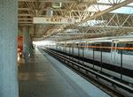 Image 21448 (208k, 800x600) Photo by: Robert Ferreira Location: West End | 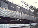 Image 21453 (171k, 640x480) Photo by: Robert Ferreira | 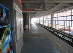 Image 47857 (127k, 1024x768) Photo by: Matthew Shull Location: Garnett |  Image 47879 (113k, 1024x768) Photo by: Matthew Shull Location: East Point |
Links
MARTA. Official site of the Metropolitan Atlanta Rapid Transit Authority, including schedules, maps, fares, and more!
Page Credits
By Robert Ferreira. Route Map by Michael Calcagno.