MBTA Orange Line
![]()
MBTA Orange Line 01200 series train at Massachusetts Avenue. Photo by Richard Panse, October 2004.
Overview
The Orange Line has seen the most dramatic changes over the past 20 years than any other of Boston's transit lines. Once known as the Main Line El, the Orange Line consisted of an elevated line from Everett, through Charlestown, and entered a shared portal with the Green Line at North Station. It then exited the subway in Chinatown, and proceeded as an elevated line over Washington Street through the south end, about four miles to Forest Hills. The elevated lines were once connected to another defunct elevated line over Atlantic Ave., which skirted Boston harbor.
Before the Washington Street Tunnel was built, the Main Line El trains shared part of what is now the Green Line subway with the trolleys. Platforms were raised in certain parts of each station to allow for both street cars and El trains. Trains connected to the northern and southern elevated lines via this tunnel and/or the Atlantic Ave El. This procedure ended with the construction of the Washington Street tunnel through downtown in the early 1900's. This tunnel connected with the Washington Street elevated in Chinatown, ran under downtown, and exited along side the current Green Line in the north end of Boston. In the 1940's, the Atlantic Ave. El was torn down due to low ridership. This made the Washington Street tunnel the only connector between the north and south elevated. Photos of the demolished elevated portion are included in the photo gallery.
There were plans to extend the line from the northern, and southern elevated, but those was scrapped, in favor of a decision to tear down the remaining elevated lines.
The northern portion of the El was removed in 1975, when a new northern Orange Line was constructed along a Boston & Main rail route, into Somerville. This line was later extended into Malden. This new line was much faster and more reliable than the old elevated line. The extension ran through a new length of subway under the Charles River, exiting out of a new portal on the other side. For now, Green Line cars still use the old portal, but the "Big Dig" and North Station renovation projects will eventually see the old Main Line El portal competely abandoned.
In 1987, the southern elevated was removed when the new southwest corridor opened, completing the new Orange Line project. This marked the end of heavy rail elevated lines in Boston. There is very little evidence left of the elevated. The only original part of the Orange Line is the subway tunnel through downtown.
Extensions were also envisioned with these new lines. The Orange Line would be extended further north and south. The MBTA thought of using overhead wires on these proposed lines, and provisions were made for this on new equipment. But commuter rail already serves these areas, and so these ideas were put on hold.
Expansion proposals for Washington Street Service: The Orange Line elevated over Washington Street was demolished in 1987 after the southern end of Orange Line was relocated. Since then, the MBTA has promised to restore some type of replacement service. Right now, several bus routes make up for the lost elevated service. But residents of the area want direct service once again, as they had with the "El". When the elevated was to be demolished, residents even asked if the northern part of the el could be retained until replacement service was found. But track and tunnel connections would not allow this.
Several proposals have been on the boards to furnish a direct transportation route from Washington Street to downtown Boston. One was a light rail extension of the Green Line. This would use a dedicated route in Washington St., and enter the unused Tremont Street subway tunnel. This route could even be extended further southward and bring rapid transit into areas that have never had it before. Another proposal was to use trackless trolleys along the same route. One of the most recent ideas is to use alternative fuel busses along a dedicated lane, into Tremont Street tunnel. This route would be called the Silver Line. Only time will tell what idea will be put to work to solve the transportation problems on Washington St.
Route Map
Historical Orange Line Route Map, Part 1. By Gerry O'Regan (PDF Format).
Historical Orange Line Route Map, Part 2. By Gerry O'Regan (PDF Format).
Track Map
Station by Station
For our station by station tour, we will begin at Oak Grove in north Malden, the current northern terminus of the line. Stations on this part of the route are large modern concrete structures, featuring a center platform with the tracks on either side.
Heading south, the line travels through a small depressed right of way, then through the center of Malden. In Malden the line is actually above the landscape on a fill. At the Malden Center stop, one can transfer to MBTA commuter rail. The northern Orange Line follows a Boston and Maine / MBTA Commuter line, to downtown. Southward from Malden, the line rolls on an exclusive right of way, and ducts through a small tunnel to allow B&M rails to cross over.
Approaching Wellington station, you can see the shops and yard just west of this stop. This is the primary maintenance facility for Orange Line as well as equipment and storage. At Wellington a third express track peels off and follows the route southward. All stations south of here to the subway feature 2 platforms, split by three tracks. The express track is seldom used, and is part of the route to the subway portal.
From 1997 to 2006, a pair of cable-hauled people mover cars connected Wellington Station with an office, shopping, hotel, and parking garage complex on the west side of the MBTA yard. Designed by Poma-Otis, companies well versed in people mover construction, the system was not reliable and was often out of service. The people mover was closed and its guideway replaced by a covered walkway, which opened in 2007.
Just south of Wellington, the line crosses the Mystic River on a large modern bridge, shared with the MBTA commuter rail line. After running through an industrial area at ground level, the Orange Line approaches the large elevated double deck structure of Interstate 93. As it approaches the elevated highway, it crosses the MBTA / B&M commuter rail line on a flyover, allowing it to skirt underneath the transit line. The commuter line then merges with others, converging on North Station. After descending the flyover, the Orange line follows a surface route below the double deck structure of I-93. The next stop is Sullivan Square.
Continuing southward, under the I-93 structure the next stop is Community College station. Like the others it has center platforms, with the tracks on each side. On the west side one can see the Boston Engine Terminal, formerly of the Boston and Maine. Here, MBTA commuter trains, and cars are maintained.
Just past Community College the three tracks become two again, and head into the subway. This tunnel, built in 1974, takes the line under the Charles River, and into North Station, the next stop. The pre-1975 North Station stop used to be aboveground on the Main Line El, next to the existing Green Line stop. Today, it is a subway station, and has recently been reconstructed. This station now features a shared platform for both Orange & Green line trains.
Continuing southward, the Orange Line enters the old Washington Street subway. The old portal entrance once shared with the Green Line is visible on the west side. From here to Chinatown is the last original part of the Orange Line. The old subway is unique in how the stations are set up. The platforms are on either side of the two tracks, but not directly across from each other. The inbound and outbound platforms are constructed at an angle from the other. Basically, on the outbound platform, you have to look down the tunnel to see the inbound platform. The first station encountered is Haymarket, where another interchange with the Green Line can be made. This station has been remodeled since the 1970's, and its platforms are now directly opposite from each other.
Next stop is State. Here passengers can transfer to the Blue Line, operating on the lower level of this station.
Just down the tunnel, and alongside the opposite platform we come into Downtown Crossing, formerly known as Washington. Here a transfer to the Red Line can be made, and there is direct access to the underground portion of Filene's department store.
The last stop in the old subway is Chinatown, formerly known as Essex. The old route used to go due south, out of a tunnel portal and on to the Washington Street elevated. The "El" used to take the line into the south end of Boston at Dudley Square, and ending at Forest Hills. But this ended in 1987. Today, the line curves southwest, into the new south tunnel. The next stop is the NE Medical Center, which features two platforms across from each other, with the two tracks in the middle.
Continuing southwest, then west, we emerge out of the subway along side the Massachusetts Turnpike, and MBTA Commuter Rail, and Amtrak tracks. All share a concrete walled depressed right of way westward through Boston. Downtown streets pass overhead on numerous bridges. We duck under the streets again as line enters Back Bay / South End station. This station is more in the Back Bay, than the South End. This stop allows passengers to transfer to commuter rail, or Amtrak service. Stations on the new route are modern concrete structures with center platforms.
The line turns southwest, and enters the Southwest Corridor. This alignment follows a depressed walled right of way, and is shared with commuter rail, and high speed Amtrak trains. Since this route opened in 1987, it has provided faster and more accessible service than the old elevated. Ridership on the new corridor has also increased since its opening. The new route has more stops and faster trains than the old elevated line.
The next stop is Massachusetts Ave.. This station, like the others is a concrete structure, partially covered by a bridge, The next stop is Massachusetts Ave.. This station, like the others is a concrete structure, partially covered by a bridge, with a center platform.
Continuing southward the next stop is Ruggles station. Here one can transfer to MBTA commuter rail. The southwest corridor continues due south. A linear park along the corridor was constructed as part of this extension. This has helped redevelop the areas around the line. Alongside the "southwest corridor" runs Amtrak's "Northeast Corridor", with new catenary and high speed Acela trains.
The next stop is Roxbury Crossing, a central island station with the two tracks on either side. It is in a depressed right of way with concrete side walls.
Our next few stops include Jackson Square, Stony Brook, and Green Street.
Last up is Forest Hills. This is not the old Forest Hills stop on the elevated. The new Forest Hills stop is a large modern structure. It also allows transfer to MBTA commuter rail. The (currently disused) Arborway Green Line route passes over the corridor just north of the Forest Hills stop. The unused Arborway station of the Green Line sits nearby.
Roster
The Orange Line uses heavy rail cars, using third rail pick up. This has been the case throughout the history of the route.
Once the "T" had a fleet of Pullman-Standard heavy rail cars for the Orange Line. These cars known as 01100s had been in service since the 1950's, and saw service on both elevated, and the northern extension before they were retired in 1981. Several remained on the property for some time, before being scrapped. The 01100 cars were a favorite for fans, as the small motorman's cab allowed for passengers to stand at the front, for an operators view.
Currently the Orange Line uses a fleet of Hawker-Siddeley built heavy rail cars, known as 01200 series. These cars, nicknamed Orange Blossoms, feature 6 doors, 3 on each side. They have been in use since 1981, and are currently the only type of passenger equipment in regular service on the line. These cars have reinforced roofs for pantagraphs. It was thought that if the Orange Line was extended, they would opt to use overhead collection. But since these extensions were never built, pantographs were never installed. (The Hawker-Siddeley cars are based on the designs of the PA-series of cars for the PATH system of New York and New Jersey. Hawker-Siddeley built the PA-3 series of cars for the PATH based on the designes of the PA-1 and PA-2 class cars.)
Photo Gallery
| Five Random Images | ||||
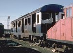 Image 18172 (172k, 1024x676) Photo by: Steve Zabel Collection of: Joe Testagrose Location: Everett Yard |  Image 70016 (226k, 1044x705) Photo by: S.L. Peters Location: Forest Hills |  Image 70028 (150k, 1044x705) Photo by: S.L. Peters Location: Haymarket |  Image 70036 (138k, 1044x705) Photo by: S.L. Peters Location: Roxbury Crossing |  Image 115020 (249k, 1024x697) Photo by: Steve Zabel Collection of: Joe Testagrose Location: Wellington Yard |
Photos By Location
Photo locations: Oak Grove, Malden, Wellington, Assembly, Sullivan Square, Community College, North Station, Haymarket, State, Downtown Crossing, Chinatown, NE Medical Center, Back Bay, Massachusetts Avenue, Ruggles, Roxbury Crossing, Jackson Square, Stony Brook, Green Street, Forest Hills, Forest Hills Yard, Wellington Yard, Everett Yard
Photos By Location (Former Elevated Route)
Photo locations: Everett (Main Line El), Sullivan Square (Main Line El), Thompson Square (Main Line El), City Square (Main Line El), Charles River Bridge (Main Line El), North Station (Main Line El), Washington Street Tunnel Portal (Main Line El), Mass Pike Bridge (Main Line El), Tower D - Location of Wye with Atlantic Ave. El (Main Line El), Between Tower D and Dover (Main Line El), Dover (Main Line El), Between Dover and Northampton (Main Line El), Northampton (Main Line El), Between Northampton and Dudley (Main Line El), Dudley (Main Line El), Between Dudley and Egleston (Main Line El), Egleston (Main Line El), Between Egleston and Green (Main Line El), Green (Main Line El), Between Green and Forest Hills (Main Line El), Forest Hills (Main Line El)
Related Documents
Boston Elevated Railway Company, Main Line Elevated Structure (HAER), Historic American Engineering Record description of the former Orange Line "Main Line El."
The New Shops at Everett, Boston Elevated (1923-1930). Electric Railway Journal describes the shop facilities for the Boston Elevated at Everett.
Page Credits
By Gerry O'Regan.