Baltimore Light Rail
From nycsubway.org
Route Map

Photo Gallery
| Five Random Images | ||||
 Image 21662 (371k, 1044x788) Photo by: David Pirmann Location: Camden Yards | 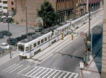 Image 21695 (259k, 1024x654) Photo by: William Mangahas Collection of: Joe Testagrose |  Image 72831 (158k, 820x620) Photo by: Bob Vogel Location: Cultural Center |  Image 79948 (223k, 1044x788) Photo by: David-Paul Gerber Location: BWI Airport |  Image 107200 (334k, 1044x788) Photo by: Brian J. Cudahy Location: Lexington Market |
Photos By Location
Photo locations: Hunt Valley, Pepper Road, McCormick Road, Gilroy Road, Warren Road, Timonium (Park & Ride), Timonium (Business Park), Lutherville, Falls Road, Mt. Washington, Cold Spring Lane, Woodberry, North Avenue, Penn Station, Mt. Royal/University of Baltimore, Cultural Center, Centre Street, Howard & Franklin, Lexington Market, Howard & Fayette, University Center/Baltimore Street, Howard & Lombard, Pratt Street/Convention Center, Camden Yards, Westport, Cherry Hill, Patapsco Avenue, Baltimore Highlands, Nursery Road, North Linthicum, Linthicum, Ferndale, Cromwell Station/Glen Burnie, BWI Airport
Page Credits
Map by Michael Calcagno.