BMT Canarsie Line
Overview
There are four distinct phases of development of what is today's Canarsie Line, also known as the 14th Street Line, also known as the "L" line. Before becoming a BRT subway line in 1906, the Canarsie line operated as a steam railroad between East New York and the area around Canarsie Pier/Canarsie Beach Park (terminus may have been near present-day Canarsie Road and Skidmore Avenue). The BRT began train service in 1906 between Canarsie and Williamsburg, with the trains using trolley poles for power in the ground-level section. This line ran at grade level from the Canarsie Pier terminus to a point north of the East 105th Street station, after which it became elevated. It then connected with the Broadway El at Eastern Parkway station, with service continuing west along Broadway to the now-vanished Williamsburg terminus. At Atlantic Avenue station, there was a connection to the Fulton Street (Kings County Electric railroad) line. The easternmost platform of this station is a remnant of this line. The Atlantic Avenue station was rebuilt under the Dual Contracts, and reopened in 1916. When fully operational, it served Fulton Street trains, Canarsie line trains and Broadway trains.
In 1924, at what is now the other end of the line, a subway line was opened running beneath 14th Street in Manhattan and extending under the East River, through the Williamsburg neighborhood to Montrose and Bushwick Avenues. Four years later, in 1928, this line extended further east beneath Wyckoff Avenue and then south paralleling the New York Connecting Railroad, to a new station at Broadway Junction, above the existing Broadway-Eastern Parkway elevated station. This route was then extended south, connecting to the 6-track Atlantic Avenue BMT station.
In 1931 an additional station was opened at 8th Avenue and 14th Street in Manhattan, connecting the Canarsie Line to the newly-opened Eighth Avenue Independent Subway. This station was built to look like the other IND stations. At this point, the Canarsie Line's route took the shape that it still has to this day.
In the early 1940's the subway line discontinued the use of the Canarsie Pier terminal, terminating instead at Rockaway Parkway. The Canarsie Pier line maintained trolley service until that was replaced by the B42 bus and the right-of-way abandoned and built over. For the record, this right-of-way ran between East 95th and East 96th Streets as far south as Seaview Avenue.
The corridor for the segment of the line to the pier is mostly built up and can no longer be resurrected. In the streets around Rockaway Parkway station are remains of tracks leading out of the station into this corridor. It was a bit raised above the surrounding terrain which accounts for the curious hump in the cross streets between East 95th and East 96th Street. There were high hopes for this line for cargo in World War I. The plan was to relocate the City's shipping industry to Jamaica Bay. The Bay would be hollowed and built out into a gigantic harbor for overseas ships. There would be a canal in what is now Van Wyck Boulevard and Flushing Meadow Park joining this harbor to Long Island Sound. The rail line from East New York would be the cargo carrier for the piers along the shore. Only one was ever built, Canarsie Pier itself. This is much overbuilt for a inland bay. It was intended for seafaring ships.
Construction
The section from Rockaway Parkway/Glenwood Road to Van Sinderen Avenue and East 108th Street is a two-track, grade level railroad. A storage yard with at least eight tracks is located just east of the the Rockaway Parkway station.
The East 105th Street station was the site of the only grade crossing in the New York transit system. The grade crossing was not removed by separating the level of the train and road-- the road was deleted in the area of the station!
The line rises to a low elevated structure running down the center of Van Sinderen Avenue, dividing it into two one-way streets. This elevated structure is approximately 20 feet above street level at New Lots station, rising to about 25 feet by Sutter Avenue. This section was constructed in the early 1900's, as part of the BRT system, opening in 1906.
On the section from New Lots Avenue to Wilson Avenue, the line parallels the LIRR Bay Ridge line. In the 1960s the Rockefeller scheme for new transit would have relocated the Canarsie line in the LIRR corridor and added a branch along that railroad to Nostrand Junction, where the IRT Nostrand Avenue line ends.
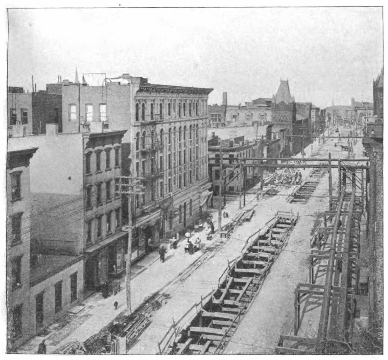
The section between Broadway Junction and Morgan Avenue was opened in 1928. Broadway Junction station features BMT/BRT Contract Three el station architecture, with shaded lamps and arched pillars. The underground stations are similar, with highly ornate mosaic bands adorning the walls, even at island platform stations. In 1924, the original underground section opened between Montrose Avenue, Brooklyn and Sixth Avenue and 14th Street, Manhattan. These underground sections were also built under BMT/BRT Contract Three. The architecture of the 1924 and 1928 sections is similar, except in the 1924 section, at island platform stations, the mosaic bands are up higher, and separated by iron girders.
In 1931, a final station was opened at Eighth Avenue and 14th Street. This station does not resemble a BMT station at all, rather it looks very much like the IND station with which it shares a connection, although a 1999 renovation added Dual Contracts-style mosaic friezes to the walls.
The entire Canarsie Line is two tracks, with the exception of a third, center layup between Myrtle Avenue and Halsey Street.
 Fourteenth Street-Eastern Line, Rock Tunnel Under 14th Street Showing Segmental Timbering. PSC report 1917. |
 Fourteenth Street-Eastern Line, Steel Shell, Manhattan Shaft. Circular Panels Removable to Permit Egress of Tunnel Shields When Caisson Reaches Subgrade. PSC report 1917. |
 Fourteenth Street-Eastern Line, Street Decking over Excavation, With Openings for Construction Work, Gas By-passes, etc., Meserole Street, Brooklyn. PSC report 1917. |
 Fourteenth Street-Eastern Line, Details of Gas By-passes, etc. in Scholes Street at Bushwick Avenue. PSC report 1917. |
 Fourteenth Street-Eastern Line, Method of Construction at Lorimer Street Stationn. PSC report 1918. |
The Canarsie Line's Serpentine Route
Nothing like a good, sharp curve excites some subway buffs and annoys the daylights out of everyday riders. The Canarsie Line is full of them. Especially interesting is the track route between Bedford Avenue and Broadway Junction. This section was bent into a serpentine in order not to tunnel under some sections of Williamsburg and Bushwick. Basically, the subway line stayed under the area streets instead of cutting crosswise beneath them. The line starts off in Brooklyn beneath North Seventh Street in northern Williamsburg, then turns onto Metropolitan Avenue just west of Lorimer Street station. It then continues east to Bushwick Avenue, where it turns sharply southward. South of the Montrose Avenue station, it turns east onto McKibbin Street, then at Bogart Street it veers slightly right then left and onto Harrison Place. At Harrison Place and Flushing Avenue, it turns again southeasterly onto Wyckoff Avenue, running a mile and a half to Moffat Street, where it turns southwest then due south before emerging from its tunnel. At this point, the tracks run east of the streets, parallel to the NY Connecting Railroad. Ride up in the front car of the train to observe this fascinating track layout. And watch how the train leaps out of its tunnel and up a steep ramp as it enters Broadway Junction station.
Canarsie Line Service
Service patterns over the Canarsie Line varied little through the years; initially trains ran over the Broadway Line from Williamsburg, through Atlantic Avenue and on to Canarsie, then when the subway opened, two services ran from Manhattan - one to Canarsie and one to Lefferts Boulevard (in the rush hours) on the eastern leg of the Fulton Street El. The route was given BMT marker "16", although trains running to Lefferts Boulevard usually were marked as "13". When the Fulton El was torn down, some rush-hour Broadway trains ran through from Eastern Parkway to Canarsie on the "flyover". These were marked as "14". In 1967, when all BMT lines were given letters, the Canarsie line was designated as "LL". The rush-hour Broadway service was designated "JJ", and ran until 1968 when it was replaced by the "KK" which did not run through from Eastern Parkway to Canarsie. The flyover connection has not been used for revenue service since then.
Rolling Stock
The BMT Canarsie line subway started operating in 1924 with BMT Standards. The Standards were delivered by a temporary ramp located near the Montrose Avenue station. See BMT Canarsie Line Car Delivery for more information. The elevated portion of the line may have seen gate car service prior to that. The line continued to operate with Standards until 1969, when the Standards were put out to pasture. BMT odd cars like the Multi-Section units and Bluebirds appeared alongside the Standards. When the Standards were retired, they were replaced by IND R7 and R9 cars, which served until the late 70's. These were replaced briefly by R16 cars, then R27's and R30's. A few R42 cars, delivered in 1969, also made up part of the fleet. These same R42's, along with their brethren and a group of R40 and R40M's held down the Canarsie Line's fleet for many years in the late 1980s and throughout the 1990s. The new R-143 displaced the R40/R42 cars in 2002-2003, in preparation for the line's conversion to CBTC signalling. Some of the R-160 fleet has been converted to CBTC and operates the Canarsie line as well.
The Canarsie Line Mosaics
Few places in the NYCT system have mosaics as beautiful as some of those found on the Canarsie Line. These mosaics were created in the "arts and crafts" style, and contain various geometric shapes: squares, rectangles, oblongs, diamonds, right and isosceles triangles and hexagons. Each station between Sixth Avenue and Bushwick-Aberdeen has a different color pattern. Most of these are constructed of cut ceramic tile, with the exception of Montrose Avenue, Wilson Avenue and Bushwick-Aberdeen, which are made of cut porcelain, highly glazed. The bands are 18.5" high and run the length of the station wall. Hexagonal icons measuring approx. 11.5" wide by 16" high are spaced at approx. 13.5' intervals. The hexagons are not equilateral, rather their top and bottom angles are 36 degrees and their corners are 72 degrees, giving them a slightly flattened shape. Each hexagon bears a single character denoting the station's initial or numeral. Three vertical bands are spaced roughly 4 feet between each icon. These also appear on either side of the icons. Near the top and bottom edges of the band are rows of 2" square tile, with varying colors. Above the vertical bands are 4" x 2 1/4" rectangular tiles, each with a diamond of a different color embossed on them. A single 2" square tile is below each of the vertical bands. A right triangle is located above and below each icon's corner. In the center section of the tile band are irregularly cut tiles of between three and ten different colors, depending on the station. Some of these tiles are square, others are rectangular, and still others triangular. They have no set pattern, the tilesmiths who created them left to their own devices as they were made. Among the most vivid color patterns are those found at Montrose Avenue, Wilson Avenue and Myrtle Avenue. Other stations have more neutral colors, but are handsome nonetheless. Some stations also have slightly smaller tile bands in the station's entrances and mezzanines. These are somewhat similar to the bands at platform level, especially with respect to color, but are only 8 1/2" high and have smaller cut tiles. Stations that do not have mezzanines (3rd Avenue, Graham Avenue, Grand Street and Halsey Street) lack these decorations.
An anomaly among all these exists at Halsey Street station's Covert Street exit on the southbound side; here, the original tile has been replaced with a simple 17" wide blue band, devoid of any ornamentation. Let's hope that this is just temporary. The Wilson Avenue station's lower-level trackside wall is bare, but once had tiles with a band matching that of the platform-side wall. It is thought that water damage necessitated the removal of these tiles. Also, the Union Square station's mezzanine has been redone with new tile not matching the original, but two sections of the old tile have been lovingly preserved inside red metal frames.
Timeline
- 19th Century - 1906: Operated as a steam railroad between Canarsie Pier and East New York.
- 1906: Opened for BRT service between Rockaway Parkway and Williamsburg, via the Broadway El.
- 1908: Through train service to Canarsie Pier begins.
- ca. 1916: Atlantic Avenue station rebuilt under Dual Contracts.
- 1920: Through subway service to Canarsie Pier ends; track loop is added at Rockaway Parkway and service to Canarsie Pier is replaced by trolley. Connection to Rockaway Parkway/Wilson Avenue trolley line is added.
- 1924: First underground segment opens, between 6th Avenue-14th Street and Montrose Avenue.
- 1928: Second underground segment opens, between Montrose Avenue and Broadway Junction. Connection to Atlantic Avenue established. Canarsie Line assumes its current shape.
- 1931: Third and final underground segment is opened, to 8th Avenue and 14th Street.
- 1942: Trolley service via the East 95th/East 96th Street right-of-way ends, and the track is abandoned. The trolley line begins operation to Rockaway Pier via Rockaway Parkway.
- 1951: Trolley service to Canarsie Pier ends, and is replaced by the B42 bus.
- 1956: East end of Fulton El is closed.
- 1963: New Lots Avenue station burns. Reopened in 1964.
- 1967: Route designation "LL" is adopted.
- 1968: Through service between Atlantic Avenue and Eastern Parkway ends.
- 1969: First air-conditioned cars (R-42) arrive. BMT standards are retired and replaced with R-7 and R-9 cars.
- 1973: Grade crossing at E.105th Street eliminated. Station entrance and platform are rebuilt.
- 1977: Last of the R-7/R-9 cars are retired. R-16 cars take over.
- 1984: Rebuilding of Rockaway Parkway station is completed.
- 1985: Route designation "LL" is changed to "L", sign color changed from black to grey.
- 1988: R-42/R-40M fleet is put into service.
- 1994: Slant R-40's make their debut on the Canarsie Line.
- 1996: Decision to go forward with CBTC (Communication-based train control) is finalized.
- 1999: Union Square station renovation is completed after two years of work. 8th Avenue station is renovated.
- 2000: Reconstruction of Broadway Junction station begins.
- 2001: First R143 cars arrive.
- 2001: Flyover to Broadway Line closed in preparation for track realignment.
- 2001-2002: Construction of new box girder elevated structure for new northbound tracks begins over Van Sinderen Avenue.
- 2002: Slant R40 cars are reassigned to Coney Island as R143 cars displace them.
- 2002: Sutter Avenue station is re-lighted and the original 1906 lights are removed.
- 2002: Demolition begins on unused portions of Atlantic Avenue station.
- 2003: R143 cars now comprise almost all of the "L" fleet.
Opening/Closing Dates
| Station | Opened | Closed |
|---|---|---|
| 8th Avenue | 6/13/1931 | |
| 6th Avenue | 9/21/1924 | |
| Union Square | 9/21/1924 | |
| 3rd Avenue | 9/21/1924 | |
| 1st Avenue | 9/21/1924 | |
| Bedford Avenue | 9/21/1924 | |
| Lorimer Street | 9/21/1924 | |
| Graham Avenue | 9/21/1924 | |
| Grand Street | 9/21/1924 | |
| Montrose Avenue | 9/21/1924 | |
| Morgan Avenue | 12/14/1928 | |
| Jefferson Street | 12/14/1928 | |
| DeKalb Avenue | 12/14/1928 | |
| Myrtle Avenue | 12/14/1928 | |
| Halsey Street | 12/14/1928 | |
| Wilson Avenue | 12/14/1928 | |
| Bushwick-Aberdeen | 12/14/1928 | |
| Broadway Junction | 12/14/1928 | |
| Atlantic Avenue | 12/28/1906 | |
| Sutter Avenue | 12/28/1906 | |
| Livonia Avenue | 12/28/1906 | |
| New Lots Avenue | 12/28/1906 | |
| East 105th Street | 12/28/1906 | |
| Rockaway Parkway | 12/28/1906 |
Station by Station
8th Avenue
Artwork Parallel Motion (Ross Lewis, 1989), Life Underground (Tom Otterness, 2000)
Transfer to IND 8th Avenue Line
L 8th Avenue is the Manhattan terminus of the Canarsie Line. This station opened in 1931, and was not originally built like a BMT station, rather, it was built in the same style as the IND station with which it shares a transfer point. As originally constructed, a simple blue tile band adorned the wall. A major reconstruction and renovation in 1999 allowed the spirit of Dual Contracts designer Squire J. Vickers to catch up with this station - a new frieze in the Vickers Canarsie Line style was designed and installed along the track side walls. Tan and beige at the edges, with brick red, jasmine yellow, lime green and dark green in the faithfully-reproduced "crazy quilt" pattern, it is adorned with a dark green border, maroon vertical stripes, and perfectly-recreated blue hexagonal icons with white "8"s on them. Brown borders and accents complete the design. New white tile can be found in the rampways. Winding staircases with many landings lead to the IND upper level and the IND 8th Avenue Line.
 Photo by: Doug Grotjahn |
 Photo by: John Barnes |
 Photo by: Robert Mencher |
 Photo by: John Dooley |
 Photo by: Robbie Rosenfeld |
| More Images: 1-50 51-100 101-129 | ||||
6th Avenue
Artwork MTA Jewels (Jennifer Kotter, 1993)
Transfer to IND 6th Avenue Line, IRT West Side Line, PATH Port Authority Trans-Hudson
L This station has an island platform with two tracks. 6th Avenue served as the Manhattan terminus of the Canarsie line from 1924 until 8th Avenue station was opened in 1931. A long corridor leads to the Seventh Avenue line, while a narrow, winding stair leads to the Sixth Avenue line. The main entrance has a modest mezzanine, which has a dimly-lit corridor leading down from it. This mezzanine appears to have extended further east towards Fifth Avenue, and may have had an entrance there, but this half has been sealed off; one stairway at the platform's east has been removed, and another has been replaced with a metal one, leading to what is now a storage area and ventilation room. Earthy tones of olive green, brown, ocher and tan augmented by light green and Copenhagen blue make up the mosaic band, which in some places at platform level is barely visible due to age, grime and electrical conduits. Powder blue and slate blue can also be seen in the mezzanine tile bands, some of which actually have symmetrical patterns. These bands show the colors as they originally were. Recent visits to the station have found the tile bands on the trackside walls revealing some of their original colors in spots as the result of patient cleaning, especially on the inbound side. However, there is still much work remaining to be done. The 6th Ave. station is approximately 40 feet below street level.
 Photo by: Wayne Whitehorne |
 Photo by: DeAndre Burrell |
 Photo by: David Pirmann |
 Photo by: Peter Ehrlich |
 Photo by: John Barnes |
| More Images: 1-43 | ||||
Union Square
Artwork Sorry, no artwork here.
Transfer to IRT East Side Line, BMT Broadway Line
L Single island platform, two tracks. The platform has with numerous stairways and exits leading from it. There is one mezzanine attached to this station with entrances on the south side of 14th Street between Broadway and University Place. The original mosaic band of sky blue, sea green, lime green and yellow ocher stands clearly visible above new green-bordered tile panels. Fall 1999 finds it scoured clean of seventy-five years' dirt and grime, the original colors and details shining brightly beneath a new coat of clear glaze and several missing and damaged pieces repaired and lovingly restored.
 Photo by: Wayne Whitehorne |
 Photo by: Gary Chatterton |
 Photo by: Bill E. |
 Photo by: Roberto C. Tobar |
 Photo by: John Dooley |
| More Images: 1-34 | ||||
3rd Avenue
Artwork Sorry, no artwork here.
L Two side platforms alongside two tracks. A mezzanine is located over the single exit, located at the east end of the platform. The platforms are free from pillars, providing a wide open view from the platforms. The mosaic band has a bit of brown mixed into tiles of blues, greens and yellows.
 Photo by: Wayne Whitehorne |
 Photo by: Wayne Whitehorne |
 Photo by: Zach Summer |
 Photo by: Roberto C. Tobar |
 Photo by: Roberto C. Tobar |
| More Images: 1-16 | ||||
1st Avenue
Artwork Queens of the Night (Katherine Bradford, 2021)
L Two side platforms alongside two tracks. A mezzanine is located over the single exit, located at the west end of the platform. The platforms are free from pillars, providing a wide open view from the platforms. The mosaic band is made up of tiles of blues, greens and yellows.
 Photo by: Wayne Whitehorne |
 Collection of: Joe Testagrose |
 Photo by: David Pirmann |
 Photo by: Roberto C. Tobar |
 Photo by: Roberto C. Tobar |
| More Images: 1-33 | ||||
Bedford Avenue
Artwork No Less Than Everything Comes Together (Marcel Dzama, 2021)
L![]() Single island platform and two tracks. The wall tile is separated by
girders spaced about every seven feet. There are two exits, each with
a mezzanine, one at Bedford Avenue and one at Driggs Avenue. The
Driggs Avenue exit differs from the Bedford Avenue exit and has a
longer corridor. Where visible, the mosaic band predominates browns,
with green at the edges. It can be seen more clearly in the
mezzanines.
Single island platform and two tracks. The wall tile is separated by
girders spaced about every seven feet. There are two exits, each with
a mezzanine, one at Bedford Avenue and one at Driggs Avenue. The
Driggs Avenue exit differs from the Bedford Avenue exit and has a
longer corridor. Where visible, the mosaic band predominates browns,
with green at the edges. It can be seen more clearly in the
mezzanines.
 Photo by: Peter Ehrlich |
 Photo by: Kevin Lee |
 Photo by: Roberto C. Tobar |
 Photo by: Roberto C. Tobar |
 Photo by: Marc A. Hermann / Metropolitan Transportation Authority |
| More Images: 1-30 | ||||
Lorimer Street
Artwork Personal Choice #5 (Chloë Bass, 2024)
Transfer to IND Crosstown Line
L![]() Island platform with two tracks. There is a slight curve at the
platform's east end. There are two exits, with a mezzanine at the
east end, and the west end exit leading to the transfer to the
Crosstown line. Mosaic band predominately browns, white and light
blue with light grey, bronze and slate blue at the edges; there are
also terra-cotta brown and bright yellow accents. At the west end of
the station is a maze of ramps, stairways and passages which connect
the two lines.
Island platform with two tracks. There is a slight curve at the
platform's east end. There are two exits, with a mezzanine at the
east end, and the west end exit leading to the transfer to the
Crosstown line. Mosaic band predominately browns, white and light
blue with light grey, bronze and slate blue at the edges; there are
also terra-cotta brown and bright yellow accents. At the west end of
the station is a maze of ramps, stairways and passages which connect
the two lines.
 Photo by: Wayne Whitehorne |
 Photo by: Roberto C. Tobar |
 Photo by: Wilfredo Castillo |
 Photo by: Wilfredo Castillo |
 Photo by: Bernard Chatreau |
| More Images: 1-19 | ||||
Graham Avenue
Artwork Sorry, no artwork here.
L Graham Avenue is similar to Grand Street in design, with a single platform-level exit near the west end of the station. Again, there are no pillars present here, although the platform is straight. Tile band is ornate, predominating blues and greens, with mauve and peach at the edges.
 Photo by: Robbie Rosenfeld |
 Photo by: John Dooley |
 Photo by: Wilfredo Castillo |
 Photo by: Wilfredo Castillo |
 Photo by: Roberto C. Tobar |
| More Images: 1-28 | ||||
Grand Street
Artwork Gratitudes Off Grand (Glendalys Medina, 2023)
L![]() Grand Street station has no pillars at the platform edge, possibly due
to the fact that the platform curves about 12 degrees. It also has no
mezzanine. There is one single exit near the north end of the
station. Mosaic band features greys along with aqua, orange, ocher,
light blue and light green. Near the south end, gratings can be seen
near the ceiling, with the tile band cut out to fit around them.
Grand Street station has no pillars at the platform edge, possibly due
to the fact that the platform curves about 12 degrees. It also has no
mezzanine. There is one single exit near the north end of the
station. Mosaic band features greys along with aqua, orange, ocher,
light blue and light green. Near the south end, gratings can be seen
near the ceiling, with the tile band cut out to fit around them.
After Grand Street station the "L" train slows to a crawl. This area is designated as "no-key-by", meaning that trains must proceed at no more than 15 miles an hour and must not "key by" red signals. A sharp curve just before the Graham Avenue station, with limited sight distance, is the reason.
 Photo by: Wayne Whitehorne |
 Photo by: Wayne Whitehorne |
 Photo by: Roberto C. Tobar |
 Photo by: Roberto C. Tobar |
 Photo by: Wilfredo Castillo |
| More Images: 1-21 | ||||
Montrose Avenue
Artwork Sorry, no artwork here.
L Montrose Avenue station certainly qualifies as having among the most beautiful mosaics in the entire subway system. The mosaic band here is of exquisite cut porcelain, with vivid pastel shades of sky blue, cerulean blue, rose, yellow, maize and white, on a background of black, raspberry and greyed lavender. Brilliant blue stripes adorn the top and bottom of the tile band. View the hexagon "M" icon up close at the center stairs of the citybound platform. There is a single entrance with a mezzanine in the center of the station.
Somewhere just beyond, on the citybound side, is a long-forgotten ramp leading to the street. This is where BMT Standard cars were fed directly into the subway back in the twenties. Long closed off and forgotten, remnants can be seen from the front of the passing train. See BMT Canarsie Line Car Delivery for more information.
 Photo by: Wayne Whitehorne |
 Photo by: Eric Oszustowicz |
 Photo by: Roberto C. Tobar |
 Photo by: Roberto C. Tobar |
 Collection of: Frank Pfuhler |
| More Images: 1-28 | ||||
Morgan Avenue
Artwork Sorry, no artwork here.
L Morgan Avenue station has an unusual entrance - long ramps lead to the station's east end from the mezzanine. This is the only station on the line to have such a feature. The other entrance, at Bogart Street, is dimly lit and has narrow stairways leading to it. Mosaic band is predominantly earth tones of brown, tan, orange with white accents.
 Photo by: Wayne Whitehorne |
 Photo by: Wayne Whitehorne |
 Photo by: Wayne Whitehorne |
 Photo by: Wayne Whitehorne |
 Photo by: Roberto C. Tobar |
| More Images: 1-16 | ||||
Jefferson Street
Artwork Sorry, no artwork here.
L Jefferson Street is a side-platform station with a mezzanine at one end and platform-level exits at the other. The mosaic tile bands are predominately green and blue, with yellow and tan accents. New mosaic tile in the stairway from the mezzanine to the Manhattan-bound platform was installed in Summer 2000, featuring a 7-inch entrance motif design with a dull green and blue background. The center colors are relatively close to the others in the station.
 Photo by: Wayne Whitehorne |
 Photo by: Roberto C. Tobar |
 Photo by: Roberto C. Tobar |
 Photo by: Peter Ehrlich |
 Photo by: Bernard Chatreau |
| More Images: 1-17 | ||||
DeKalb Avenue
Artwork Sorry, no artwork here.
L DeKalb Avenue is very similar to the preceding Jefferson Street station, with a mezzanine at one end only, and platform-level exits at the other end. The mosaic tile bands here are predominately blue and brown with yellow and tan accents. New tile was installed in Summer 2000, at the west exit of the Brooklyn-bound platform. Here, we have a full frieze with icons, and all the correct "details". The colors, however, shift from the earth tones found in the original design, to more pastelized shades of rose, slate blue, yellow and peach. Some of the background tile is mottled, which is unusual for a subway station mosaic. This is a hand-made work, with all of the proper elements, including randomly-cut and set tiles in the center. Dual Contracts designer Squire Vickers would be proud.
 Photo by: Wayne Whitehorne |
 Photo by: Wayne Whitehorne |
 Photo by: Wayne Whitehorne |
 Photo by: David Pirmann |
 Photo by: Roberto C. Tobar |
| More Images: 1-24 | ||||
Myrtle Avenue
Artwork From Earth To Sky (Cadence Giersbach, 2007)
Transfer to BMT Myrtle Avenue Line
L![]() Myrtle Avenue station features an island platform. It is a transfer
point for the BMT Myrtle Avenue Line ("M"), which is reached via
an escalator link to the elevated line above. The mosaic band is set
at eye level, rather than high up on the wall, with brick red, yellow,
tan and light blue offset by indigo and maroon. Unlike the other
island platform stations, the walls do not have girders showing. The
ceiling is also lower than those at the other island platform
stations.
Myrtle Avenue station features an island platform. It is a transfer
point for the BMT Myrtle Avenue Line ("M"), which is reached via
an escalator link to the elevated line above. The mosaic band is set
at eye level, rather than high up on the wall, with brick red, yellow,
tan and light blue offset by indigo and maroon. Unlike the other
island platform stations, the walls do not have girders showing. The
ceiling is also lower than those at the other island platform
stations.
 Photo by: Richard Panse |
 Photo by: Richard Panse |
 Collection of: George Conrad Collection |
 Photo by: Philip D'Allesandro |
 Photo by: Roberto C. Tobar |
| More Images: 1-32 | ||||
Halsey Street
Artwork Sorry, no artwork here.
L Halsey Street station has two entrances with no mezzanine. The platform ends are offset from each other, with plain white tiles in the tunnel sections. The offset is about sixty feet in length on either end of the station. Some replacement tile can be seen near the Covert Street (east end) exit, see photo above and the mosaic section for details. Original mosaic band predominates blues and greens, with yellowish accents.
 Photo by: Wayne Whitehorne |
 Photo by: Wayne Whitehorne |
 Photo by: Wayne Whitehorne |
 Photo by: Christopher Sattler |
 Photo by: Roberto C. Tobar |
| More Images: 1-14 | ||||
Wilson Avenue
Artwork Sorry, no artwork here.
L![]() Wilson Avenue station has some interesting features. Here the Canarsie
Line squeezes in next to the New York Connecting Railroad, and the two
tracks are one on top of another. The southbound tracks sit on a low
elevated structure, guarded by a tall fence, with a panoramic view of
Trinity Cemetery. The northbound tracks are immediately below, and
the station gives the impression of being underground, but it is
really at street level (note that there are no stairs leading to the
station entrance, which is in a dead-end at the foot of Wilson Avenue,
just east of Moffat Street). A concrete wall closes off the east side
of the lower level; the shed on the upper level runs the entire length
of the platform. Mosaic band is predominantly green at edges with a
vivid multicolored design throughout, 28 colors in all. The trackside
wall once had tiles that matched the platform's, but sometime after
1982, these tiles, unfortunately, were removed.
Wilson Avenue station has some interesting features. Here the Canarsie
Line squeezes in next to the New York Connecting Railroad, and the two
tracks are one on top of another. The southbound tracks sit on a low
elevated structure, guarded by a tall fence, with a panoramic view of
Trinity Cemetery. The northbound tracks are immediately below, and
the station gives the impression of being underground, but it is
really at street level (note that there are no stairs leading to the
station entrance, which is in a dead-end at the foot of Wilson Avenue,
just east of Moffat Street). A concrete wall closes off the east side
of the lower level; the shed on the upper level runs the entire length
of the platform. Mosaic band is predominantly green at edges with a
vivid multicolored design throughout, 28 colors in all. The trackside
wall once had tiles that matched the platform's, but sometime after
1982, these tiles, unfortunately, were removed.
ADA accessibility at this station is limited to Manhattan-bound trains.
 Photo by: David Pirmann |
 Photo by: David Pirmann |
 Photo by: David Pirmann |
 Photo by: David Pirmann |
 Photo by: Roberto C. Tobar |
| More Images: 1-50 51 | ||||
Bushwick-Aberdeen
Artwork Sorry, no artwork here.
L Bushwick-Aberdeen station has an interesting design. The entrance to this underground station is in a small building on the north side of Bushwick Avenue between Aberdeen Street and DeSales Place. In this space are 11-foot high coffered ceilings, suspended light fixtures and fancy ironwork. Parchment brown replacement tiles can be observed. The platform is slightly curved to the right, and the two tracks are at different levels at the north end of the station, with the southbound tracks being higher due to their descent from an elevated stretch at Wilson Avenue. The pillars are covered in white tile, with mosaics on each one bearing the station's name, "Bushwick Aberdeen". The elaborate porcelain mosaic band is predominantly tan, peach, mauve and brown with yellow, cream, green, rosy beige, slate blue, indigo and black grape tiles in the center. In the mezzanine, there are also bright aqua tiles, as well as the above-mentioned brown replacements.
 Photo by: Wayne Whitehorne |
 Photo by: Wayne Whitehorne |
 Photo by: Wayne Whitehorne |
 Photo by: Robbie Rosenfeld |
 Photo by: Bernard Chatreau |
| More Images: 1-15 | ||||
Broadway Junction
Artwork Sorry, no artwork here.
Transfer to IND Fulton Street Line, BMT Nassau Street-Jamaica Line
L The large station complex at Broadway Junction serves trains on the BMT Nassau Street-Jamaica Line (J, Z), and the BMT Canarsie Line (L). In the past there were also tracks and platforms serving The Fulton Street Elevated (Brooklyn). It is in fact the largest elevated complex in the system, with many artifacts remaining of its former glory, including ironwork for the old Fulton Street Elevated trackways which can be seen underneath and to the south of the current platforms.
Of the two remaining elevated stations at Broadway Junction, the lower level serving the Jamaica Line was built first (1884). It consists of three tracks and two island platforms.
The upper level, serving the Canarsie Line, was added in 1928. It connected the Canarsie Line subway from Manhattan with existing trackage built in 1906 for the Fulton Street Elevated. There are two tracks, one side platform (on the outbound side) and one island platform (used for the inbound side only). The Canarsie Line platforms must be one of the highest elevated platforms in the city, second only perhaps to Smith/9th Street, as it sits above the already-elevated Jamaica Line platforms. As high up as these platforms are, the tracks plunge abruptly into a tunnel at the north end. This end of the station slopes sharply downward, and it is less than 200 yards from the platform end to the tunnel's portal.
An interesting feature here is the mezzanine, which is above the Broadway line platforms. The upper mezzanine extends most of the length of the station and is made of concrete, resembling the style of the mezzanines on the #7 Flushing line. This mezzanine is used to connect to the BMT Canarsie Line and to exit to street level via two long escalators. To reach the inbound Canarsie Line platform, one must climb up a flight of stairs from the mezzanine to an overpass. The overpass was added during recent (2000's) renovations to the station complex and replaced a former dodgy underpass. This new crossover has steps that can be seen through, which gives the area a light, airy feel and makes them impossible to hide behind and underneath, a safety improvement. There is no direct access from the inbound Canarsie Line platform to the mezzanine or to the street.
A headhouse at street level contains the fare control and a transfer to the IND Fulton Street Line (subway). There is an old, "traditional" mezzanine, underneath the Jamaica Line platforms at the south end. It is currently used by various track maintenance operations as office space.
There is track connections at each end of the Jamaica Line station to the East New York Yard, and also a connection south of the Canarsie Line station.
There are also tracks connecting the Canarsie Line and Jamaica Line here. Clearly noticable from the inbound Canarsie Line platforms is a flyover track, connecting inbound Canarsie Line to inbound Jamaica line. This track is rarely used, but now and then a train being rerouted will use these tracks, particularly during track work in the Canarsie Line tunnel. The outbound connection track can be seen emerging below the Canarsie Line platforms. For detail of the track configuration in this area see the East New York Area Track Map. A fine view of the yard can be had from the inbound Canarsie Line platform.
 Photo by: Robert Marrero |
 Photo by: Richard Chase |
 Photo by: Robert Mencher |
 Photo by: John Dooley |
 Collection of: David Pirmann |
| More Images: 1-50 51-100 101-150 151-200 201-250 251-255 | ||||
Atlantic Avenue
Artwork Sorry, no artwork here.
L Atlantic Avenue station is a model of the Dual Contract architecture, and a must-see photo opportunity. The station dates back to the construction of the Fulton El, which opened through Atlantic Avenue on June 13, 1889. The Canarsie extension was opened December 28, 1906, and the station was reconfigured to accept the connection from the 14th Street-Eastern Dual Contracts subway line. In its heyday there were three island platforms and six tracks. The station was arranged with four tracks and two island platforms over Van Sinderen Avenue and two tracks and one island platform over Snediker Avenue.
Today, the Atlantic Avenue station architecture is much as it was then, with some modern touches, such as fluorescent light in the mezzanine, a new token booth and new turnstiles. Much of the period woodwork and ironwork is intact. The mezzanine features high, rounded windows. The original 1916 platform lamps are still in place, some of them still retaining their heavy, iron shades, typical of the Brooklyn BMT lines.
Over the years, the reduction of elevated service led to changes at Atlantic Avenue. The station once had six tracks; the first reduction was the removal of the easternmost northbound track over Snediker Avenue, leaving five. Cessation of Fulton El service caused the center island platform (over Van Sinderen Ave.) to become redundant along with its trackways (these occasionally used for train storage). As described on the Sutter Avenue station page, the early 2000s project to reduce further the elevated structures in this area has eliminated all service by the Canarsie line on the Snediker Avenue portion of the el, which will be totally removed along with the disused Fulton El platform over Van Sinderen Avenue.
North of Atlantic Avenue, a complex junction once had tracks leading north to the BMT subway (upper level of Broadway Junction), the BMT Jamaica line leading west to Manhattan ("lower level" of Broadway Junction), onto the Fulton El leading west toward downtown Brooklyn, and into the East New York Yard. In fact remnants of the Fulton El connection can easily be seen at Broadway Junction. The tracks leading north from Atlantic Avenue still have access to the Jamaica line to the west and to the East New York Yard but service is only run via the upper level of Broadway Junction into the BMT subway. (Through service from the Jamaica line to the Canarsie line hasn't been run since 1968 although this connection is occasionally used by work trains and in the case of construction along the lines.)
 Photo by: Wayne Whitehorne |
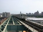 Photo by: Joe Testagrose |
 Collection of: Joe Testagrose |
 Photo by: Filip Matuska |
 Photo by: John Dooley |
| More Images: 1-50 51-100 101-150 151-200 201-209 | ||||
Sutter Avenue
Artwork The Habitat for the Yellow Bird (Takayo Noda, 2007)
L The Sutter Avenue station is a microcosm of early-20th century BRT construction. Ornate period ironwork adorns the quaint wooden crosswalk beneath the south end of the station. The hook-armed lamps at the station's north end are still there, but need repair. Be careful when accessing this end of the platform - there is an area of almost no clearance between an iron fence and the platform's edge - face the fence and hold on with both hands, then shimmy along - slowly and carefully.
The elevated structure just north of Sutter Avenue station has recently undergone a transformation. Formerly, the Canarsie line split into two separate elevated structures - one over Van Sinderen Avenue and another a block east over Snediker Avenue. The curve into Snediker Avenue was one of the sharpest curves in the entire subway system - an "S" curve with 75-degree angles. As the curve swung around to the east, it passed under the last remnant of the old Fulton Street elevated. The Fulton el tracks curved east as if they were heading down the old route to Pitkin Avenue and on to City Line, then abruptly ended. The two Canarsie elevated structures ran north into separate platforms at Atlantic Avenue station.
Because of all of the extra elevated structure at Atlantic Avenue (two tracks for the Canarsie line and three for the Fulton El), it was decided to take advantage of this and remove half of the line, the part over Snediker Avenue. Completed in 2005, this work removed much of the old Fulton El structure and a substantial portion of the Atlantic Avenue station. The "S" curve has disappeared; northbound trains are now routed on what was formerly the southbound of the Fulton El tracks.
 Photo by: Doug Grotjahn |
 Photo by: Joe Korman |
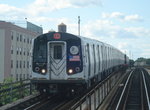 Photo by: DeAndre Burrell |
 Photo by: Robbie Rosenfeld |
 Photo by: Filip Matuska |
| More Images: 1-50 51-90 | ||||
Livonia Avenue
Artwork Seasons (Philemona Williamson, 2007)
L![]()

This station is about one block from the Junius Avenue station on the IRT New Lots line. There is a long foot bridge over the LIRR Bay Ridge line joining the two stations. The IRT line crosses directly above the Livonia Ave. platforms. Despite there being a walkway, there is no free transfer provided here.
Just south of this station is a spur leading to a small yard, which is known as the Linden Shops, which is connected to the IRT line as well. These spurs have no third rails, and are used by NYCT locomotives going to and from the facility. For detail of the track configuration in this area see the track map.
 Photo by: Steve Zabel |
 Photo by: Joe Testagrose |
 Photo by: Aliandro Brathwaite |
 Photo by: Robbie Rosenfeld |
 Photo by: Robbie Rosenfeld |
| More Images: 1-50 51-100 101-113 | ||||
New Lots Avenue
Artwork 16 Windows (Eugenie Tung, 2007)
L This is an intriguing station, with large trees overhanging the platform sheds. Take a look at the tiny entranceway below the platform.
 Photo by: Joe Testagrose |
 Photo by: Ed McKernan |
 Photo by: Robbie Rosenfeld |
 Photo by: Robbie Rosenfeld |
 Photo by: Robbie Rosenfeld |
| More Images: 1-50 51-76 | ||||
East 105th Street
Artwork Crescendo (Michael Ingui, 2007)
L Single island platform with two tracks. Another grade level station. The view from the waiting area above the platform is picturesque, allowing views of the trains and tracks.
At the edge of the East 105th St. station, there was a gate-protected gate crossing, the only one on the NYC Subway System. The grade crossing was eliminated in 1973.
 Collection of: David Pirmann |
 Collection of: Joe Testagrose |
 Collection of: George Conrad Collection |
 Photo by: Robert Taylor |
 Collection of: Joe Testagrose |
| More Images: 1-50 51-100 101-140 | ||||
Rockaway Parkway
Artwork Sorry, no artwork here.
L![]() Single island platform with two tracks. Rockaway Parkway is the
terminal of the present-day Canarsie line and is one of the few
grade-level stations in the system.
Single island platform with two tracks. Rockaway Parkway is the
terminal of the present-day Canarsie line and is one of the few
grade-level stations in the system.
An interesting feature at Rockaway Parkway is the operation of a bus transfer station within the fare control. When the rail and trolley service to Canarsie Pier was shut off the riders were entitled to a free transfer to the replacement buses. Rather than issue paper transfers so riders could exit to the street for the buses, a loop was built next to the station with a boarding platform. Train riders could walk directly to the bus platform without leaving the fare control zone. At the street there was a chain link fence gate blocking access to the bus area to try to prevent pedestrians from sneaking in for a free ride. The gate was operated by an electric trigger. Other buses that serve the station passed by on the street and picked up passengers outside the fare control.
Adjacent to the station is the Rockaway Parkway Yard (aka Canarsie Yard).
 Photo by: Tony Mirabella |
 Collection of: David Pirmann |
 Photo by: Peter Ehrlich |
 Photo by: Brian J. Cudahy |
 Collection of: David Pirmann |
| More Images: 1-50 51-100 101-150 151-157 | ||||
Sources
Many photos, route descriptions, and details of the construction progress of the subway lines can be found in: Report of the Board of Rapid Transit Railroad Commissioners in the City of New York, for the year ending... 1901, 1902, 1903, 1904, 1905, 1906; and Report of the Public Service Commission for the First District of the State of New York, for the year ending... 1907, 1908, 1909, 1910, 1911, 1912, 1913, 1914, 1915, 1916, 1917, 1918, 1919, 1920.
Page Credits
By Wayne Whitehorne.