New Jersey Transit Hudson-Bergen Light Rail
From nycsubway.org
![]()
NJT-HBLR LRV no. 2044 at the Marin Blvd. overpass in Jersey City. Photo by David Pirmann, April 2012.
Overview
New Jersey's Hudson-Bergen Light Rail ties together cities in New Jersey's Hudson and Bergen Counties. The initial operating segment connected Bayonne and Jersey City, with a second phase reaching Hoboken Terminal. Future extensions covered the west side of Hoboken, Weehawken, Union City, and North Bergen. So far there are no stations in Bergen County, but proposals are on the table. The eventual overall length of the line will be about 20.6 miles. The system began operational testing in May, 1999, with opening day, April 22, 2000.
Starting in Bayonne at 8th Street, the HBLR runs north along the former Jersey Central Railroad (CNJ) Main Line northward to Communipaw Junction ("CJ"). A second branch originates from the west side of Jersey City near NJ Route 440 and an old Bethlehem Steel plant, along the former CNJ Direct Line (more recently known as the Conrail West Side Industrial Track) to Communipaw Junction. The system's yard and shops are located at CJ.
North of CJ, a stop is made serving Liberty State Park at Johnston Avenue, then ducking under the NJ Turnpike along a private right-of-way to intersect Jersey Avenue. The route turns north along the east side of Jersey Avenue, then east again in private right-of-way as far as Van Vorst Street. The part of this PRW alignment between Marin Blvd and Van Vorst St. is along the former Morris Canal right-of-way. Then, the line runs in the right-of-way of Essex Street, with the eastbound track in a private reservation and the westbound track sharing a traffic lane with automobiles.
At the riverfront, the line turns northward along brand new trackage and snakes its way past the former Colgate properties, Exchange Place, and into Harborside, Harsimus Cove, and Newport. Several bridges carry the line over streets and parking lot access in the Newport Mall and office complex area, finally rising to a viaduct across Newport Parkway, several ground-level parking lots, and 18th Street, turning eastward to reach a station on the south side of the Hoboken Terminal property.
From Hoboken Terminal, the alignment continues west along 18th Street (Jersey City), and turns north to join the former Conrail/NS-CSX National Docks Secondary freight branch, which has been given over to HBLR operations and will not be shared with freight service. At the north end of Hoboken it will connect with the ex-New York Central/Conrail River Line, and follow it through the Weehawken Tunnel (with a station serving Bergenline Avenue to be built inside the tunnel). The terminal for this phase of construction will be located adjacent to Tonnelle Avenue in North Bergen.
Future plans have the line being extended northwestward into Bergen County, to the Vince Lombardi Park and Ride adjacent to the New Jersey Turnpike, and to other Bergen County destinations. Some discussion of these extensions have the new trackage operated with DMU vehicles instead of extending the electrification, possibly requiring vehicle transfer at Tonnelle Avenue. There is some possibility of an additional station south of Bayonne-West 8th Street, and occasionally, a Bayonne Bridge-Staten Island line has been mentioned, but no real plans for that have been floated as of yet.
Station By Station
West Side Avenue. The terminus of the West Side Jersey City branch is located on the east side of West Side Avenue, near the intersection of West Side Avenue and Claremont Avenue in a mostly residential neighborhood. The station is on an embankment above the street, and consists of an island platform and two tracks. Bumper blocks are at the west end of the station, although the CNJ right of way formerly continued west across Newark Bay. An aerial photograph of the area clearly shows the former right of way and bridge pilings in the bay. Located across West Side Avenue is a large park and ride lot, connected to the station by a pedestrian bridge and elevator. Departing West Side Avenue the tracks enter a deep cut dating back to CNJ times. This station opened April 22, 2000.
Martin Luther King Drive. Located on the east side of Martin Luther King Drive, near the intersection of MLK Drive and Virginia Avenue, this site was the location of a former station on the Jersey Central. The headhouse is still in place on the southeast side of the tracks. In CNJ times, the station here was located in the deep cut, but the track level was raised to keep the HBLR station on the surface adjacent to the surrounding streets. The two side platforms have several art installations. Departing MLK Drive the tracks descend again into the deep cut, which ends just prior to the next station at Garfield Avenue. This station opened April 22, 2000.
Garfield Avenue. Garfield Avenue station is located between Randolph and Garfield Avenues just south of Union Street in Jersey City. The station, with two side platforms, is located on an embankment. East of here the tracks descend toward Liberty State Park. A fine view of the lower New York City (and now, downtown Jersey City) skylines can be had from the platforms. This station opened April 22, 2000.
8th Street. The terminus of the Bayonne Branch is located at West 8th Street and Avenue C, in the city of Bayonne. The station consists of two tracks around a central island platform, and is located on an elevated viaduct parallel to NJ Route 440. The viaduct begins at the foot of East 11th St. and continues south past the platform for approximately one two-car train length. A freight service track (former CNJ railroad right of way) runs directly adjacent to NJ Rt. 440 at a slightly lower level than the light rail viaduct. A headhouse built to replicate the former CNJ station at this location is located at ground level. Occasionally the thought of extending the HBLR over the Bayonne Bridge into Staten Island has been mentioned but so far, nothing's come of that idea. Presumably the viaduct would allow further extension crossing over the freight track. The viaduct north of the station is single tracked, and north of E. 11th St. the track runs on the ground level alongside a freight yard to just south of the East 22nd St. Station. The 8th St. station opened on January 31, 2011.
East 22nd Street. The E. 22nd St. station of the Bayonne Branch is located between East 21st Street and East 22nd Street, adjacent to Avenue E in the city of Bayonne. It has two tracks and a center island platform. This station opened on November 15, 2003, and served as the terminus until 8th St. station opened in 2011.
East 34th Street. East 34th Street station, a single island platform centered approximately on East 34th Street on private right of way adjacent to Avenue E. A pedestrian bridge with elevators connects the station to a large park and ride lot east of the station. A route map of the HBLR system is embedded in the tile flooring of the platform. This station opened April 22, 2000, and served as the terminus of the line until 22nd St. opened in 2003.
East 45th Street. East 45th St. station, located near the intersection of East 45th St., Centre St., and Avenue E, is an island platform station serving the residential neighborhood to the west.
Danforth Avenue. The Danforth Avenue station, a single island platform, is located at the foot of Danforth Ave. just east of Garfield Avenue in Jersey City. This station opened April 22, 2000.
Richard Street. Richard Street station, a single island platform, is located at the foot of Richard Street near Garfield Avenue and Bayside Terrace, alongside Bayside Park. A decorative archway featuring sculptures of people with wheels adorns the entryway to the station from the park. This station opened April 22, 2000.
Liberty State Park. Liberty State Park station is located just north of the junction of the West Side and Bayonne Branches, alongside a large (large) park and ride lot. The parking lot is accessible from Johnston and Communipaw Avenues. The two side platforms have shelters with glass block walls; the glass blocks feature logos and slogans of current or "fallen flag" railroads that serve/served northern New Jersey (e.g. "Ship with Susie Q"). This station opened April 22, 2000.
Jersey Avenue. The Jersey Avenue station is a single island platform station located on private right of way immediately east of Jersey Avenue, south of Grand Street in Jersey City. When this station was built, there was literally nothing around it, but since then, a new facility for the Jersey City Medical Center has been constructed between the tracks and Grand Street. This station opened April 22, 2000.
Marin Boulevard. Marin Boulevard station (two side platforms) was also located at the time of its construction really in the middle of nowhere, at the foot of Marin Blvd. inside what was abandoned industrial land. Liberty Harbor Marina was more or less the only nearby feature. New schools and condos have sprung up along Grand Street near the Marin Blvd. station and more development is surely on the way. This station opened April 22, 2000.
Van Vorst Street/Essex Street. The corner of Van Vorst Street and Essex Street is not the location of a station (although it probably should be), but it is noteworthy as the location of the start of the street running portion of the HBLR. Tracks run down Essex Street to the Hudson River waterfront; the westbound track is shared with the westbound traffic on this one-way street, and the eastbound track has its own private reservation where on-street parking used to be located. The residents of Essex Street were predictably up-in-arms about the choice to run the light rail down their street, although the resulting boom in townhouse and condo construction on the three blocks between Van Vorst Street and Greene Street has driven up the value of real estate in the area by a tremendous amount.
Essex Street. Essex Street station consists of two side platforms located between Greene Street and Hudson Street, in a "street running" section that is closed to cars. Not much was nearby when this station was opened but since then two large condominium towers and New Jersey's tallest building (built for Goldman Sachs) were constructed adjacent to the station. This station opened April 22, 2000.
Exchange Place. The light rail tracks turn north along Hudson Street in a private reservation dedicated to the trains, until reaching the intersection of Hudson Street and York Street where they enter the Exchange Place station. Exchange Place has an island platform between the tracks and a side platform adjacent to the northbound track on the east side. A bronze relief map of Hudson County is embedded in the island platform's tile floor. This station is directly adjacent to 101 Hudson Street, formerly New Jersey's tallest building until the Goldman Sachs building opened near Essex Street in 2004. The PATH Exchange Place station is not even a half-block walk east along Montgomery Street. This station opened April 22, 2000.
Harborside. From Exchange Place station the tracks have a short stretch of street running on Hudson Street between Montgomery Street and Christopher Columbus Drive, then turning left onto Columbus then immediately north onto private right of way along the western side of the Harborside Financial Center buildings. The Harborside development was built up on the Pennsylvania freight yards of the same name. The station itself is an island platform located between what would be the extensions of Steuben and Morgan Streets were those streets to be brought through into the Harborside property. Several other office towers and hotel properties have been built in this area bounded by Columbus Drive on the south, Washington Blvd. on the west, 2nd Street on the north, and the Hudson River on the east, since the station opened. This station opened April 22, 2000 and acted as the northern terminal of the HBLR from April 22 to November 19, 2000.
Harsimus Cove. The tracks wend their way through the Harborside development, until finally crossing Washington Blvd. at grade at the foot of 1st Street. Turning north on a private right of way the Harsimus Cove station, with its two side platforms, is located between the grade crossings at 2nd Street and Metro Plaza Drive. Since the station opened a large condominium development sprung up directly adjacent to the station. This station opened November 19, 2000.
Pavonia/Newport. The Pavonia/Newport station, a single center island platform, is located on private right of way alongside Mall Drive East, between the Newport Centre Mall and the some of the Newport office complex towers and parking decks. For a time the Newport station was the northern terminal of the line. The Pavonia/Newport PATH station is not visible from here; one has to walk through and around the office buildings to find the PATH station at the corner of Washington Blvd. and Pavonia Avenue. This station opened November 19, 2000.
Hoboken. From Newport, the tracks ascend onto a viaduct that winds its way through the Newport complex and through a set of strip mall developments, crossing above Newport Parkway and then 18th Street before entering New Jersey Transit's Hoboken Yard limits. Adjacent to 18th Street on the viaduct is a wye allowing trains to head east into the Hoboken station or west to the northern extension of the line along the west side of Hoboken into Weehawken. The Hoboken HBLR station is located at the very south end of the Hoboken Terminal property, which is not very conveniently located for access to Hoboken streets. The original plan had the light rail somehow entering Hoboken around Marin Blvd. and Observer Highway, and running east along Observer Hwy. on a private right of way (which is now the Observer Hwy. parking lanes) into the area around Hoboken Bus Terminal. This infinitely more useful routing was of course shot down by Hoboken NIMBYs who now complain the light rail isn't very useful or accessible. Power was enabled on the viaduct north of Newport on August 16, 2002, and the Hoboken station opened on September 29th, 2002.
2nd Street. This first station on the northern extension of the HBLR is a long distance from the station at Hoboken Terminal. It doesn't appear that any provision for future stations have been made, for instance at Marin Blvd, Grove Street, or Jersey Avenue, where there is plenty of undeveloped former industrial land just begging to be built on. The 2nd Street, Hoboken station has two side platforms and is located between 1st and 2nd Street, on a private right of way alongside Marshall Street. Two large condominium towers adjacent to the station were built at around the same time. The residential buildings along Harrison Street north of the station provide the bulk of the ridership at 2nd St. This station opened September 7, 2004.
9th Street/Congress Street. This station, located between the ends of 8th and 9th Streets in Hoboken along the private right of way adjacent to Jackson Street, has an elevator and pedestrian bridge up the "Palisade" to the foot of Congress Street, Jersey City, at its intersection with Paterson Plank Road. Two side platforms. This station opened September 7, 2004. A fairly long distance separates 9th Street from the next station at Lincoln Harbor. The area around the tracks is industrial and former industrial land in the northwest corner of Hoboken, and it is likely that future development will require an additional station, perhaps located between 15th and 16th Streets at their intersections with Madison Street.
Lincoln Harbor. Lincoln Harbor is a central island station located just north of the intersection of 19th Street and Waterfront Terrace, along the west side of the Lincoln Harbor office, hotel, and residential complex. This station opened September 7, 2004.
Port Imperial. Port Imperial has two tracks and a wide island platform. The highlight here is a million dollar view of the New York City Skyline as seen across Port Imperial Blvd., although the view from the station is quickly being blocked by condominium development on the waterfront. When opened on 10/29/2005, it was served on weekends only until the Bergenline Avenue and Tonnelle Avenue Stations opened on 2/25/2006. A new ferry terminal for NY Waterway is being constructed here.
Palisade Tunnel (Portal). A short walk north of Port Imperial is the east portal of the Palisade Tunnel, and good views can be had through the fence from the street.
Bergenline Avenue. Bergenline Avenue station is the only HBLR station in a tunnel. There are two tracks and an island platform which somewhat resemble Exchange Place on the PATH in that there is a center curtain wall between the sides of the platform. There are fire doors between the two sides that can be closed in emergency. The curtain wall has benches and windows to see through to the other track. The high speed elevators are at the north end and lead to the street level plaza. There is an artwork at the street plaza by Maria Mijares, entitled Between Manhattan and Meadowlands, which consists of four murals in porcelain enamel on steel, named: "Beneath the Palisade", "To the Point", "Night Bus", and "Across the Street". See here for more details about the artwork.) The platform-level art consists of what appears to be fossils installed in the ceiling with neon accents; a dinosaur on the east wall; and a replica of a Mercury space capsule. The station is located along 49th Street between Bergenline Avenue and John F. Kennedy Boulevard (West) in Union City.
Tonnelle Avenue. Tonnelle Avenue has two tracks and an island platform. It is located in a cut and features a loop at the north end which diverges from the main tracks just north of the station. The two main tracks end at a bump block. The station is located directly under Tonnelle Avenue at 50th Street in North Bergen, NJ.
Track Map

Roster
| Numbers | Type | Manufacturer | Year Built | Status |
|---|---|---|---|---|
| 2002-2018; 2020-2029 | LRV | Kinki-Sharyo | 2000-2001 | MOS-1 initial operating fleet; HBLR 2001 to Newark, renumbered 117; HBLR 2019 to Newark, renumbered 118 |
| 2030-2057 | LRV | Kinki-Sharyo | 2003-2004 | MOS-2 supplementary fleet; contract let 2002 |
Photo Gallery
| Five Random Images | ||||
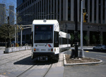 Image 45193 (184k, 1044x691) Photo by: David Pirmann Location: Exchange Place |  Image 47329 (221k, 1044x788) Photo by: Mike Jiran Location: Exchange Place |  Image 48243 (218k, 864x574) Photo by: Peter Ehrlich Location: Along Essex Street |  Image 48252 (161k, 864x574) Photo by: Peter Ehrlich Location: Marin Boulevard |  Image 53885 (198k, 561x864) Photo by: Peter Ehrlich Location: Essex Street |
Photos By Location
Photo locations: West Side Avenue, Martin Luther King Drive, Garfield Avenue, Bayonne 8th Street, East 22nd Street, East 34th Street, East 45th Street, Danforth Avenue, Richard Street, HBLR Shops/Yard, Liberty State Park, Jersey Avenue, Marin Boulevard, Van Vorst Street, Along Essex Street, Essex Street, Along Hudson Street, Exchange Place, Harborside, Between Greene and Hudson Sts., Greene St. Grade Crossing, Washington St. Grade Crossing, Between Washington St. and Harsimus Cove, Harsimus Cove, 6th St. Grade Crossing, Pavonia/Newport, Between Newport & Hoboken, Hoboken, Between Hoboken Wye and Paterson Ave., Paterson Ave. Grade Crossing, 2nd Street, Between 2nd Street and 9th Street, 9th Street, Three Roads to Lincoln Harbor, Lincoln Harbor, Between Lincoln Harbor and Port Imperial, Port Imperial, Weehawken (Palisade) Tunnel (East Portal), Bergenline Avenue, Tonnelle Avenue
Page Credits
By Peggy Darlington and David Pirmann.